Total distance: 380 km. Positive elevation: 34,200m.
This is the story of a three-week hiking trip across the Dolomites, camping with four hiking friends. We crossed a good part of northern Italy, also passing through Switzerland and the Austrian border. The route was improvised day by day. We had planned to loosely follow the Via Alpina at the beginning, but we quickly deviated from it…
Before I begin the story, a quick clarification for those who might be wondering: while wild camping is prohibited, bivouacking is permitted in Italy. By "bivouac," I mean pitching your tent for just one night, usually between 7 pm and 8 am. Also, feel free to check out my mountain photographs, for example, my photos of the Alps or my black and white mountain photographsNow, let the story begin!
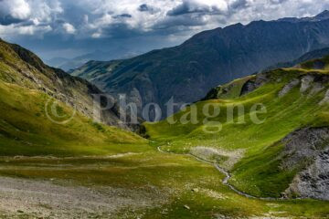
The Ortler massif
Departure from Tirano
+900 m / –100 m 5 km
So, the four of us set off at the beginning of August, weighed down as we should be with a pack that would take our shoulders a few days to adjust to. We passed through Milan at midday, which reminded me of Ho Chi Minh City in the blazing sun. Things didn't improve when we boarded a train without air conditioning. We all dreamed of only one thing: gaining altitude! And that's exactly what we did upon arriving in Tirano at the end of the day. After a considerable sweat, we camped on the slopes in the middle of the woods, as we were still far from the high-altitude meadows.
Getaway to Switzerland, Val Poschiavo
+2300 m / –1900 m 25km
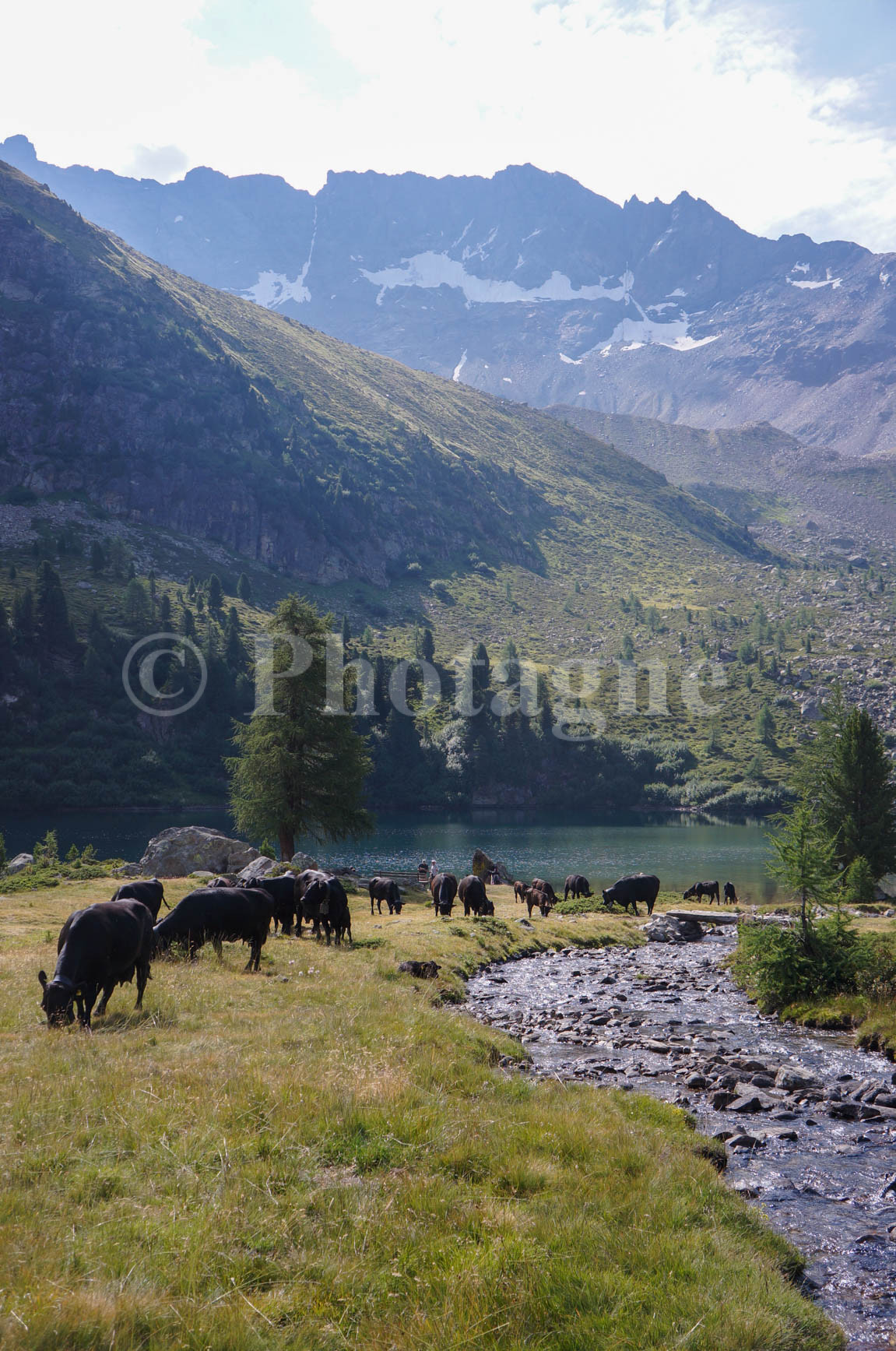
We had set off that morning with the plan of more or less following the Via Alpina. But, on a whim, we decided to venture into Switzerland, specifically the Val Poschiavo. This valley is a true enclave within Italy (just look at the map!). In fact, the people there speak an Italian dialect.
This day quickly proved quite exhausting, consisting of a series of ascents and descents, not even particularly steep ones. The scenery was typical of a Swiss valley, dotted with chalets and grazing cows. During a break in a hamlet, a local woman, taking pity on our weary appearance, offered us beers. Just what we needed to revive us! One last beer and we pitched our tent on a promontory beside a quiet track. Without really realizing it, we had completed the longest stage of our journey that day! Ultimately, the scenery wasn't very interesting in terms of the valley itself. However, the generosity of the locals made the detour worthwhile!
Back in Italy, the Viola Valley, Bormio and the foothills of the Stelvio Pass
+1500 m / –1300 m 24km
The day began with the first real uphill climb of the hike, a welcome relief. We ascended the Campo valley, passing murmuring rivers and pristine lakes. A swim in the first lake revealed we weren't alone at this early hour! The Swiss influence was definitely present. We then continued on to the Val Viola pass.
Arriving at the refuge beyond the pass, we were surprised to find a surprisingly affordable polenta with sausage for just €7! We jumped at the chance. Italy, there's no denying it, is definitely better for your wallet than Switzerland! We also bought one of the best cheeses of our hike nearby, a sort of Reblochon, at an unbeatable price. Then we headed back down to catch a bus to the village of Bormio. We experienced one of the only daytime rain showers of this first week, then indulged in a feast of peaches in the village. Fruit isn't something you carry, it's something you eat right there! Especially when it's only €2 a kilo…
We don't have time to go far for our bivouac, especially since the slopes are very steep for a considerable distance. So we camp next to the road leading to the Stelvio Pass, not far from a power pole. Not the best bivouac of the trip, even if the view of the cliffs is worth seeing…
The Stelvio Pass and Tyrol
+2100 m / –1400 m 17km
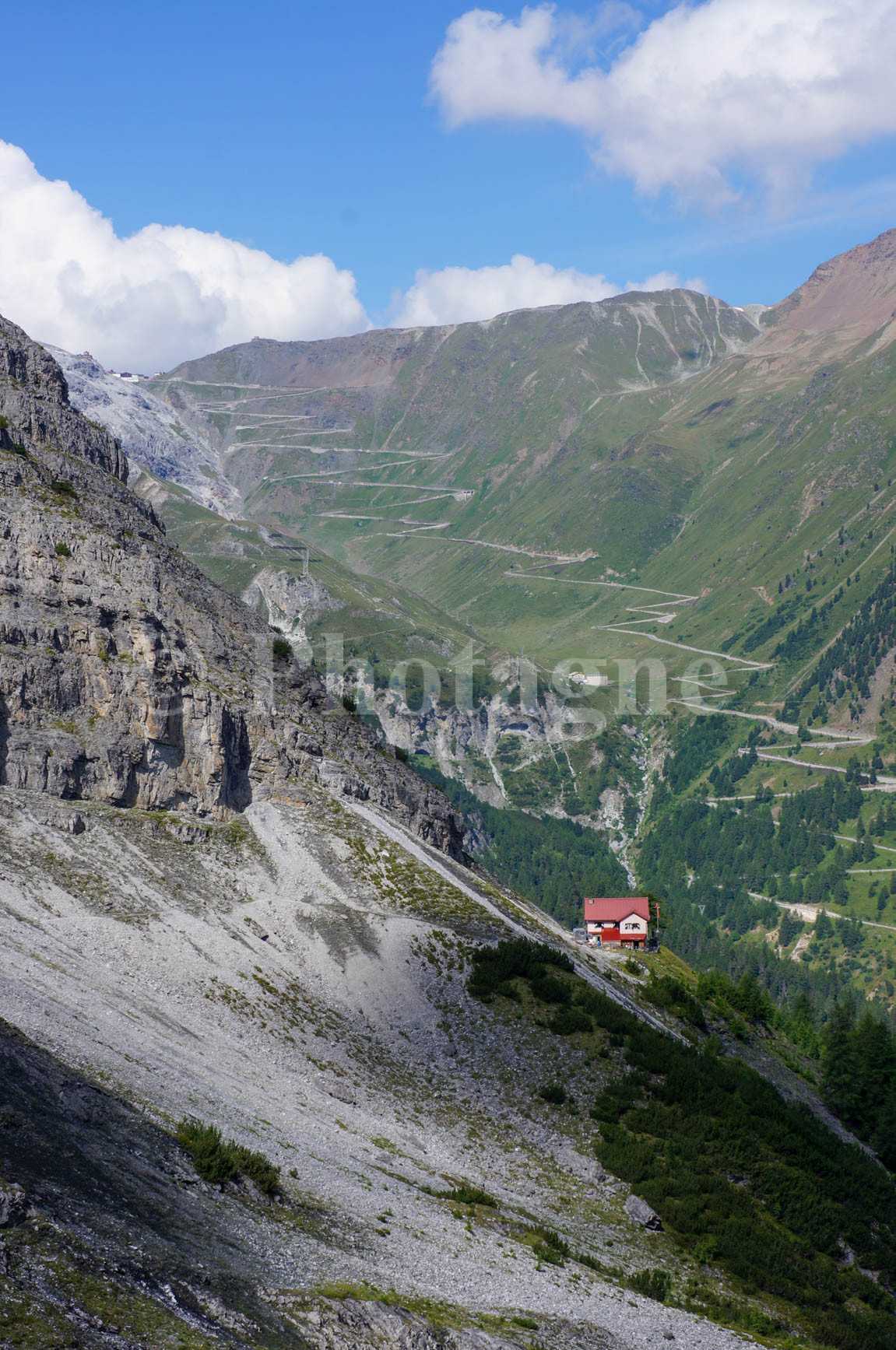
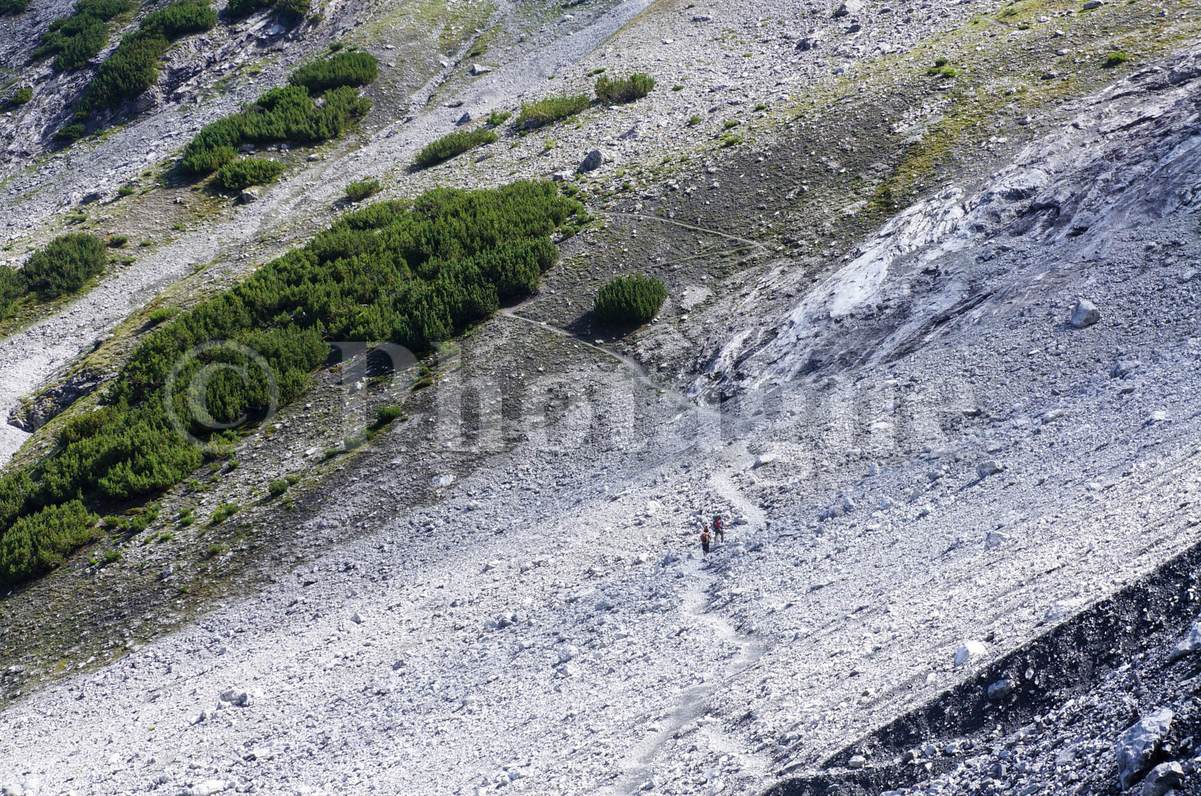
After a nighttime thunderstorm (which would be our daily companion throughout the hike, thanks to the heatwave), we set off to tackle the Stelvio Pass. Nearly 1500 meters of ascent in one go! It went smoothly, apart from a few paths that were a little difficult to find at times.
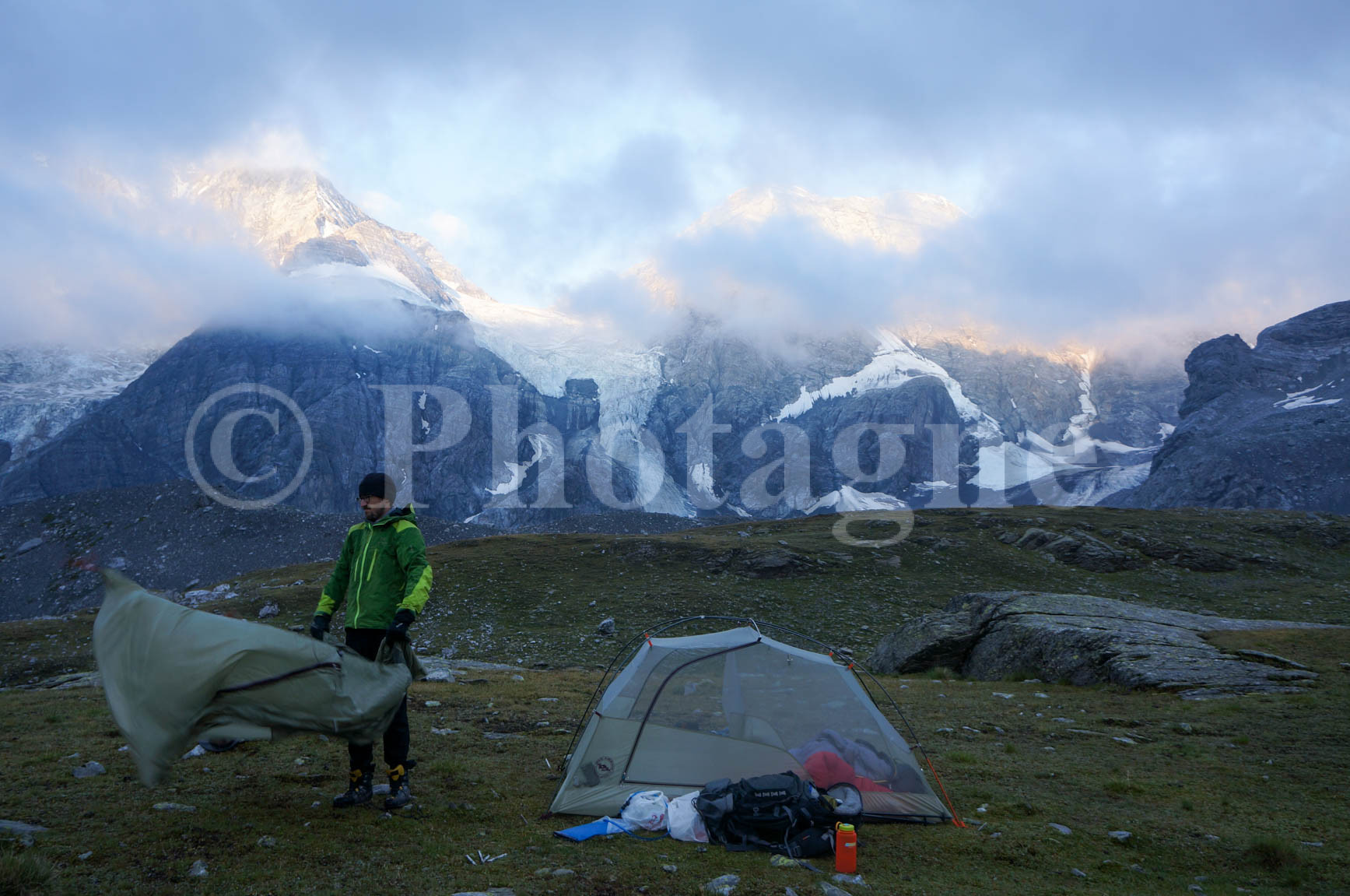
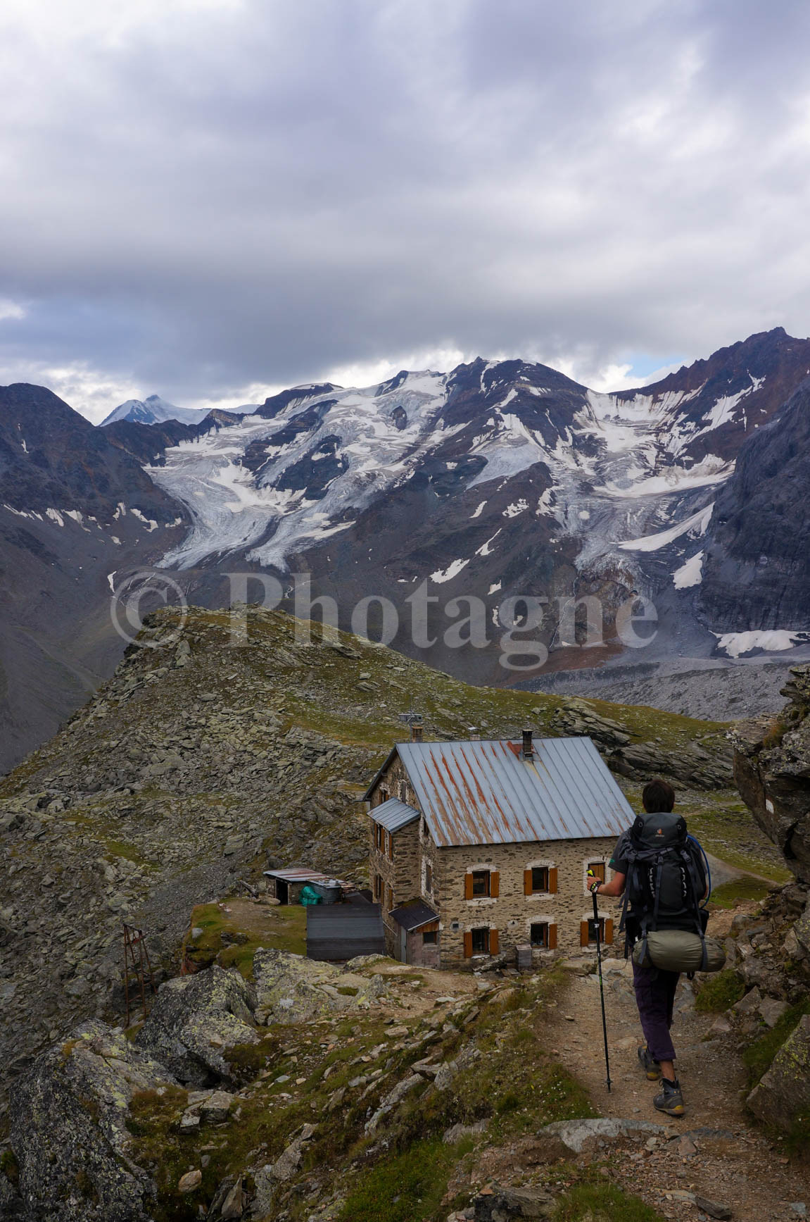
After climbing above the vertiginous cliffs, we came upon a military village. It served as a base camp for defending the Austrian-Italian border during the First World War. Most of the buildings are now in ruins, but it gives some idea of the conditions these soldiers lived in (we were there in the middle of August, and it was chilly!). After a steep chimney and a long traverse along the ridge, we overlooked the Stelvio Pass, right next to the glaciers and moraines of Monte Cristallo. At the pass, we quickly realized we were now in Tyrol, as everyone was speaking Austrian. Even when we tried to make conversation in Italian! We set up camp a little below the pass, finally in a proper high-altitude bivouac. The glaciers were magnificent in the setting and rising sun.
On the slopes of the Ortler
+2200 m / –1600 m 17km
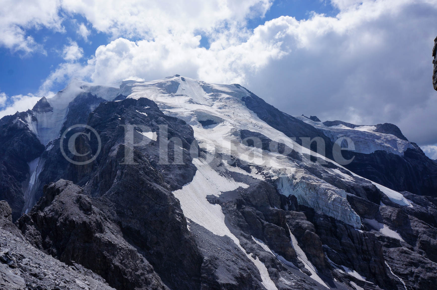
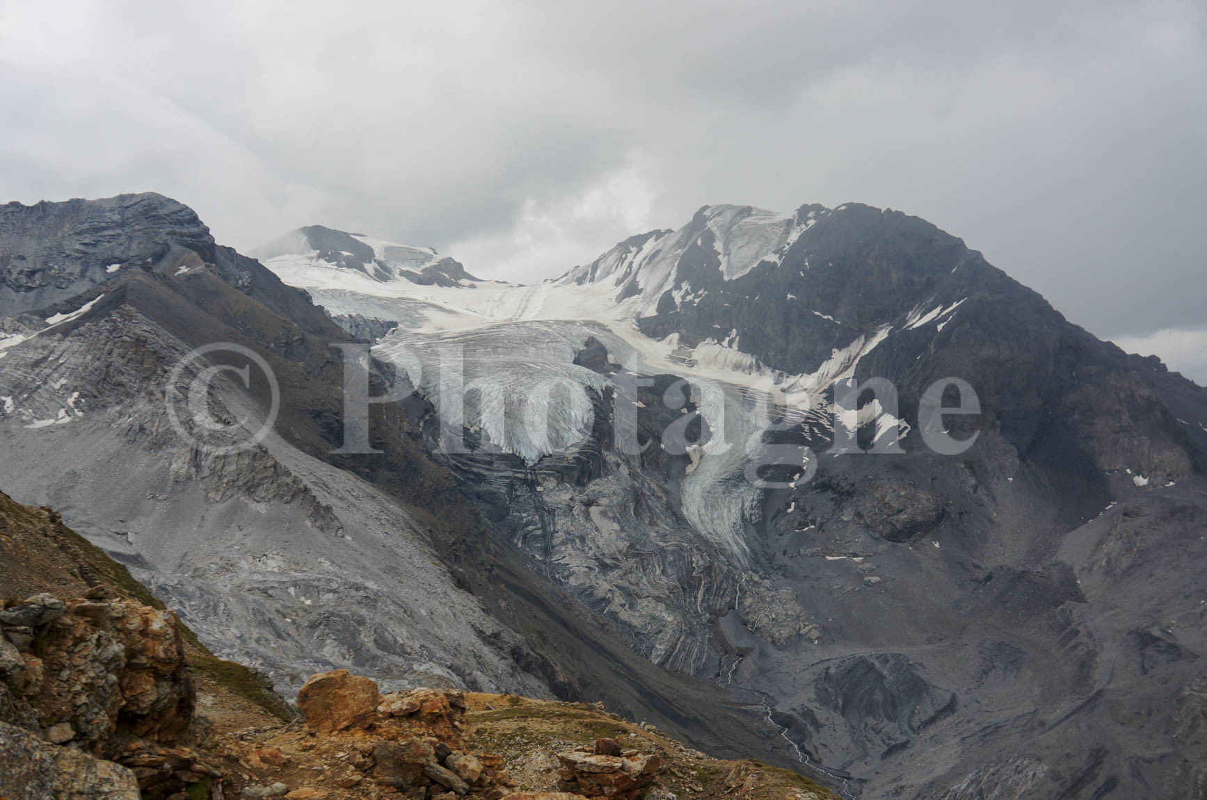
We first tried to descend the glacier trail, but unfortunately, it was closed. So we descended onto the immense moraine left by the glacier's retreat. It must have been much lower during the First World War… even though the Stelvio Pass was the scene of fighting throughout the war! Then came a steep climb through increasingly rugged terrain to the Payer refuge, the starting point for climbers heading for the Ortler. The Ortler is the giant (3905m) that we spent the day skirting, towering above us with its dazzling white glaciers. Along the way, we saw a bearded vulture soaring over the ridge.
Then we descended back down to the Refuge del Coston. It was the first of the four refuges we passed that day that offered drinking water to hikers! Luckily, we'd brought plenty... We camped there. The temperature was very high for this altitude; I didn't even need to put on my fleece in the evening! We took shelter in the tent during the evening rain, with one last look at the Zebrù glacier chain (just behind the Ortler).
Madriccio Pass and Val Martello
+1600 m / –1500 m 16km
After battling a flock of sheep very interested in our morning (powdered) milk, we set off again across a large moraine where ice sometimes protrudes. At the next refuge, we urgently buy supplies to refill our nearly empty "cheese box." It's been a long time since we've been able to resupply! This box must always be filled with at least a kilo of dairy delights, our main fuel for lunch.
A short climb to the Madriccio pass (3123m) followed by a descent into the magnificent Val Martello. This valley is a true concentration of beauty. A small alpine stream high in the mountains, then a path alongside a roaring torrent rushing through ravines (and it's wet!), and finally, cows everywhere and small lakes. We take the time to stop and eat one of the best apple strudels of the trip, as well as plenty of strawberries, since it seems to be the valley's specialty (every restaurant serves them!).
We then hopped on a bus that took us a little further into the valley, ready for one last steep climb through the conifers. We found a very pleasant farm-inn (hütte in Austrian German, or alm in Italian) near which we set up camp. This time the rain arrived even earlier, forcing us to retreat to our tents to eat our hot meal.
Col de Soi, Sainte Gertrude
+1500 m / –1700 m 17km
A steep climb awaited us in the morning, with slippery scree towards the end. But this didn't deter the hardened mountaineers we'd become, and we quickly reached the Col de Soi. The descent to Sainte Gertrude was quite pleasant. A stream arrived just in time for lunch, allowing us to wash up. Despite being over 1000m high, we arrived in the sweltering heat. We'd hoped to find a shop to stock up on supplies, but we were disappointed: the village is just a residential area...
We swapped one of our hiking companions for another—perfect timing! Luckily, he brought us enough food for another day. Then, in the late afternoon, we set off again to gain some altitude before setting up camp. An excellent idea, as it turned out: we discovered a truly idyllic high-altitude lake, perfect for pitching our tent. And as a bonus, there were blueberries galore to pick! Large cumulonimbus clouds were rising on the horizon. It looked like a major thunderstorm, but fortunately, it was far away and slow to arrive. It finally broke in the early evening. Torrential rain rattled the tents while lightning struck continuously nearby. We had chosen a spot that wasn't too exposed, but that didn't stop us from feeling a little uneasy in the face of the elements…
Collechio and hospitality in Piazzola
+1000 m / –1800 m 16km
When we woke up, we discovered that a small nearby depression had become… a pond! The importance of knowing how to pitch your tent properly! We set off on spongy ground. We spent the entire morning walking along a valley dotted with numerous lakes, perhaps swollen by the previous night's rain. It was magnificent. We passed the Collechio cross (2950m), then descended into another valley, also full of lakes! We swam briefly in the largest one at midday. The descent into the valley was made in a heavy downpour. We finally got out our rain gear for the first time. We even ended up shivering and taking shelter under a tree until the rain stopped. The valley floor was shrouded in wisps of mist; it was stunning. We arrived in the small village of Piazzola around 4 pm, where we learned that the next bus wasn't until… 7 pm!
No matter, there's a co-op supermarket and a village bar, plenty to keep us occupied. We finally stock up thoroughly. Perhaps a little too much, considering the weight of our packs: gluttony is a hiker's worst enemy… Then we enjoy a delicious Italian hot chocolate at the bar. Ten minutes before we have to leave to catch the bus, a local comes into the bar, notices our bags, and immediately offers us a drink! We protest that our departure is imminent, but he won't budge. We gladly accept the local red wine and manage to hold a semblance of a conversation in Italian before we have to take the bus. It's undeniable, we've left Tyrol and its Germanic customs for a region that's more Italian at heart… it's a welcome change!
Short on time when we arrived at the next village, and after hesitating about camping in the public garden, we opted for a quiet spot by the roadside on the other side of the river. Not the most scenic bivouac, but it felt good to be surrounded by forest.
The Dolomites by bivouac
The Brenta Dolomites, 1. From the art of a balcony path
+2000 m / –1000 m 16km
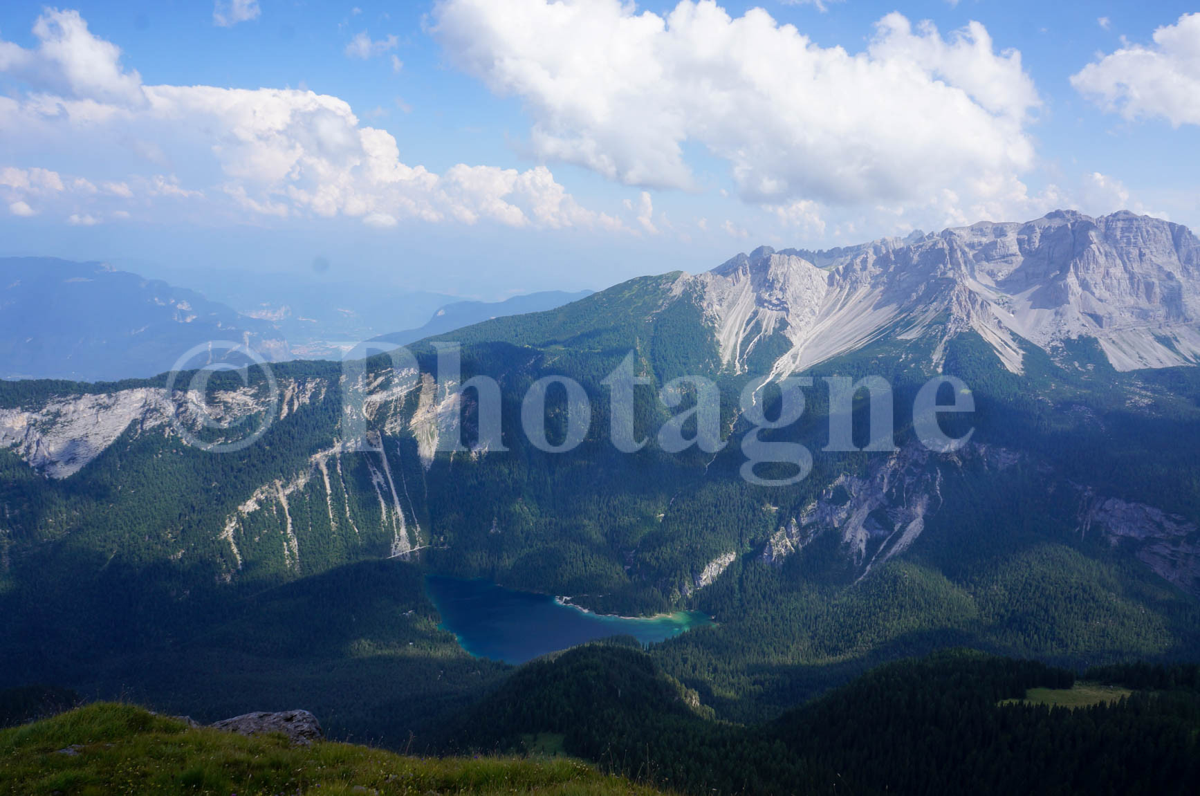
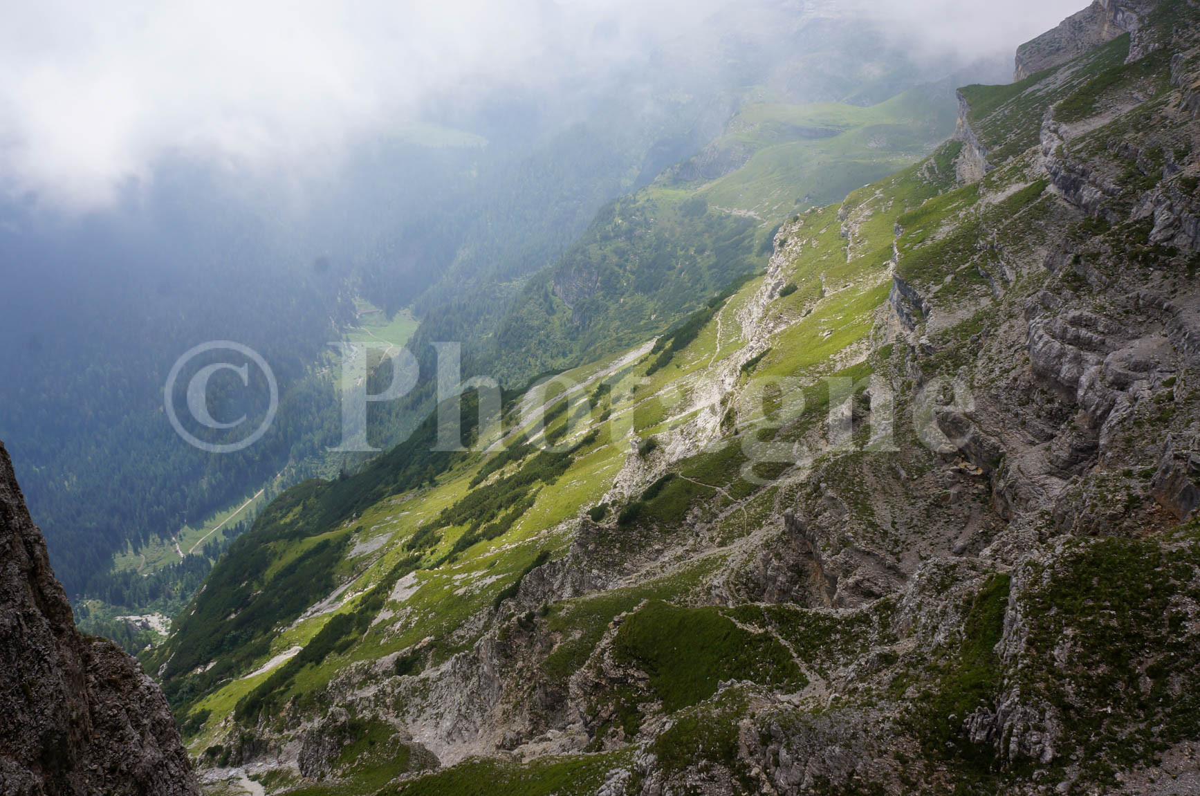
Today, after a week spent near numerous glaciers, we embark on a new stage of our hike: the Dolomites. We begin with a lesser-known part of this mountain range, the Brenta Dolomites. After a sudden 1000-meter climb (during which the altitude is indicated at every turn: depressing…), we are suddenly exposed to the distinctive rock formations of the Dolomites. We enjoy our picnic in an idyllic setting: green grass, rocky peaks, and cowbells as a bonus. All the more so because we were able to stock up on gorgonzola in the valley: what a treat! From that day on, we make sure to always have some on hand for our picnics.
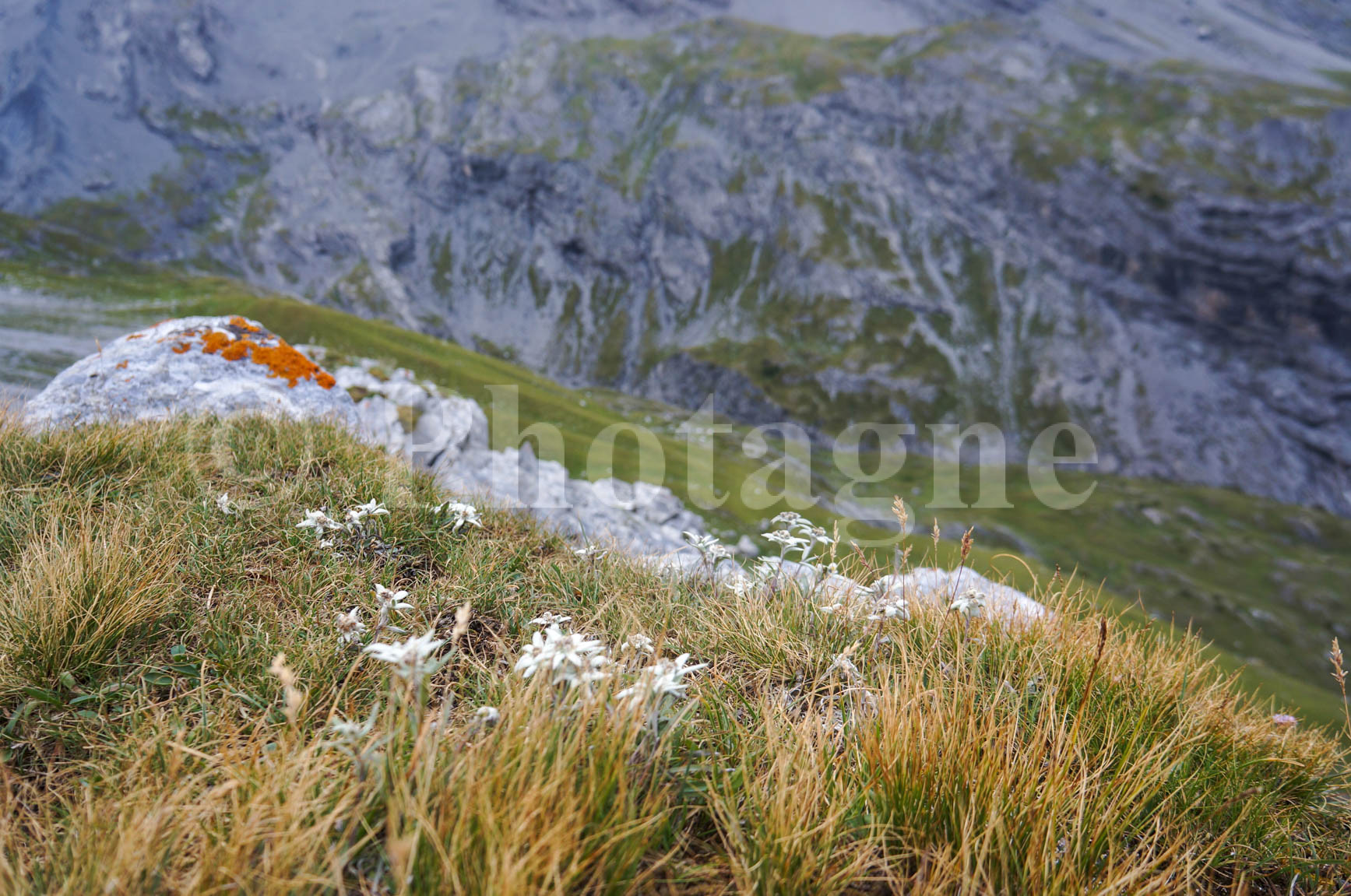
In the afternoon, we tackled a very rocky section where we needed to use our hands a bit towards the end. Then we continued along large slabs of rock riddled with cracks. We rounded a bend after a pass, and there… It was simply stunning, one of the best parts of this hike! We followed a pure balcony path, situated on a small grassy plateau between two cliffs and dotted with edelweiss along its entire length. A view gradually opened up before us, revealing the valley at the heart of the massif and a pretty lake we hadn't spotted on the map. An even more delightful surprise! The Dolomite cliffs were everywhere.
After this memorable moment, we realized that the planned stage was far too long. So we descended a very steep path back to Malga Tuena, where we enjoyed a well-deserved goat's yogurt with honey. We left the refuge to make way for some scouts. Then we set up camp in a pretty little valley a bit further on (near a spring, a definite advantage as they are few and far between in this area!).
The Brenta Dolomites, 2. Outdoor Day
+1600 m / –1500 m 16km
The first few hours of our hike were in unseasonably hot weather; it felt like we were in a pressure cooker, even the steam was rising. We arrived, sweating, at a small pass, beyond which the map indicated a section equipped for hikers… Surprise! We found ourselves facing a sign for a via ferrata! No matter, the route didn't look too difficult, so we decided to give it a try anyway. Indeed, it was a series of ladders and steep sections with handrails. Not exactly a via ferrata, but a bit more than just an equipped section… We remained cautious and navigated it without any problems.
The rest of the day unfolded under rather gloomy skies. Especially since the scenery was unremarkable: the ski resort was nearby. In the late afternoon, we arrived at a farm-inn (Malga Spora) where the prices for pastries and grappa were unbeatable. This gave us the energy for the final 1000m descent that awaited us just after. Barely had we reached the bottom of the very steep valley when we heard a monstrous thunderstorm rumbling continuously, approaching from the peaks. We barely had time to find a suitable spot before pitching our tent just before the downpour. It would definitely be one of our least memorable bivouac spots: on uncomfortable scree, right next to a 4x4 track in the middle of the woods…
A well-deserved rest
+ 500 m / – 200 m 7 km
Today we're planning to take it easy, which is just as well considering our previous long days that left us quite tired! A few kilometers this morning to reach Andalo, a rather uninteresting winter sports resort. We were looking forward to a dip in the lake… before realizing it was actually a large, muddy puddle. Then a bus down to Mezzocorona, where we rediscovered the warmth of the valley floor in summer…
We stocked up in town. We practically burst out of our stomachs eating two excellent Italian pizzas each! I'll always fondly remember the pizza with "finferli," the chanterelle mushrooms… Then came a long journey by train and two buses that took us to another winter sports resort, Pozza di Fassa. Starting the climb from the village, we stumbled upon a miraculous grassy plateau in the middle of the steep slope, complete with a picnic table: the perfect spot to set up camp!
La Marmolada
+2200 m / –1600 m 20km
We leave this spot, whose only drawback was its proximity to a busy ski slope, and begin the first climb, a rather forgettable one as it's close to the ski lifts. At the pass, we can finally glimpse the famous Marmolada, near which we plan to pass today. Before ascending its slopes, we descend to a mountain refuge where we discover, to our delight, Kaiserschmarren, a kind of large omelet with raisins served with red berry jam. Just the thing to give us energy for the climb, and we'll certainly need it! Indeed, we see many people with crampons: there's a short section on a glacier on the north face of the Marmolada, which we're told can be bypassed on the side.
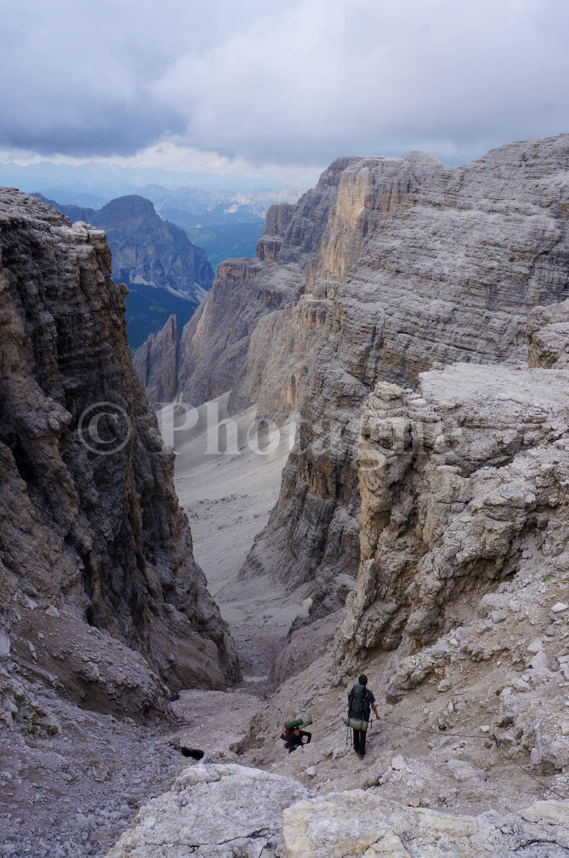
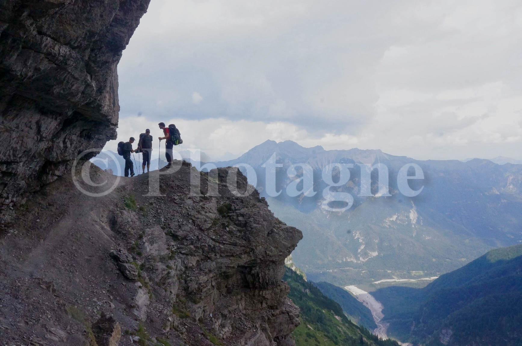
Just before reaching the pass overlooking the glacier, we were in for a surprise: there was a via ferrata section, and a real one this time, not like the last one! It was very poorly marked on the map. No matter, we cautiously set off. It wasn't difficult, but our packs were heavy on our backs. We reached the pass, a sort of narrow gap from which we could see the glacier emerging from the mist (a true mountain experience!). To get onto the glacier, we crossed another via ferrata, made slippery by the dampness: we weren't feeling very confident! But we reached the left side of the glacier without any trouble. We then had to follow the glacier along its left side, which was more like a moraine and therefore easily traversable, before finally crossing it when it became horizontal again. Phew, that was quite an adventure! Bivouacking in the Dolomites is something you have to earn!
The rest of the afternoon passed without incident. We hesitated to pitch our tent on a magnificent grassy slope on a small summit overlooking the entire valley. However, the stormy weather dissuaded us from choosing an exposed spot. We finally settled near a stream flowing directly from the glacier we had just crossed. We admired the storm raging over the Sella massif directly opposite, while not a single drop of rain reached us.
The moon Sella
+2000 m / –1600 m 19km
We slept in to recover from yesterday's long day, then headed straight for the famous Sella massif. But first, we spent the morning following a very popular ridge, as it's a magnificent balcony path accessible by cable car. Ah, the ravages of civilization! We hurried to leave this section, even though the view of the Marmolada was superb. That said, the rest of the hike was much the same: even though we chose to reach the Sella plateau via the "path of the brave" (a very steep 600m), a cable car takes you directly there…
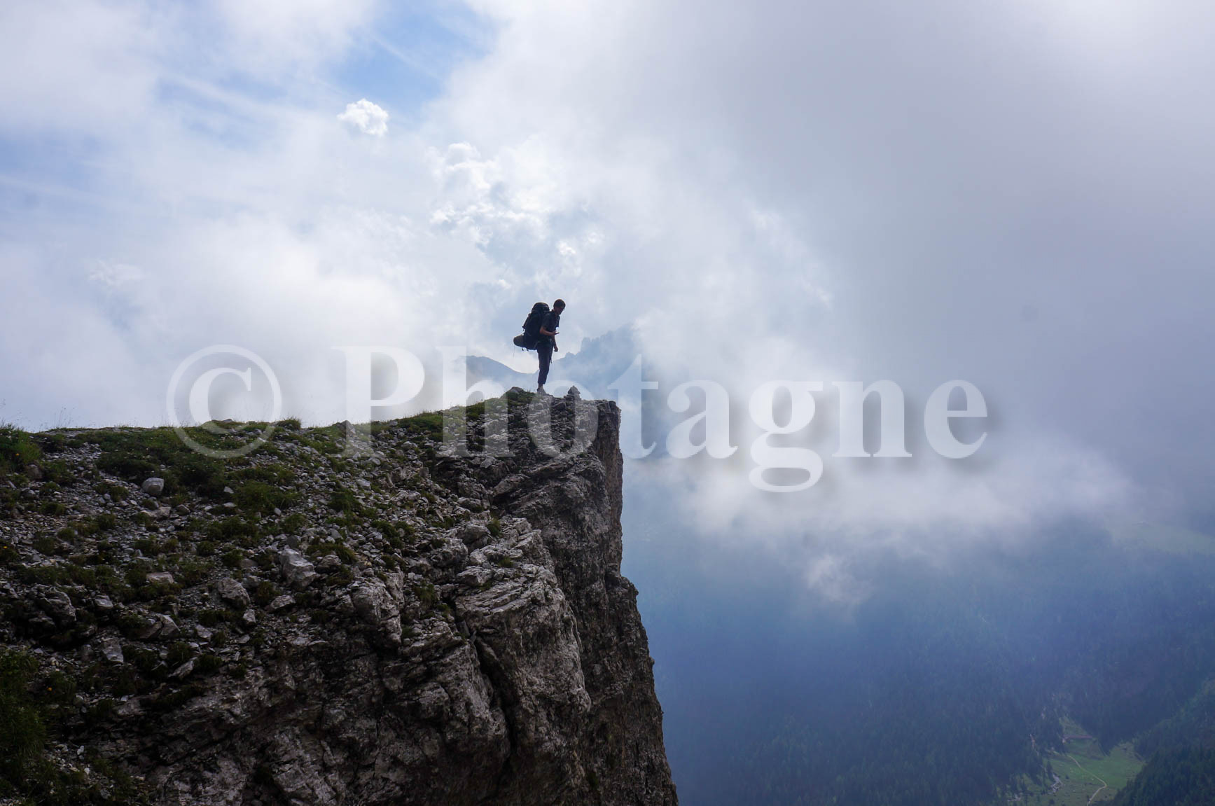
But the crowds don't stop us from admiring this incredible landscape: we emerge onto a single plateau at about 2500m altitude, composed of a mineral landscape almost devoid of vegetation. Large canyons open up here and there; we feel like we're leaving Earth… An easy climb leads to Piz Boè at 3150m (which will be the highest point of our hike), from where we overlook the entire plateau.
We carefully refrain from buying anything at the refuge given the prices. As we begin to compare prices, we become increasingly demanding… Then we start the descent. Alas, it's marked as very dangerous and strongly discouraged, and our experience from the previous day was enough for us… So we climb back up to the plateau and try to find another way out. The end of the day drags on: we absolutely cannot pitch a tent in this rocky wasteland. Besides, we pass other people just as exhausted as we are, but going in the opposite direction.
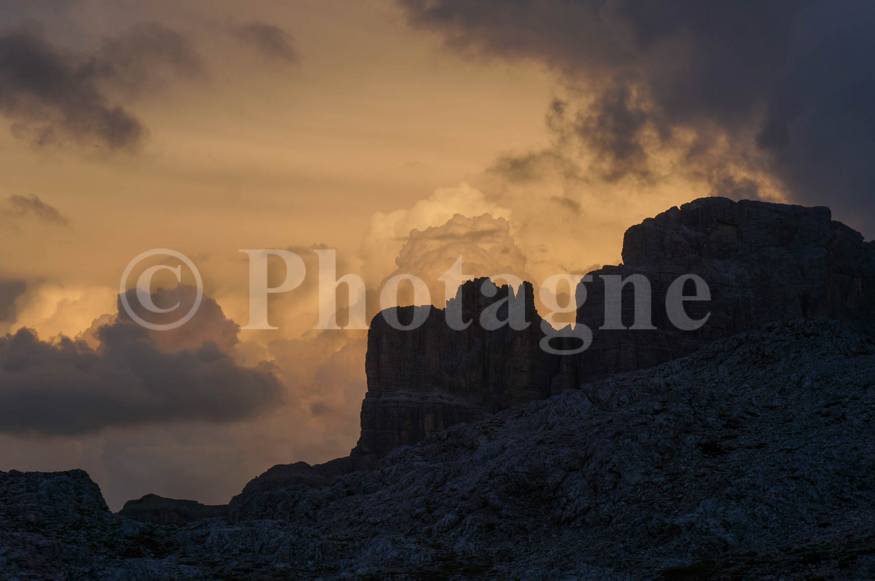
After encountering a group of decidedly fearless ibex, we spotted the refuge and decided to sleep there if no other bivouac site presented itself… But a miracle occurred: right next to the refuge, a tiny triangle of grass (the only one for miles around!) was all we needed to pitch our tent. Phew… The evening would reward us with a magnificent sunset over the Dolomite cliffs.
Le Puez-Odle
+1600 m / –1500 m 18km
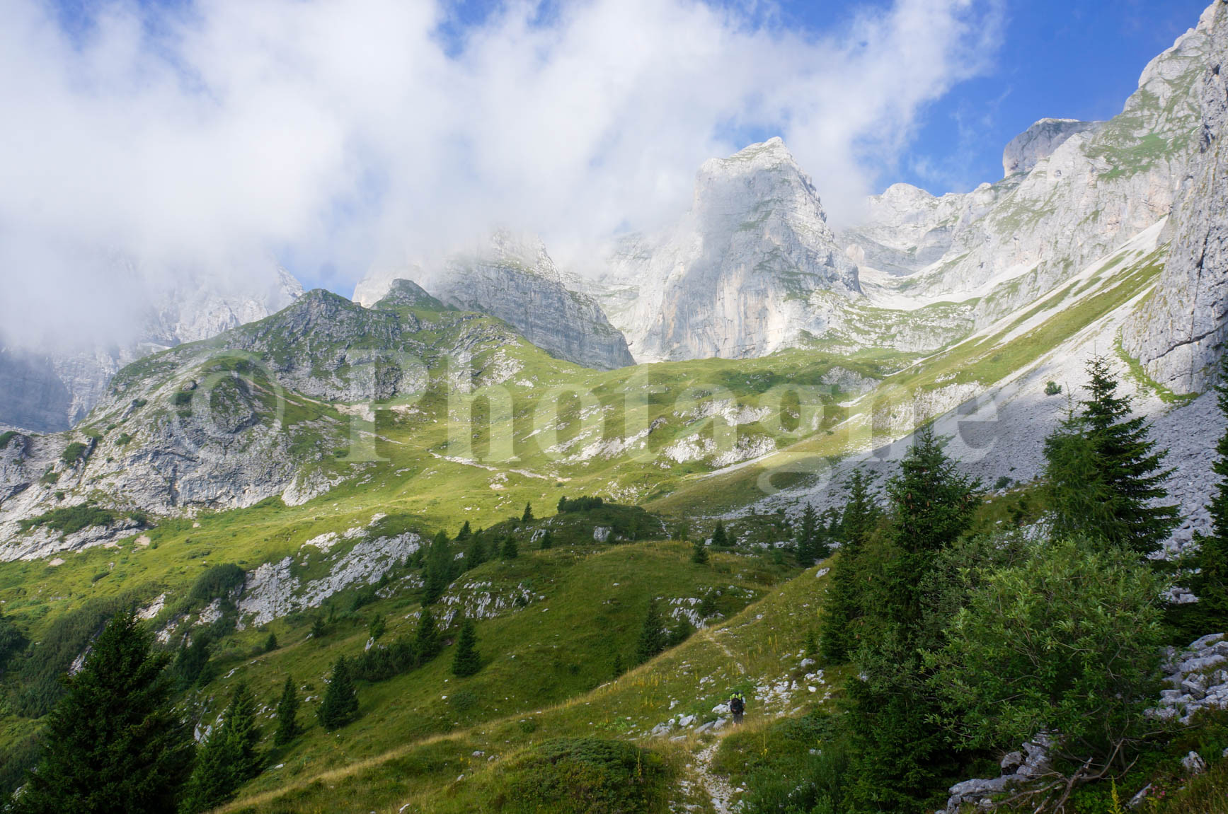
After bravely eating our breakfast in the cold, facing the impressed guests of the refuge, we finished the descent of the Sella massif in a short, steep, equipped couloir. Given the lines of people we encountered on the other side, we were very glad we'd made it down early. We then climbed into the Puez-Odle massif. Unfortunately, we were once again in the crowds: the long August weekends were definitely taking their toll… The path wound across a large grassy and stony plateau. With the weather not exactly cooperating, the landscape seemed rather unremarkable. Above all, the path seemed long. During these stretches where my concentration waned, I nearly twisted my ankle. It would painfully remind me of its presence with every misstep for the next few days.
The descent from the plateau is in the rain. I'm starting to get exhausted, but we keep going; we have to maintain the pace. We're looking for a bivouac site near the next town, Badia, since two of us will be leaving tomorrow on the first bus (to make room for someone else joining us—these tents are certainly paying for themselves!). But the end is so long… I finish the day completely worn out. We settle down on a small plateau behind a group of houses. In the evening, some children from the neighboring village and their father come to talk with us. We learn that an ancient dialect is spoken in this valley and a few others. It's Ladin (related to Romansh), one of the rarest languages in Europe! In fact, the father tells us he can recognize the people from the village across the valley by their accent…
Rest in Badia
+900 m / –500 m 13km
This morning, we set off on an empty stomach because the thought of a proper breakfast in the nearby town was too tempting. After two weeks of hiking, a croissant seemed like an unbelievable luxury! We stuffed ourselves with croissants (the Italian version, with Nutella inside) and then spent the day relaxing peacefully by the river. Our friend who was joining us wasn't due until mid-afternoon. We took advantage of the delay to stuff ourselves with pizzas once again. Then we were off again (in the middle of a thunderstorm!) straight up the mountains, heading towards Veneto. We settled down on a lawn so perfect it could have been mistaken for a golf course, just below the rocky section we were saving for the next day. Typical Dolomites bivouac!
The Fannes-Sennes-Braies
+1700 m / –2300 m 23km
Beneath this somewhat barbaric triple name lies a lovely natural park, a little less frequented by tourists than the more famous neighboring mountain ranges, and where we'll spend the entire day. Once we reach the plateau, we find ourselves in the familiar landscape of high-altitude meadows and limestone pavements. We arrive at the Fanes refuge, located right in the heart of the park. It easily wins the title of the most luxurious refuge I've ever seen: the automatic door in the entrance sets the tone… After that, we take a little-used path to descend into the next valley.
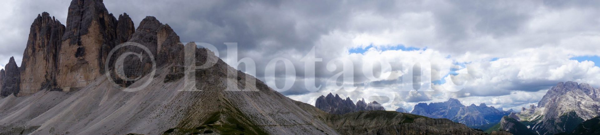
Bad idea: likely due to violent storms, large drainage ditches crisscross the path on both sides of a steep slope. We cross the smaller ones without difficulty, but the largest one proves challenging. It's a good three meters deep, and the rock is crumbly… We nevertheless find a somewhat unstable path and overcome the last obstacles. Once in the valley, we decide to push on as far as possible in order to tackle the Tre Cime (undoubtedly the most famous massif in the Dolomites) early the next morning. A late afternoon bus takes us to the "Tre Cime Panoramica," which certainly lives up to its name… A beautiful place to rest after this long day.
The Tre Cime
+1600 m / –1400 m 19km
And so we set off towards this famous three-peaked massif. The ascent is through a pleasant, verdant landscape, except for a stop at a farm-inn where we're asked to quickly pack up our belongings, which are cluttering up the unused parking lot… Then, barely having reached the balcony trail accessible by road, we're met with a sea of people. Admittedly, it's one of the best views in the Dolomites; you can see our entire route and much more. Admittedly, the three peaks are majestic, and it's fun to spot the climbers right in the middle. But the crowds, reminiscent of New Year's Eve on the Champs-Élysées, somewhat spoil the walk. At the Tre Cime refuge, there's a real queue just to get in!
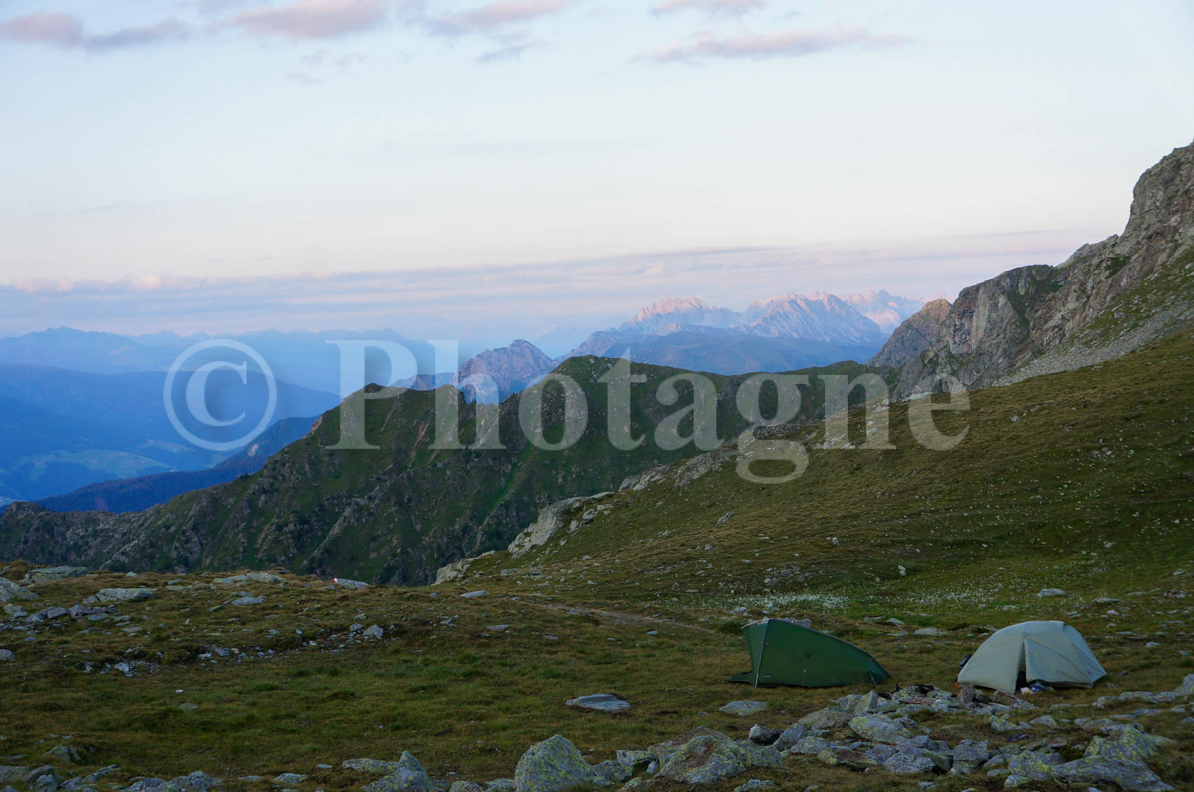
We continued along a path that began to climb, and then came a sudden drop in the number of people. Apparently, bivouacking in the Dolomites isn't the trend right now. The descent led us into a stunning valley with a torrent that flowed in a very wide bed of pebbles (it must be quite a raging torrent in the spring...). We found such a perfect bivouac spot that we decided to stop, even though it was a bit early. Lush grass, a picnic table, a fountain: what more could you ask for? It was the perfect opportunity to have a drink at the nearby refuge! In the evening, we came across (for the first time in fifteen days, no less!) some other backpackers, who turned out to be... French! You'd think tents were a Gaulish thing. It would be a good opportunity to use our Tarot cards.
The Carnic Alps and Friuli – Julian Veneto
Sexten and the Carnic Alps
+1600 m / –1500 m 16km
Reinvigorated by the restful evening before, we began our descent towards Sexten early in the morning. We stocked up on supplies in town. The croissants weren't as good as in Badia, which was a shame; however, the pretzels were worth it, given we were practically on the Austrian border. We then started the ascent of Mount Helm, at 2500m, which marks the beginning of the Carnic Alps, the border between Austria and Italy.
We're thrilled to be setting foot in Austria: that makes one more country (along with Switzerland and Italy) to add to our hiking itinerary! However, we're not quite there yet, because on the way up we stumble upon some tempting mountain huts. At the third one, which offers an enticing menu at low prices, we decide to stop for lunch. Never mind if we can't make it back afterward! And it's an excellent meal we have, with spaetzle, canederli (a kind of bread dumpling with speck or mushrooms), and ricotta cake…
The uphill climb right after is indeed tough! However, the ridge isn't far and offers a beautiful panorama. We'll follow it until noon the next day; it's hard to keep an eye on the path! We never tire of this beautiful, varied ridgeline, which is remarkably quiet compared to the Dolomites. We camp near a small pond with a breathtaking view (and a few rather persistent sheep).
The Carnic Alps, continued
+1300 m / –2600 m 24km
And so we set off again along the ridge on a crisp, cool morning. We conquered a series of peaks with 360° panoramic views – a real treat. Shortly after a refreshing dip in a fish-filled lake, we left this beautiful ridge to reach the next valley. The plan was to climb back up into the next mountain range to reach San Stefano di Cadore that evening. However, time was getting on, and one of us had a slightly sore ankle. So we decided to take the shortest route and passed through a pleasant but not particularly memorable little valley (apart from the fact that we also managed to get each other lost). The goal was to start the next day from Forni di Sopra, which is a bit of a bus ride away, to meet up with another friend.
Upon arriving in the tiny village of Sega Digon, we realized that the bus schedule required us to spend the night in a halfway village, Lozzo di Cadore. With an hour to spare before the bus arrives, we decided to prepare our dinner. Unfortunately, a storm rolled in and threatened our gas stove. Undeterred, we settled into the only available shelter: a small oratory with a roof! All the passersby seemed to enjoy themselves watching us cook our pasta in front of the Virgin Mary.
The day's farcical adventures weren't over yet! We took the bus, which dropped us off in Lozzo under a still-rumbling thunderstorm. We decided to wait it out at the local café with a game of tarot. The rain continued, and night fell… At ten o'clock, we were forced to set off with our headlamps, hoping to quickly find a spot that wasn't too flooded to pitch our tent. That's when we went under the highway and discovered a large, comfortable area covered in sawdust… Without hesitation, we set up camp under the autostrada! It certainly wasn't the most glamorous bivouac of the trip, but it saved us in the pouring rain. There was even relatively little traffic, so we ended up having a pretty good night's sleep.
Friuli, Part One
+1600 m / –1600 m 15km
We took an early morning bus to Forni di Sopra, where a final friend was waiting for us for the last leg of this hike in Friuli. We set off with our packs fully loaded for these last two days, to celebrate a little. The climb was under a blazing sun (the altitude wasn't so high anymore). There were a few hikers up to the first refuge, but after that, it was completely deserted! We could clearly see that we had left the tourist zone.
A short rocky section to keep our feet sharp, and then it's back to the 1000m descent to the next valley. The final stretch through the forest is particularly lovely, and since we have some time, we take the opportunity to relax by a stream. We quickly reach the next valley, where a well-deserved aperitif awaits us at the Pussa refuge (and a heavy thunderstorm after our meal).
Friuli, Part Two
+2000 m / –1500 m 17km
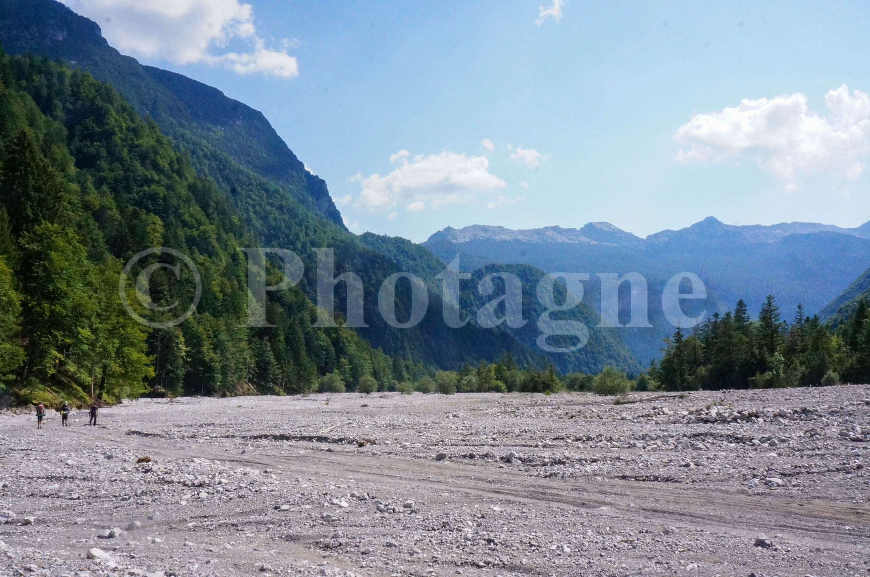
A steep 1000m climb, similar to yesterday's, awaits us early this morning. The path is well-marked, but we don't encounter a single soul; it's a pleasure to walk this trail, wilder and more remote than anything we've done in previous days. However, after the pass, a long and unpleasant descent awaits us in the bed of a dry stream. Yes, the path does indeed go this way; we see markers from time to time! We have to descend 800m, hopping from rock to rock, searching for the most passable route in this bed of stones…
Towards the end, we crossed paths with the first hikers of the day, exchanging greetings in hesitant Italian… only to realize they were also French! They intended to climb to the pass in the blazing sun of this stony path; we wished them good luck and continued on our way. Shortly after, we emerged abruptly into the valley, which was actually a vast, dry bed of pebbles. The rainy season must be no joke around here! We took a long, well-deserved break in one of the few shady spots, then resumed our trek along the valley floor. At the end of the day, we climbed a little again to reach pastures overlooking a small valley. We set up our last bivouac of the hike, enough time for a little celebration as we finished off all our provisions.
There's no doubt about it, camping in the Dolomites is fantastic!
End of the Dolomites bivouac, goodbye mountains…
+700 m / –1500 m 11km
We set off early because the bus passes through the village of Claut before noon, and we didn't want to miss it. We had planned time for one last short climb to a peak not far from the path (Monte Fratte), hoping for a beautiful view of Friuli and perhaps even as far as Venice. No such luck: not only was the weather misty, but another mountain range before the plain obscured the view. We still took the time to admire the panorama. Then came the descent, which was quite quick on this good path (it wasn't the torrent we'd encountered the day before!).
We arrived in the village early, so we took the opportunity to enjoy one last swim in a beautiful, clear mountain stream. After that, it was back to civilization! In Padua, where we waited for the Thello train back to France, we rushed to a delicious pasta restaurant we know well, one that had been making our mouths water for the entire rest of the journey. What a wonderful adventure this three-week trip has been, taking us through remarkably diverse landscapes! Perhaps we'll return to this area next year to hike further east…
This article, "Dolomites by Bivouac," was originally published on the website i-trekkings.netBecause the camera was chosen for its lightness, the photos are of lower quality than on the rest of this website. To see my mountain photos, head to the page PicturesYou can buy photo prints on the page of products, for example a draw on poster, canvas or framed print.
0 Comments