A magnificent route to follow over ten days in summer, giving pride of place to the French and Italian slopes of the Alps near Bardonecchia. As usual, I did it in the company of a group of friends in complete autonomy with tent and bivouac equipment. If you only need to do a few steps, don't miss the bivouac at the top of Thabor : an unforgettable moment at sunset and sunrise. Especially because we are seriously peeling them, it must be said! Time for the story.
On the heights of Termignon
+ 1150 m / – 50 m 7.5km
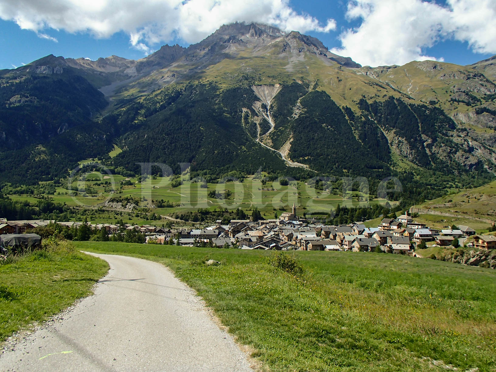
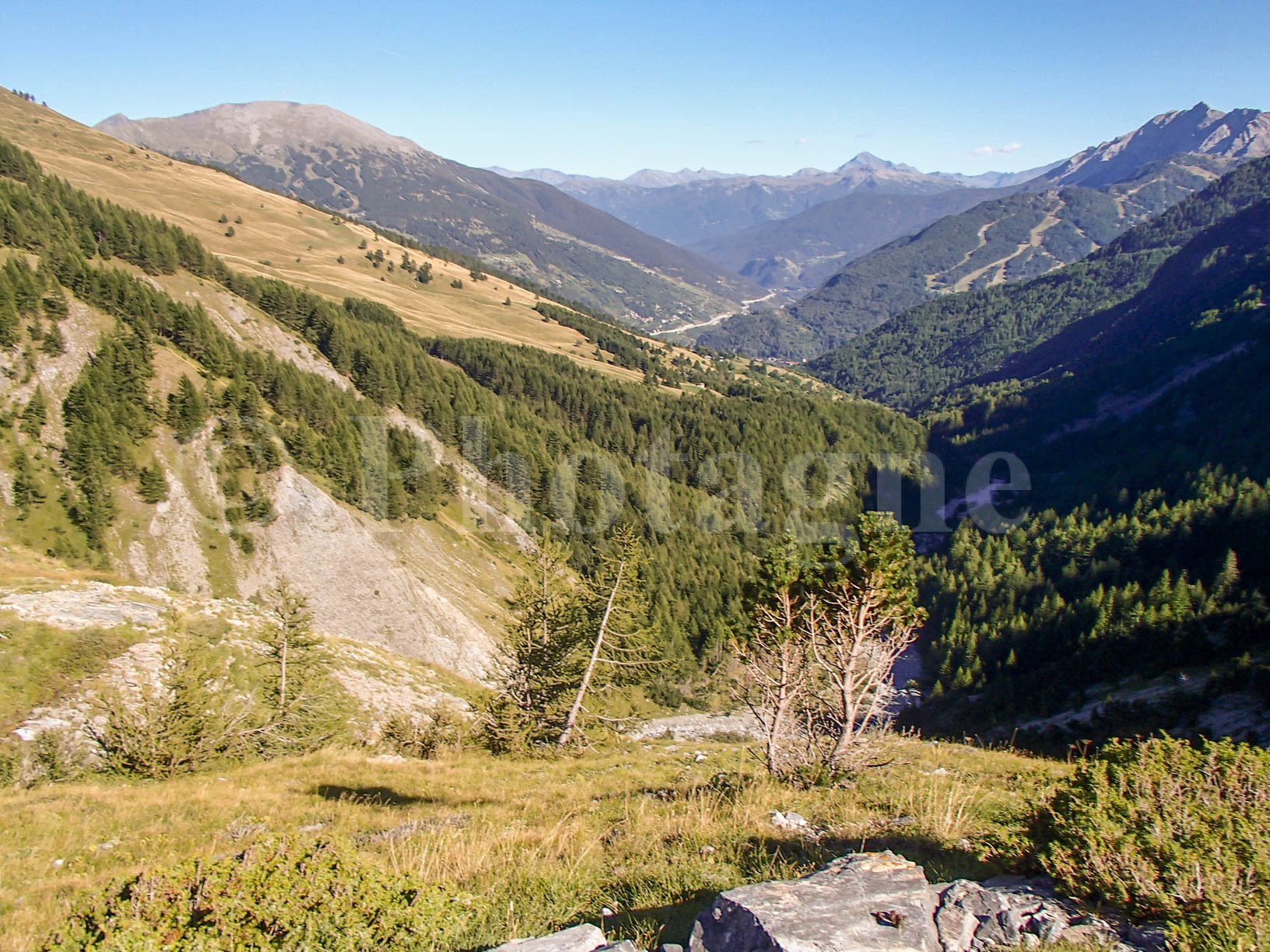
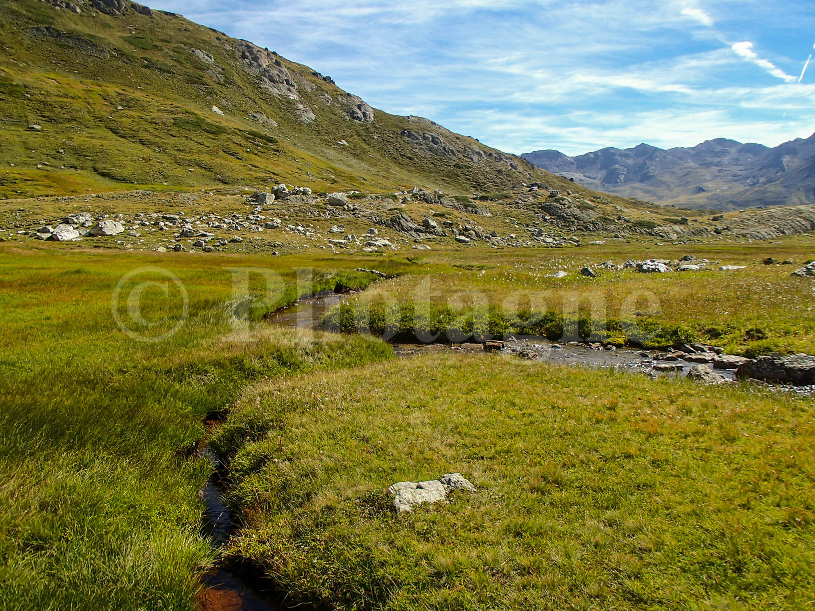
Here the three of us left at the end of August for our annual dose of bivouac in the mountains. The hike starts from Termignon, easily accessible from the Modane valley. We climb quickly into the forest thanks to a path that is effective in terms of elevation. Arriving on the mountain pastures, disappointment: we had planned to bivouac near a lake indicated on the map but this one is only a puddle of mud! We continue the path to finally find a stream with (no longer) drinkable water just below the pass which we reserve for the next day.
Petit Mont Cenis and Lake Savine
+ 550 m / – 550 m 11km
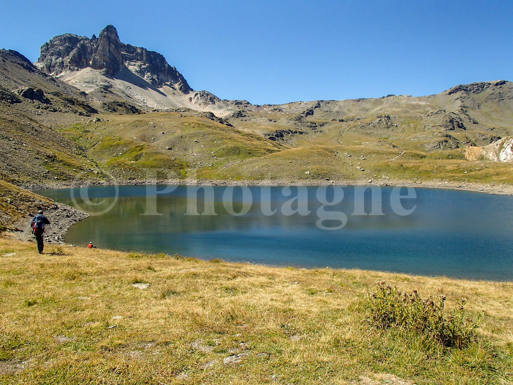
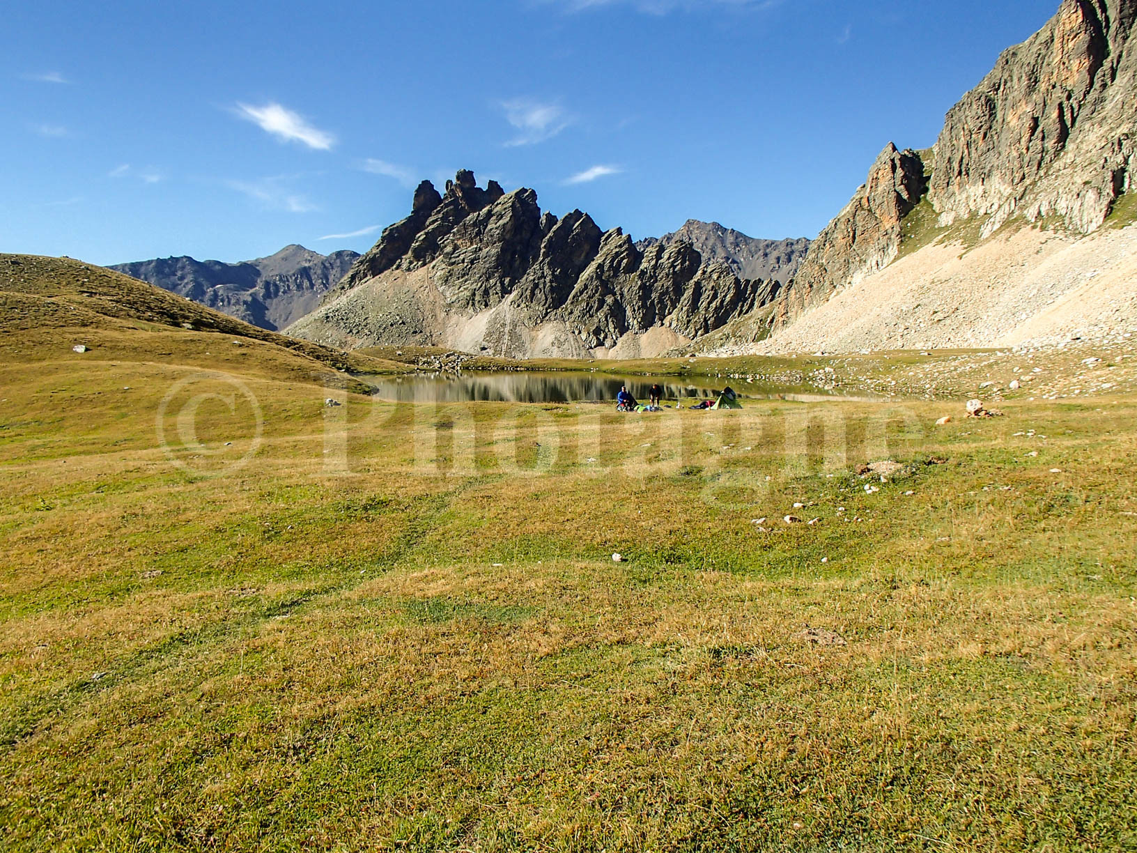
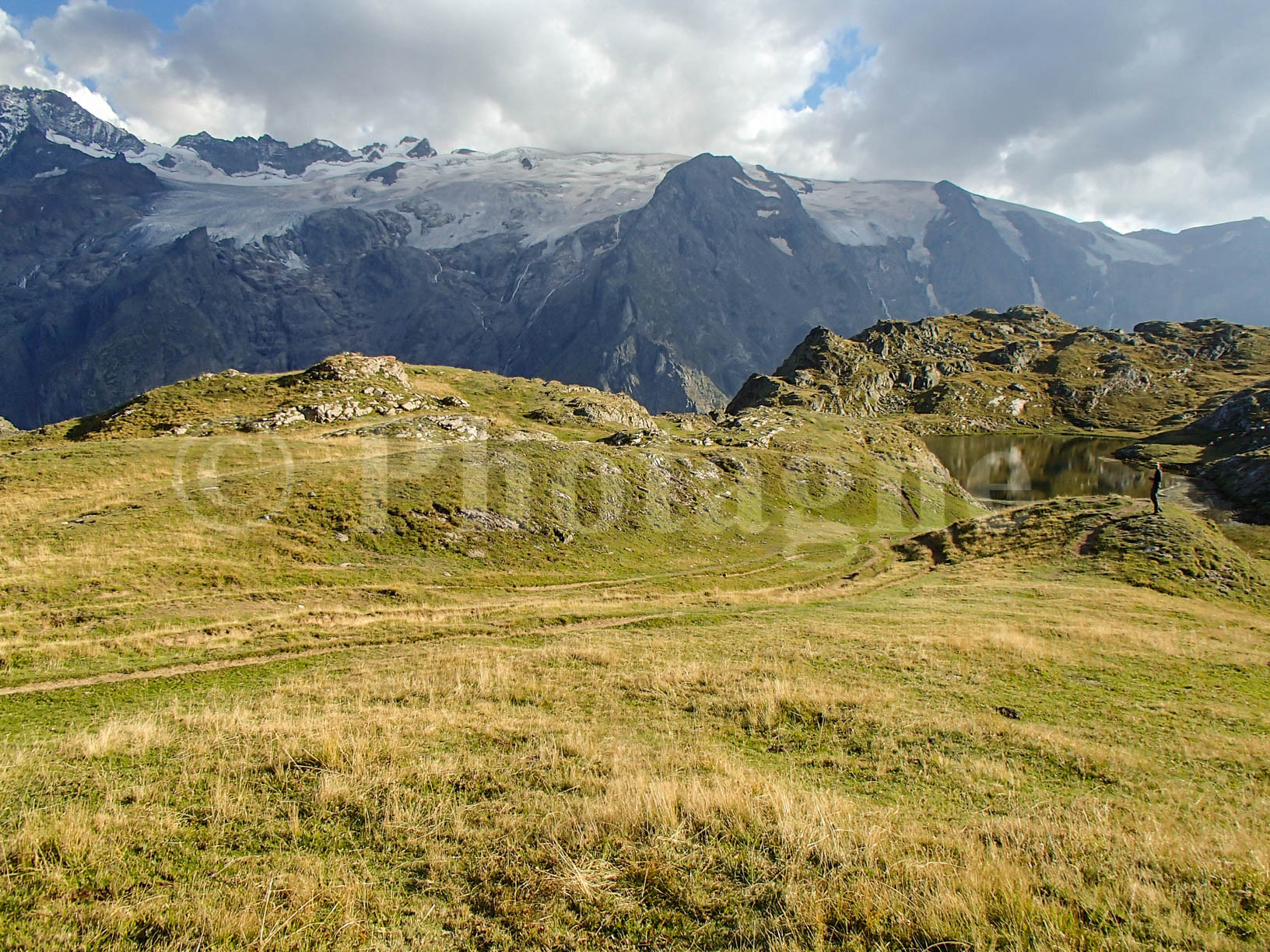
Setting off early in the morning as it should be, we quickly pass the Sollières pass and descend to the Petit Mont Cenis refuge. The route is pleasant but nothing more, the entire Petit Mont Cenis valley is just an immense meadow dotted with funnels created by the dissolution of gypsum. We quickly move on to the refuge because of the crowds and enter the valley of Lake Savine.
There, the route becomes much prettier with many small high-altitude lakes. You can find alpine newt there if you look closely. At the end of the day, we go up the long Savine valley and arrive at the eponymous lake to pitch our tent. The weather is becoming cloudy and cold, so much so that the dip in the lake that we had dreamed of in the midday heat is now less attractive! We are joined by a fourth thief (who left Paris that morning) at meal time, consisting as usual of quick-cooking shells. Between that and polenta, we quickly get tired of it... However, there are few such economical solutions for bivouacs!


O sole mio
+ 200 m / – 800 m 12km
The next day begins with pouring rain and clouds dragging across the ground. We try to withdraw the camp without soaking everything with moderate success. We then leave for Col Clapier, where we pass into Italy. This pass is supposedly part of one of Hannibal's likely routes when he crossed the Alps to conquer Rome. However, judging from the first part of the descent, we can have some reservations on the question. In the rain, we have to be very careful because the rock is slippery and we cannot breathe without balancing with our big bags.
We take refuge at the Vaccarone refuge for a little pick-me-up. The hot chocolate is Italian style, very thick, although the border is only a kilometer away! After which we have to get back to it in still inclement weather. Arriving near Monte Clopacà, we decide to change route and go down into the valley instead of persisting in remaining at altitude in such weather. We therefore descend in one go to the Levi Molinari refuge.
As we are bivouac ayatollahs, we still decide to sleep in a tent near the refuge. The plant is… wet: all the stuff is starting to get soaked. We shelter in the refuge room for the evening. It is completely deserted: it is the end of the season and there are not many people passing through. Besides, the guards wanted to take the opportunity to take a trip to town! They therefore leave the refuge to us to monitor as well as free access to their kitchens. Very nice in my opinion, especially since their gas stove heats more efficiently than our little butagaz!
Bardonecchia in the rain
+ 700 m / – 1350 m 13km
The next day, again: it's still raining and the sleeping bags are starting to get wet, so they lose their calorific value. We therefore decide to go back down to the valley and visit Bardonecchia. No sooner said than done: we go back down to Salbertrand passing through a few pretty hamlets clinging to the slope, then from there we take the train to Bardonecchia. There, all the pleasures of the city await us with open arms: plenty of food, drinks, dry places to rest your butt.
After this urban passage having boosted our morale, we headed towards a campsite outside the city. This takes us back and forth but we are in no hurry as we are waiting for someone to meet us in Bardonecchia at 11am the next day (the train having shortened the trip). But the camping prices turned out to be so catastrophic that we decided to bivouac a little further away! Don't push it, a little hot water isn't worth 15 euros per person...
We have to get back to it, head to Thabor
+ 1000 m / – 150 m 10.5km
The next day, bright sunshine in the morning! We take the opportunity to dry all the completely soaked belongings. Then we wait in Bardonecchia while waiting for the arrival of the additional thief. A good big pizza at lunchtime then off to the mountains! The climb on a full stomach is more difficult than usual.
We pass through magnificent colchicum meadows (it's the end of summer...) before quickly rising up a small steep path above the valley. We pitch the tent not far from the stream and enjoy our last view of Italy. The following day, return to France!
The Col de la Roue and Mount Tabor
+ 1600 m / – 450 m 14km
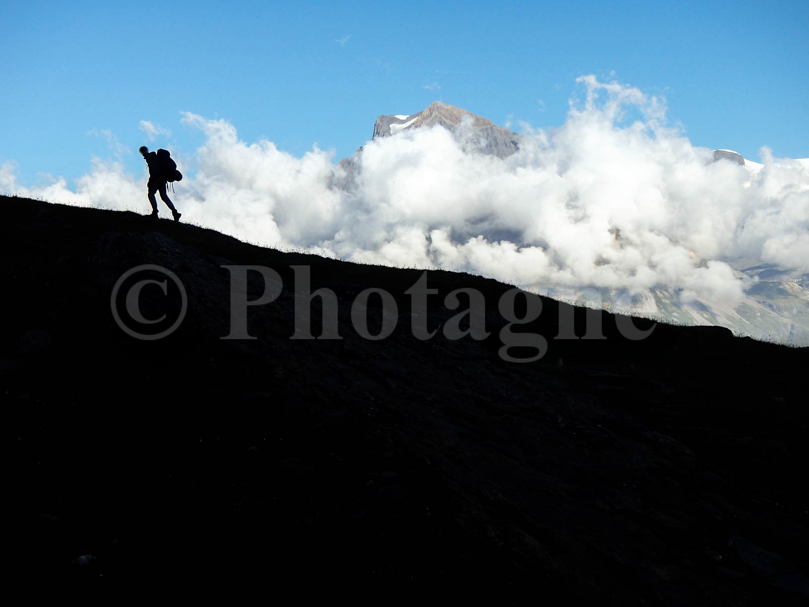
We leave early with magnificent weather which is very pleasant after all these days of rain. Passage at the Col de la Roue which takes us back to France, then towards the Mont Thabor refuge via the Col de la Replanette. The landscape is magnificent, it is a large plateau at more than 2000m which opens up to us.
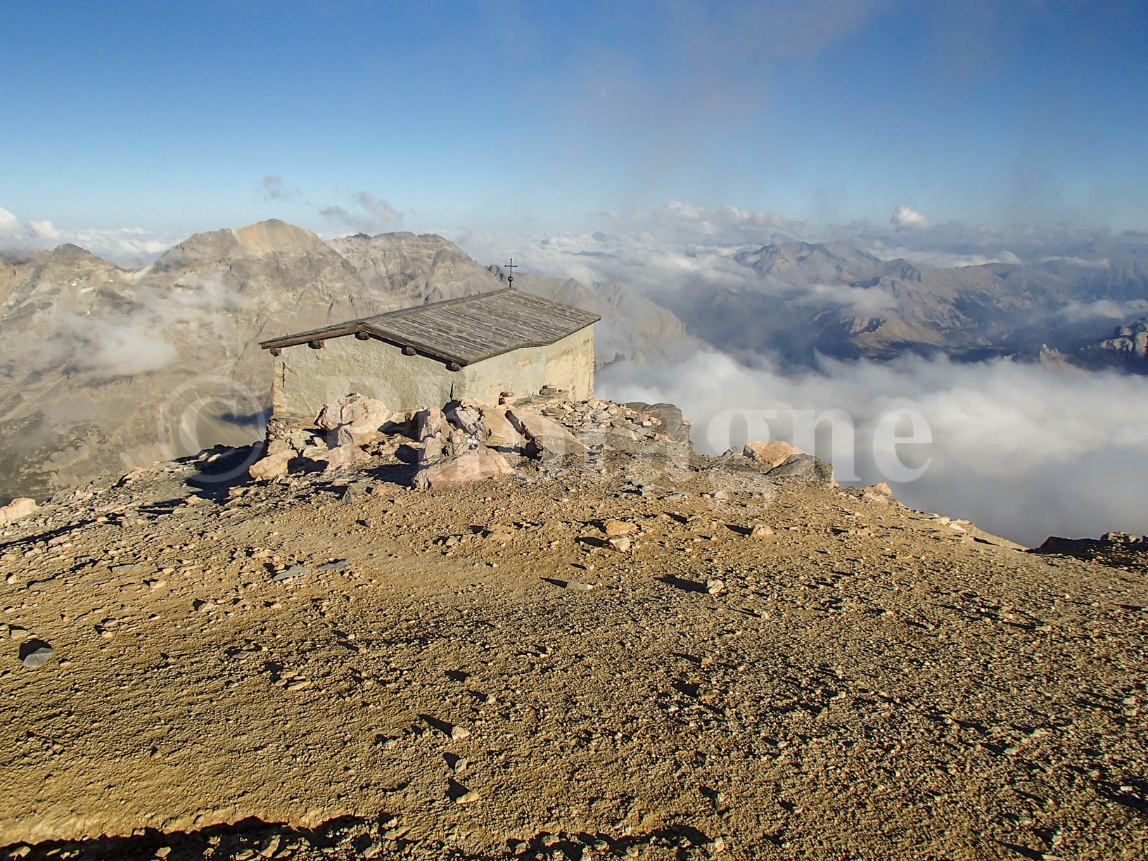
At the refuge, we take a dip in the round lake: the water is freezing but it's still fun! Then we leave loaded with plenty of water. Indeed, the evening bivouac is ambitious: we plan to sleep at the chapel of Mount Tabor (3178m), accessible by an easy hiking path. Obviously, no water at the top so you have to carry. We climb slowly at the end of the day: there is some elevation gain to reach the 3178m of Thabor... The evening light on the increasingly rocky landscape is superb.
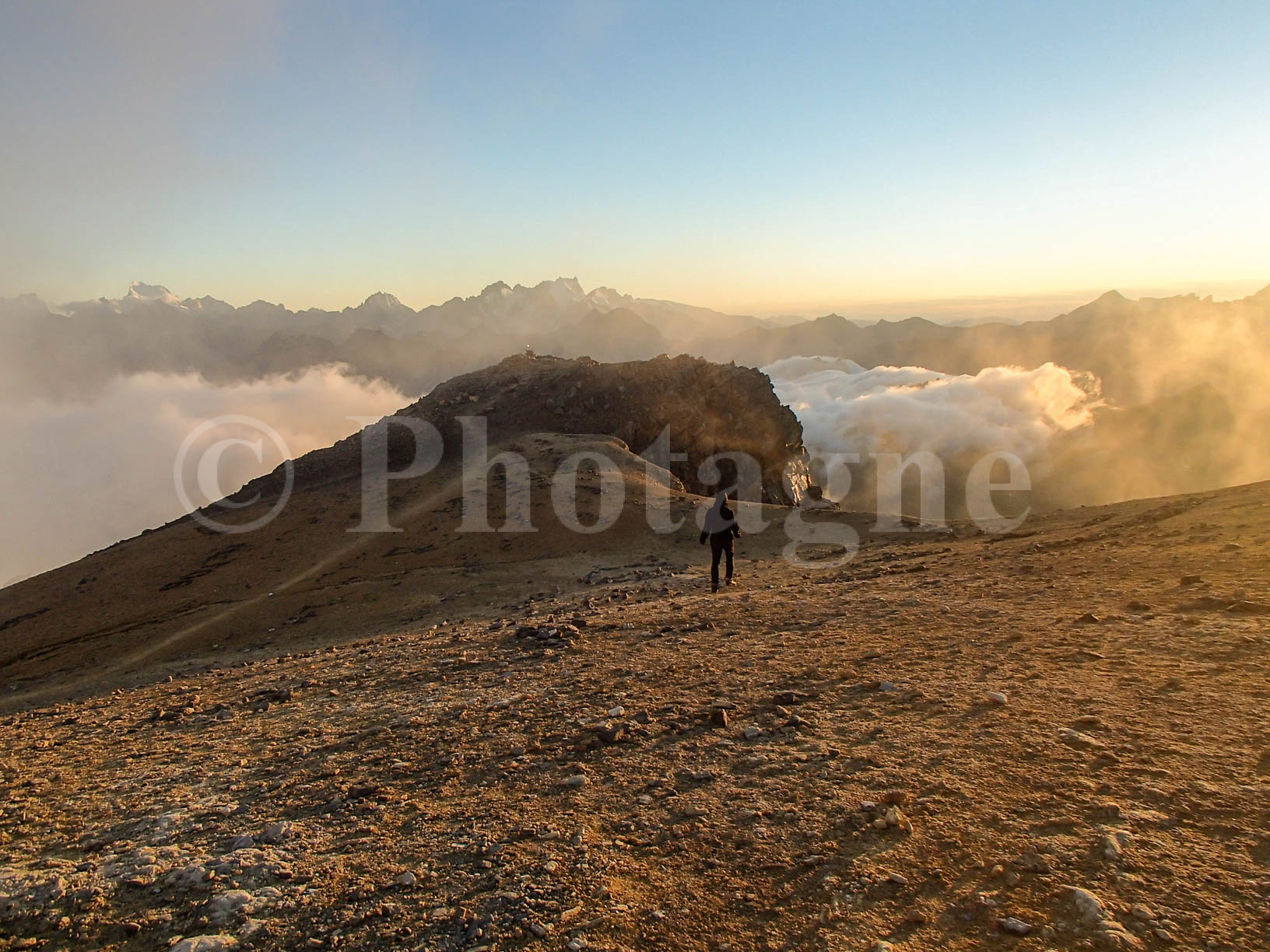
We finally arrive and sit in the Tabor chapel. Fortunately there is this shelter: the wind is blowing outside and it is bitterly cold. We bravely admire a magnificent panoramic sunset, then quickly return to warm up in our sleeping bags. This is definitely one of the most beautiful moments of this hike!


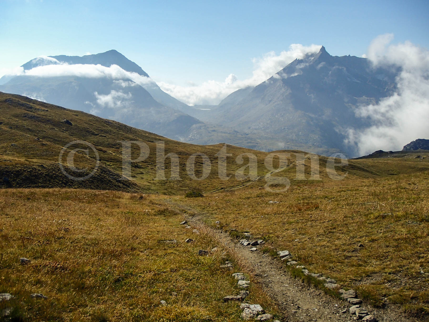
The Méandes and the Muandes
+ 350 m / – 1100 m 8.5km
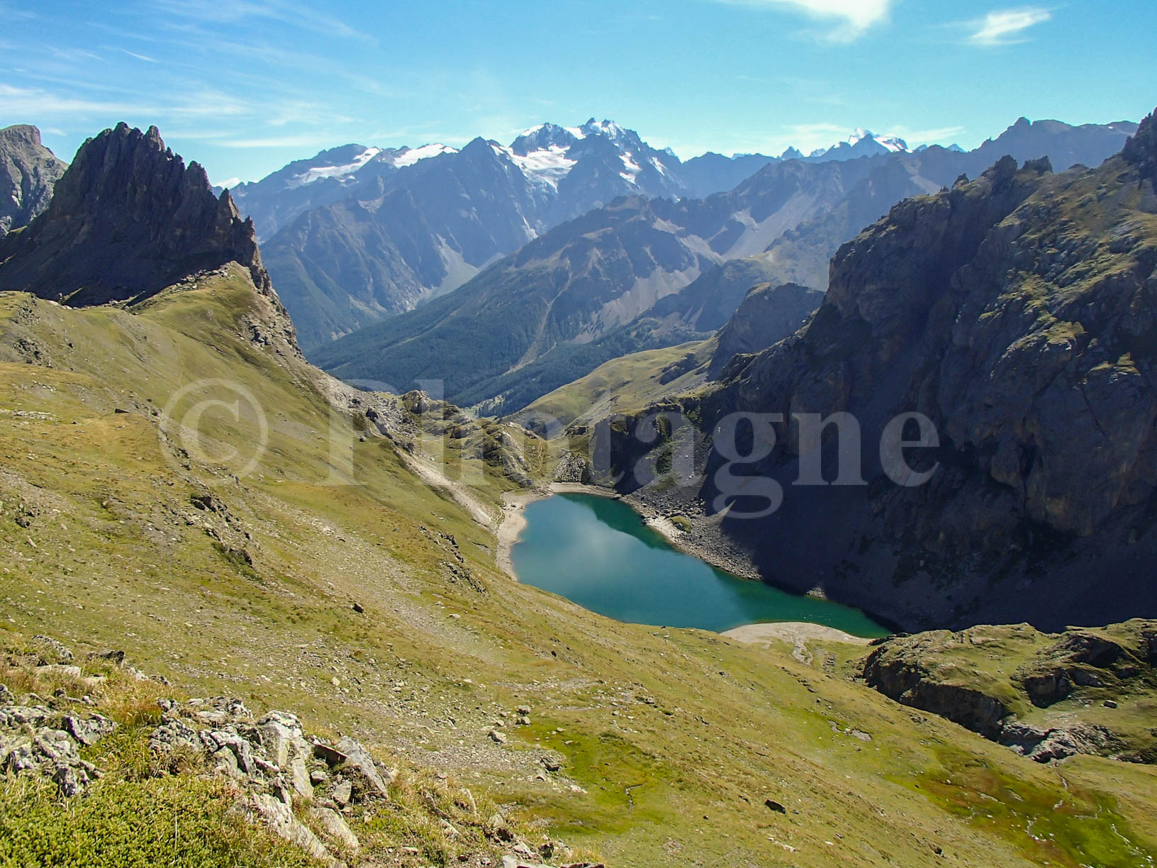
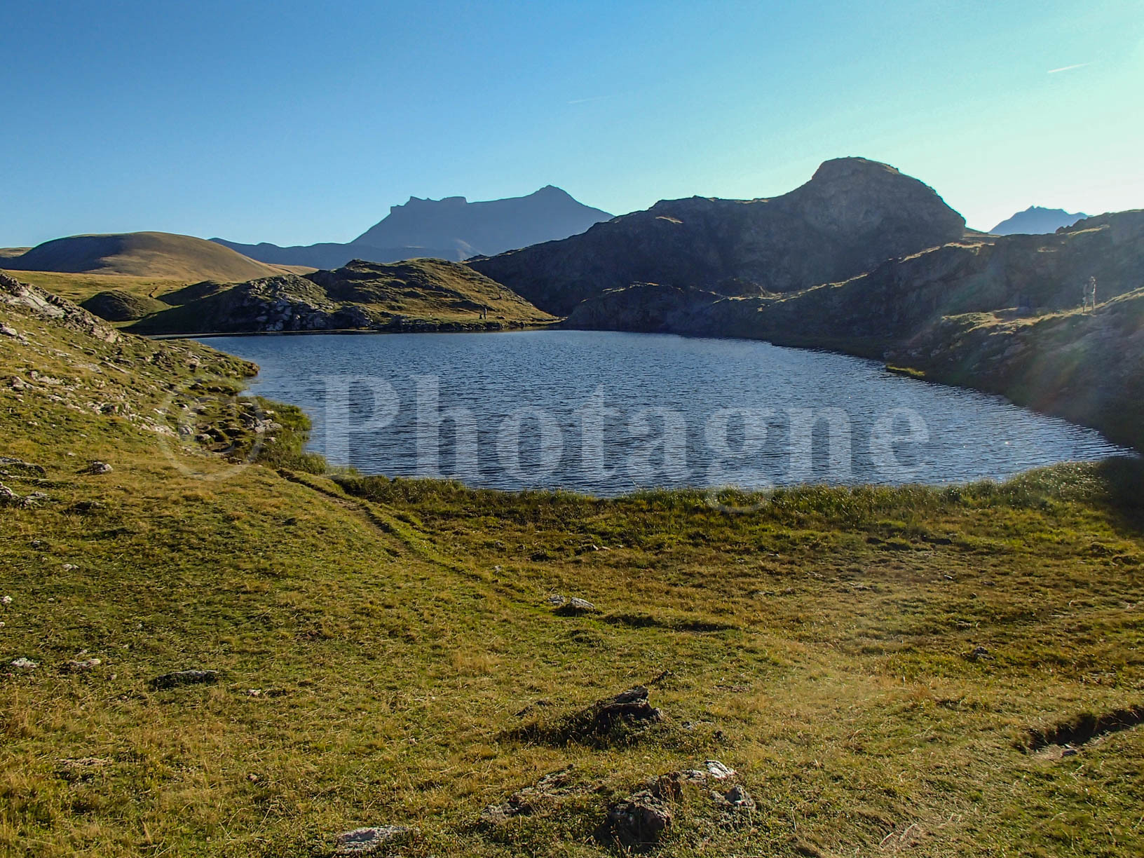
In the morning, after the most intrepid among us have admired the sunrise, we go back down to the foot of Thabor to cross the Col des Méandes. A magnificent high mountain landscape awaits us in the morning. We pass a few lakes as smooth as mirrors, then attack the Col des Muandes which overlooks the Névache valley. The view of Tabor is breathtaking. The path then goes back down along a pretty valley with multiple lakes.
In the evening, we set up camp near the last lake before reaching the Drayères refuge. The place forms a very beautiful place for bivouac. A few of us go back down to buy desserts at the shelter. Bad idea: the boss refuses to give us a reduction if we buy a whole cake instead of consuming it by the slice, and we therefore find ourselves having to pay for a chocolate cake... €40! The cake was a little salty all the same, and yet we're not even in Brittany.
Lakes Day
+ 500 m / – 1100 m 15km
Coming back down the following day, we returned to the Drayères refuge but we were careful not to buy anything. But the rest of the day made us forget this bad experience. It's simply enchanting, we go from one lake to another without getting tired of it. Except perhaps regarding the names: at the third round lake, we start to say that they didn't have much imagination in the area.
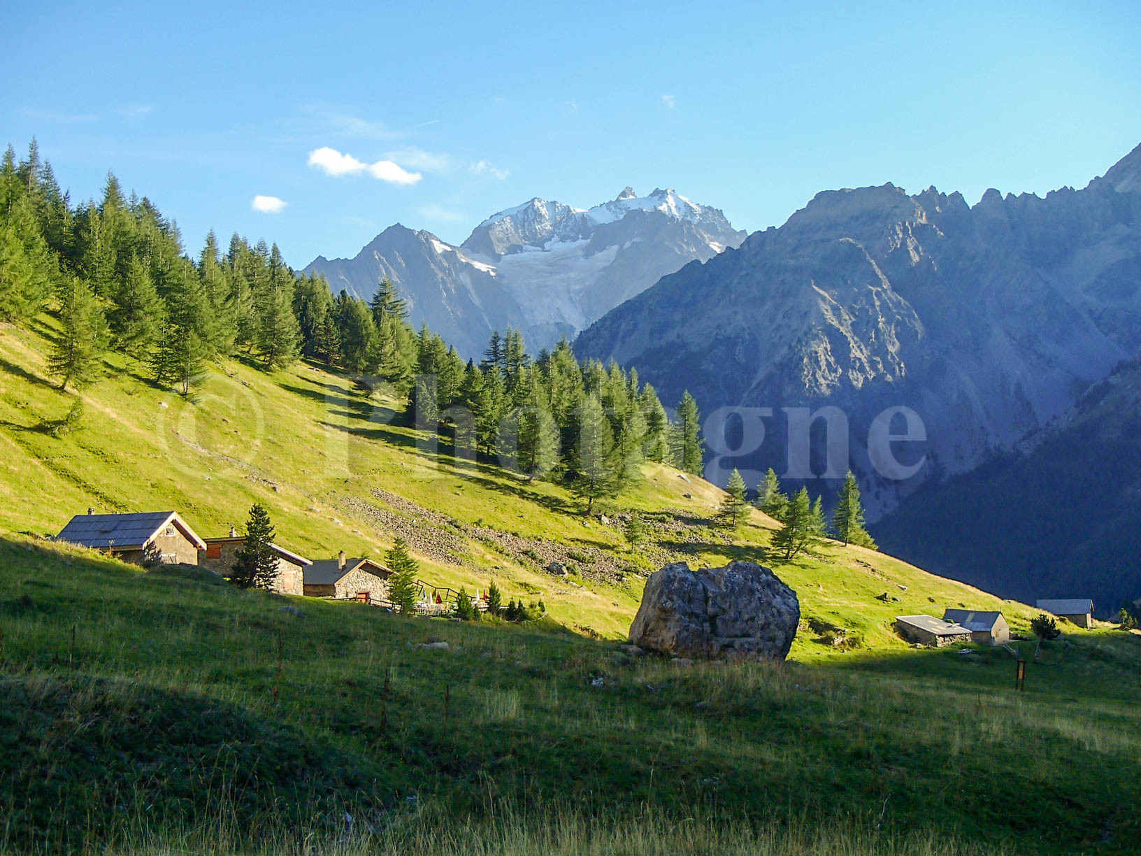
We picnic near the Ponsonnière lake with a beautiful view of the steep descent that awaits us in the afternoon. Then we attack it in unusual heat for this altitude. It's a heatwave in the rest of France. Bivouac at Alpe du Lauzet with a magnificent view of the Meije. The problem is that we barely have anything left to eat! Fortunately one of the little chalets in the Alpe saved the day: they agreed to sell us crozets and reblochon. What a meal like a king, especially when you imagine yourself eating leftover bread croutons!
Grave in memories
+ 1000 m / – 300 m 10km
We descend to the Pont de l'Alpe in the cool of the morning: no room for the nighttime heatwave at altitude. The last stage of the route requires going to La Grave, so we split into different groups to hitchhike. I managed to misplace my cell phone in my kind driver's car. He will then send it back to me by post (a huge thank you to him!).
Finally arriving safely at La Grave, we stock up on fuel (preferably milk) for the next two days. We begin the climb through the small villages above the Grave. After a memorable ice cream at Chazelet, we climb the tough hill which leads to the Emparis plateau under the afternoon sun.
The surroundings of the plateau in the evening are superb: a gently rolling landscape suspended at an altitude of more than two thousand meters, just opposite the Girose glacier. We bivouac at Lake Lérié. We are not alone but it is easy to understand why: the lake is only a few dozen meters from the cliff which overlooks the valley. The view of the glacier is fantastic. We pitch the tent on a narrow strip of land between the lake and the cliff. Definitely one of my best mountain bivouacs!
From Emparis to Paris
+ 100 m / – 1500 m 13.5 km
Already the last day of this course! We cross the Emparis plateau as if in a dream in the heat present in the morning. At the Chalets du Fay (or at the Mouterres refuge, I don't remember very well today), we see a grandmother making crozets... by hand! A titanic job. I really regret not staying to eat the evening meal.
Past these chalets, the landscape is still beautiful but less enchanting than on the rest of the plateau. We gradually descend into the valley passing by the Chatons refuge, unfortunately closed. Time for the last blueberry pie! Then it's a straight downhill run to Singuigneret, the village located on land that threatens to collapse into Lake Chambon. At the dam, we reconnect with civilization by boarding the bus which takes us back to Grenoble. At that time, I still had the misfortune of living in Paris, which means that I didn't really want to go back...
Don't hesitate to comment if you too have covered portions of this itinerary on a touring hike! Personally, I think the two best parts of the trip are Mount Tabor and the Emparis Plateau. Besides, I recently came back in winter, so go take a look at the corresponding article !
This story was written more than five years after the fact, please excuse any inaccuracies in the description of the route…
0 Comments