The northern Corsica is a unique playground for mountain hiking enthusiasts. Here, peaks plunge into the sea, ridges are sculpted by the wind, and trails traverse wild, raw, and spectacular nature. Just a few hours from the mainland, you'll find landscapes of rare diversity. Corsican pine forests, high-altitude lakes, arid plateaus, hilltop villages, and secret valleys where the voices of the maquis still echo.
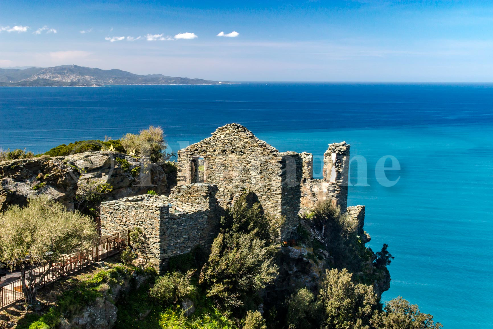
Hiking in Corsica is also a matter of rhythm and season.summer, crushed by heat, makes the effort difficult and the trails dry.winter, harsher than one might imagine, covers the high massifs with snow. It is at spring, when everything blooms, and at theautumn, when the light becomes softer, when the Corsican mountains reveal themselves in all their splendor.
And then there is the welcome. Frank, direct, often warm. After a day of walking, we finally meet around a plate of wild boar stew, of Corsican cheeses powerful, of artisanal delicatessen or a piece of fiadone very fresh. These are the moments that anchor the memory, beyond the sight.
In this article, I share my five favorite routes in Haute-CorseThese hikes, accessible by car from Bastia, are day trips chosen for their beauty, diversity, and the emotions they evoke—always on foot, often far from the crowds, and never far from the real thing. Don't forget: if you enjoy the photos on this page, feel free to visit the section Pictures – and why not buy a poster of Corsican landscapes?
Hiking on the Cap Corse customs trail from Macinaggio
Cap Corse has a charm and character that can't be found anywhere else. Particularly in spring, the tender green of the landscapes will surprise you: it's a region that receives quite a bit of rain! The vegetation inland is therefore a veritable jungle rather than maquis.
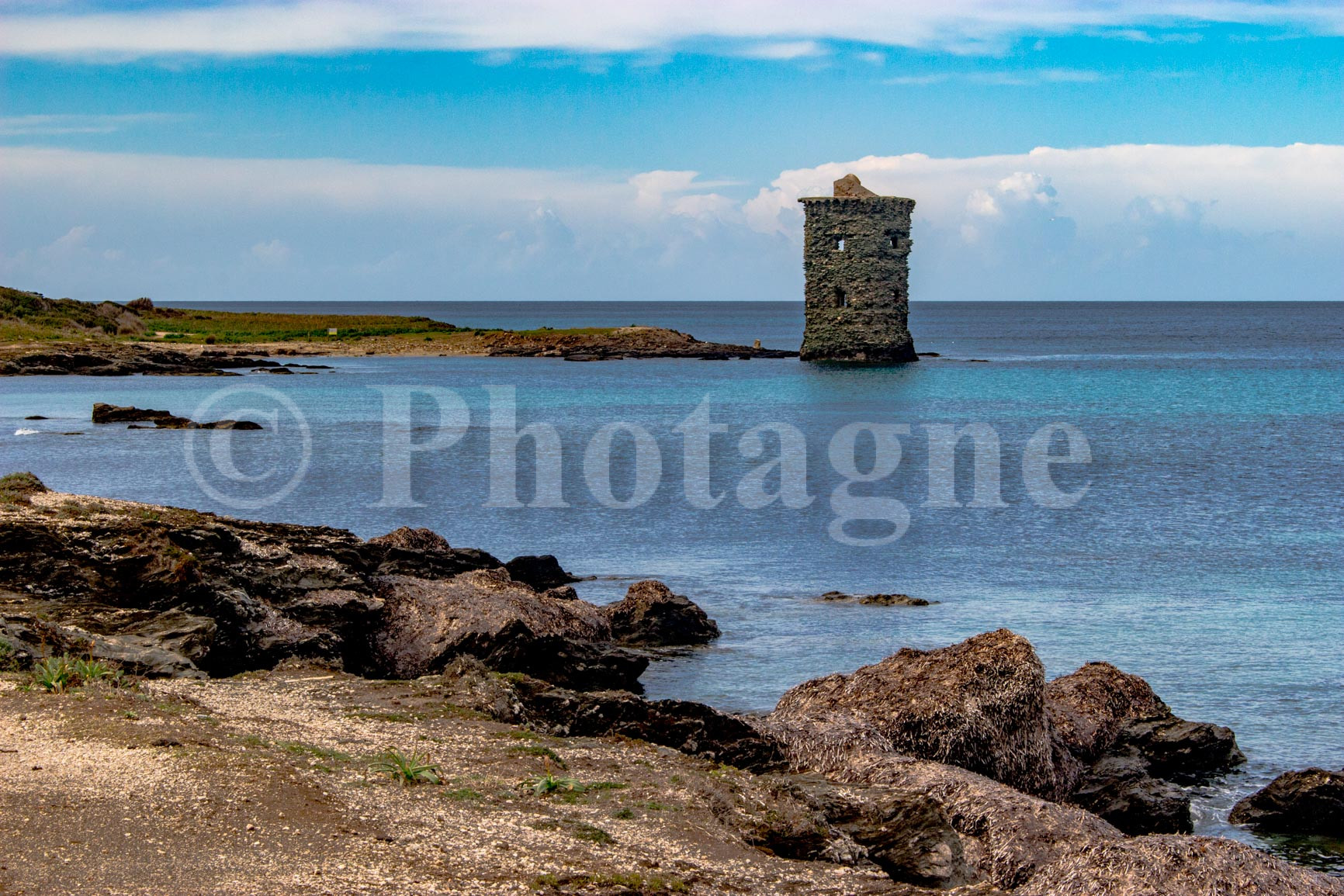
The hike in Corsica that I'm suggesting follows the coastal path from the village of Macinaggio. It's an hour's drive from Bastia. You'll find stunning, unspoiled beaches accessible only via this small footpath. It's possible to undertake a very long hike (perhaps even several days) by traversing the entire path that runs along the Cap Corse peninsula to the port of Centuri, but you can also opt for a day trip as an out-and-back hike. The route presents no technical difficulties.
Along the way, you'll discover one of the oldest chapels in Corsica, nestled in the heart of the maquis, as well as a Genoese tower with its feet in the water. I recommend spring or autumn for this hike. The heat can make it unpleasant in summer (although it's always possible to cool off with a well-timed swim!).
To find the route and GPX track, see my page. customs path at Cap CorseThe route I describe on this page is long, 24 km. But you can do the first part as an out-and-back hike if you only want to do it in one day. It's also the most beautiful part, so you won't miss anything 😉
Lake Nino
Inland, you can explore numerous hikes in the mountains of Upper Corsica. Here, you'll find rocky landscapes and pine forests, a far cry from the coastal atmosphere of the previous hike. Lake Nino is a stop on the legendary GR20. For me, it was one of the most beautiful moments of this trek, which I completed 10 years ago.
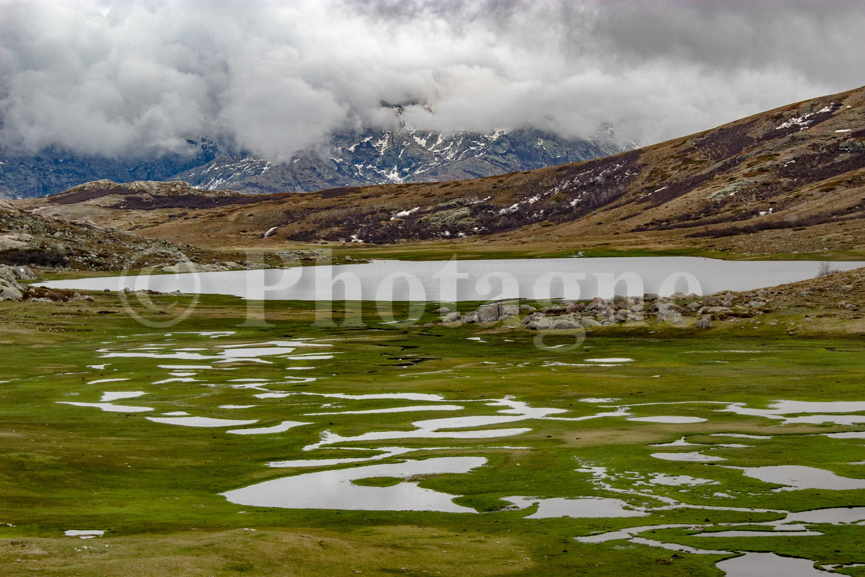
It's possible to do a day hike to see this famous lake and its "pozzines," small alpine ponds characteristic of the high-altitude marshes of Corsica. The hike I describe ascends along a poorly marked trail (bring a GPS or a good map!). The route isn't technically difficult, but you need good navigation skills and some experience hiking on rocky terrain. The lake is the perfect spot for a picnic before descending via a well-marked path, for a total descent of 900 meters. Don't attempt this hike too early in the season, as there might be too much snow at higher altitudes.
To find the GPX track of the route, go to my page hike to Lake NinoThe starting point is located on the road that passes by Lake Calacuccia, 1 hour and 30 minutes from Bastia. Don't forget to bring good walking shoes and enough water for the day.
Mount San Petrone
We're sticking with the theme of hiking in the Corsican Alps with this route that climbs to San Petrone. It's a fairly central peak at 1767m altitude with a magnificent view of the mountains of Upper Corsica. I personally hiked it in April, and it was a bit early as there was still quite a bit of snow near the summit (not enough to turn back, however).
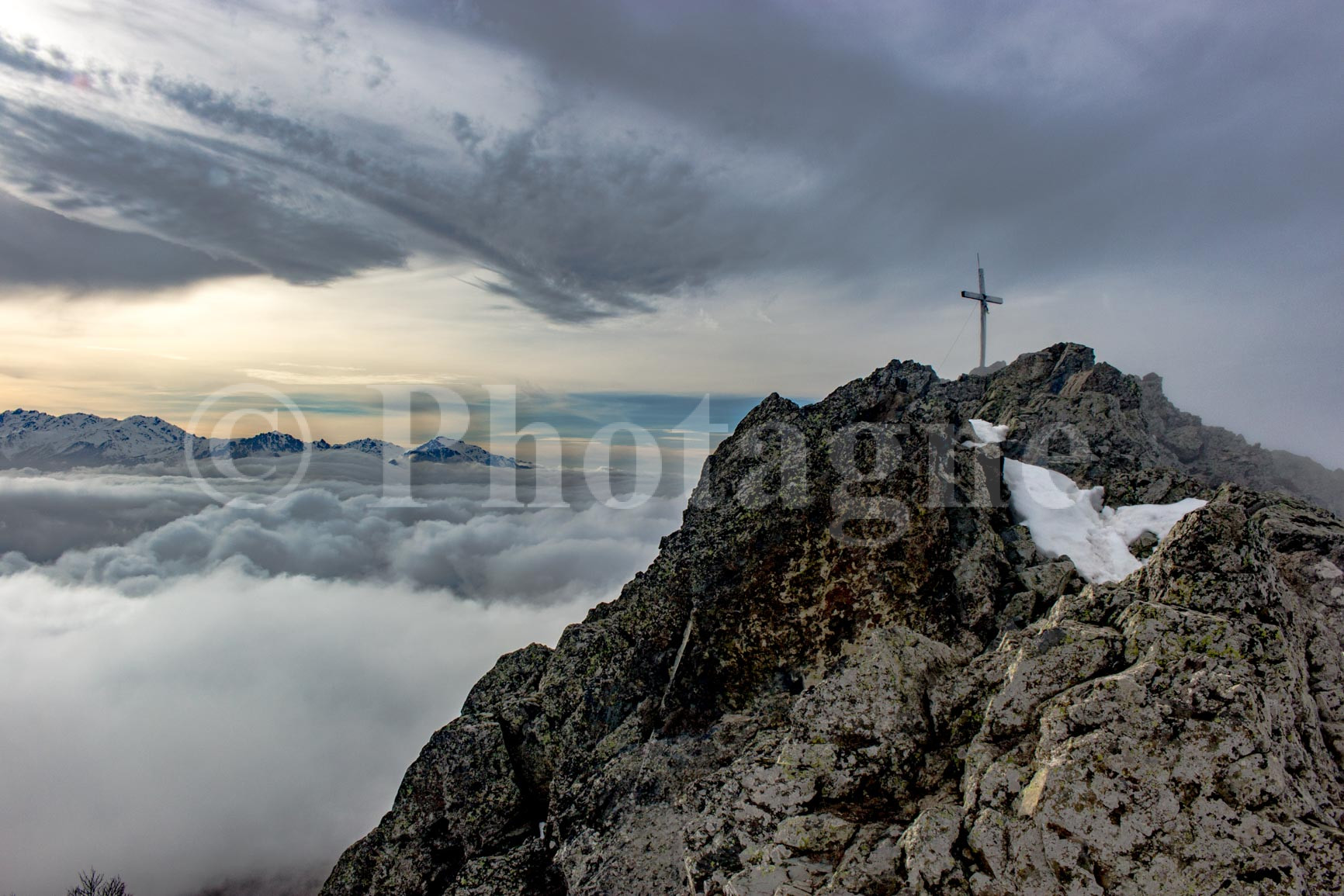
The trail starts at the Col de Prato pass, 1 hour and 10 minutes from Bastia. It winds through beautiful coniferous and beech forests before culminating in a final, steeper climb across open, rocky terrain, with a total elevation gain of 800 meters. The end of the route is somewhat vertical but presents no technical difficulties. On the return, you can stop at the Auberge du Col de Prato, which is quite good, or at a restaurant in one of the small, isolated villages along the way.
To find the route and the GPX file, go to my article hiking in San Petrone.
The Cap Corse ridge trail
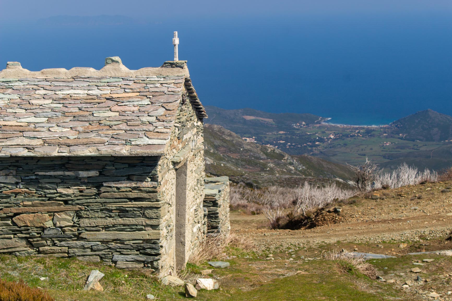
We return to Cap Corse for this superb, little-known hike in the mountains at the heart of the Cap. The starting point is in the valley behind Sisco, a 30-minute drive from Bastia. The trail climbs to Cima di E Follicie (1324m), one of the highest points on Cap Corse, with an elevation gain of 1100m. The most remarkable feature is the view of the sea on both sides of the mountain range that forms the Cap.
The route climbs along a track to the Col Saint-Jean pass, then follows the ridge path itself, which is marked with fairly discreet blazes. It presents no technical difficulties but can be hard to follow in places. You can hike it from spring onwards. Indeed, there is no shade along the path, so hot summer days are not recommended.
To find the GPX track and route description, you can visit the route description page.Altituderando.
The Gulf of Saint-Florent and the Agriates Desert
We finish with a classic hike in Upper Corsica: the Agriates Desert near Saint-Florent. It's a 40-minute drive from Bastia. This coastal hike crosses this incredibly wild and sparsely populated area between Saint-Florent and Ogliastro. The entire trek takes two or three days, but you can also do a simple out-and-back hike on the first section in just one day. It's an ideal route for relaxing and swimming along the many beautiful, secluded beaches you'll encounter.
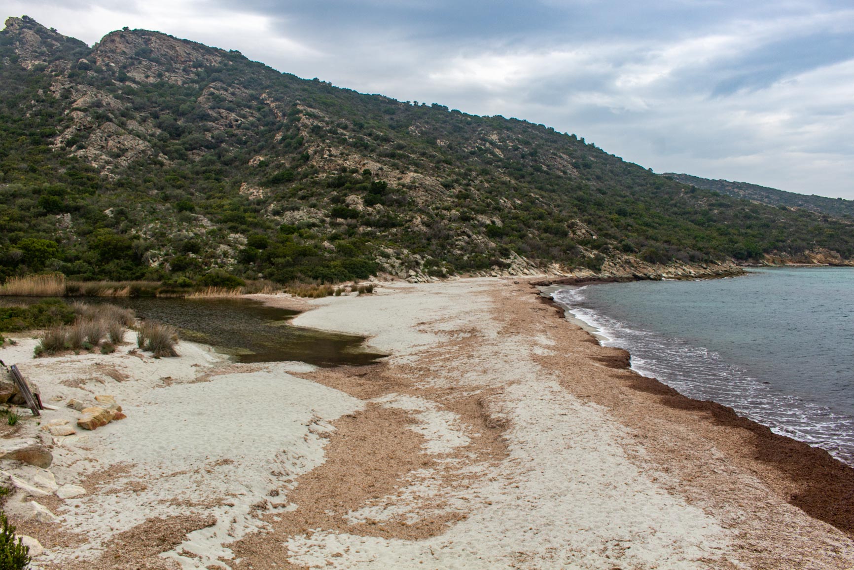
The route follows the coastline, alternating between sections along the beaches. It presents no technical difficulties, but a river must be forded after a few kilometers of walking. The crossing can be more or less difficult depending on the amount of rainfall during the season.
To find the GPX file and route description, you can go to Altituderando.
Conclusion: hiking in Corsica differently
These five hikes are just a glimpse of the richness and diversity of the northern CorsicaEach itinerary offers a different facet of the island: from windswept ridges to deep forests, from peaceful lakes to heavenly coasts. Corsica cannot be summed up—it must be traversed, slowly, on foot, and held for a long time.
To extend these moments of walking, I invite you to discover my Corsican mountain photographs. Photos taken during my hikes, often in the morning or evening light. You will find some of the landscapes evoked here, captured in their calm or their power.


 FR
FR  EN
EN  IT
IT
0 Comments