The Fisherman's Trail in the Algarve, Portugal, is a magnificent coastal path, renowned as one of the most beautiful seaside treks in the world. The complete route comprises 13 stages and covers 226 km. However, the vast majority of hikers choose to complete only 4 or 5 stages from the northern starting point, for reasons that remain unclear to me. I, on the other hand, opted to complete this trek by camping from south to north, starting in Lagos, which marks the southern end of the trail. And I'm so glad I did: between dolphins and beaches deserted by tourists, between deserted paths (unlike the northern section!) and unspoiled nature, this southern part of the Fisherman's Trail is definitely worth the trip!
In this article, I'll start by giving you some tips for hiking this trail. Then, let's get to the story! I'll tell you about my five-day trek from Lagos to Aljezur, with photos of the route. The GPX track might be slightly inaccurate as it wasn't recorded on the ground (it was drawn afterward). I hiked this trail at my own pace: my stages may differ (often longer…) from the "official" stages. I recommend you do the same and hike this trail according to your own preferences.
If you like the photos on this page, you can also check out my section Pictures And why not buy a poster print of my best photos? It's a great way to support me ;). I hope you enjoy this story and that it inspires you to embark on this adventure yourself!
Some practical tips for creating the fishermen's trail
The Fisherman's Trail presents no technical difficulties; the paths are well-marked and easy to follow. However, before setting off, it's best to prepare your hike. Below, I've listed some questions you might have and explained how I managed. If you have any further questions, feel free to ask them in the comments section of the article!
When to leave?
I personally did this trek in mid-May, and I found it ideal. Many people choose to do it in the summer, but the sweltering heat could honestly turn this trek into a nightmare in the sections further from the coast. There's very little shade along the trail, so I would recommend spring and autumn.
That said, don't leave too early either: a friend of mine went in mid-April and had a lot of rain! Portugal is a rainy region, although the weather in March and April can be unpredictable. in fine The weather can vary greatly from year to year. Finally, note that being by the coast means you'll almost always be refreshed by a sea breeze. Very pleasant, and this way you won't suffer too much from the heat!
Where to sleep?
The option chosen by most hikers is to stay in the accommodations available in the villages along the route. There are many in each village, so you should be able to find one even at the last minute.
If you've read the rest of my articles on Photagne, you know I'm a big fan of bivouacking ;). No need to book accommodation, and you can adapt your route each day to your walking pace. Unfortunately, camping is prohibited on the Fishermen's Trail, and there's no distinction between bivouacking and camping in Portugal (as a reminder, bivouacking is camping for just one night).
So I simply chose to sleep on the beach without a tent (obviously, this only works if the weather is good). It's not really camping, so we get around the restrictions. And honestly, nobody spends the evening on these deserted beaches. You can take advantage of the sea to freshen up. Plus, you sleep to the sound of the waves under the Milky Way: what more could you ask for?
If you choose to do as I do, don't forget the golden rule of bivouacking: leave nothing behind. Bury or burn your toilet paper (beware of the risk of fire, especially in Portugal…) and take your rubbish with you.
How to resupply with water and food on the fishermen's trail?
This can be one of the trickiest parts of the trail. Out in nature, there's simply never any drinking water. So you're forced to stop at bars and restaurants to refill your water bottles (what a shame! You can always grab a paster de nata while you're there). Since most places will try to sell you bottled water, be discreet when you go to the restroom with your reusable water bottles. I saw one bar put up a sign saying "non-potable water" in the restroom: it was clearly designed to force tourists to pay. I drank their water without any problem.
As for food, there are small supermarkets in almost every village you pass through daily. I chose, as usual, to eat bread and cheese at lunchtime and cook pasta on my camping stove in the evening. You can also eat in the very good restaurants you come across along the way.
What equipment should I choose?
You don't need fancy gear to hike the Fisherman's Trail in Portugal. I recommend the lightest shoes possible: they'll fill up with sand all the time, so heavy hiking boots are unnecessary. If you plan to sleep outdoors like I did, a 5-10 degree comfort sleeping bag will be perfect. A small camping stove will allow you to cook a hot meal in the evening. Hiking poles are useful. And of course, bring a towel and swimsuit, although swimming nude is perfectly acceptable on these secluded Algarve beaches.
The Fisherman's Trail, Day 1: From Lagos to Salema
From Lagos to Luz
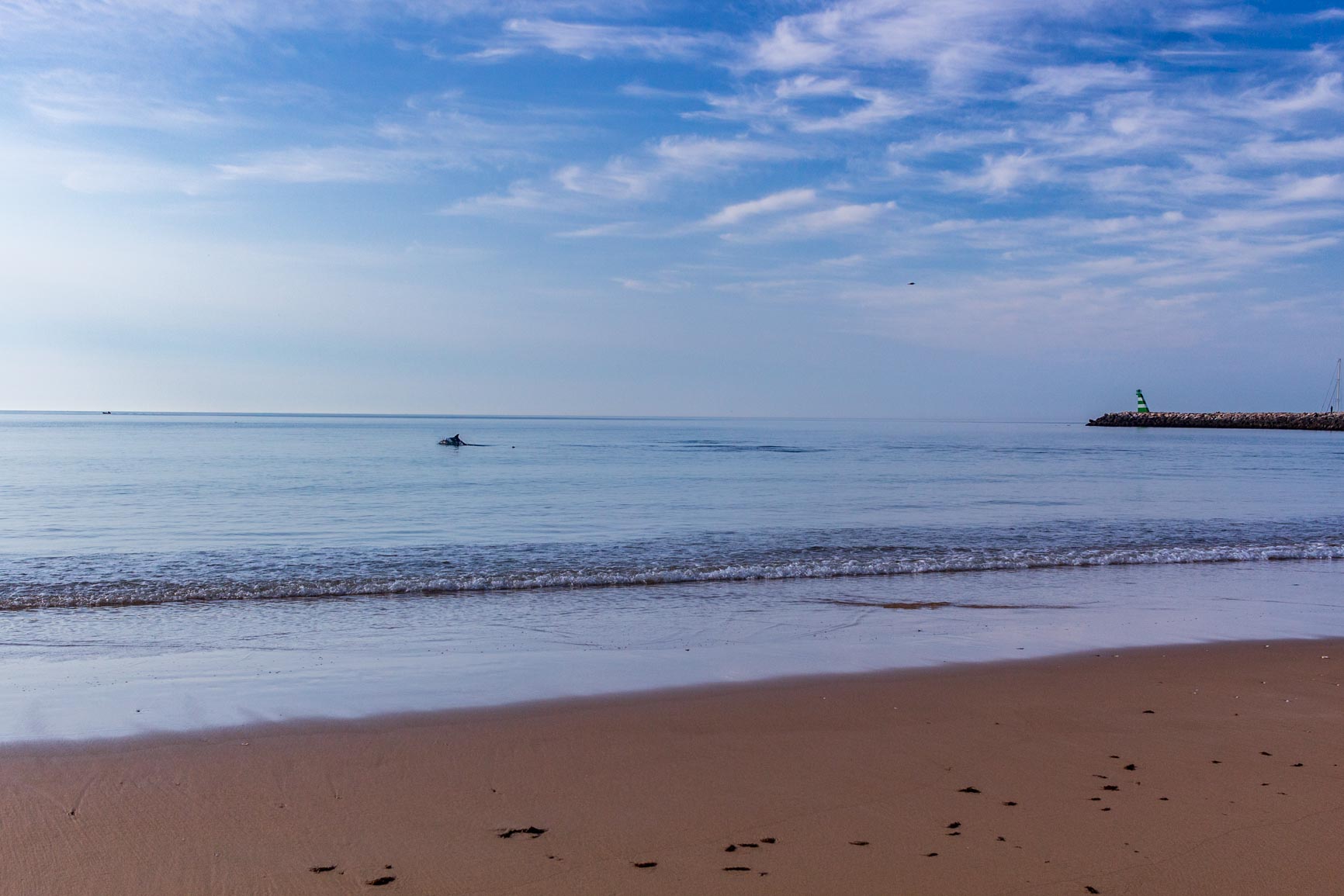
So, on this first day, we set off from Lagos on the Fisherman's Trail. We slept on the main beach in Lagos (Meia Praia), which is very quiet at night. At sunrise, an incredible welcome gift awaited us: dolphins very close! They were hunting just a few meters from the shore, and we could see fish jumping in front of them. I almost wanted to join them, but I preferred to let them hunt in peace.
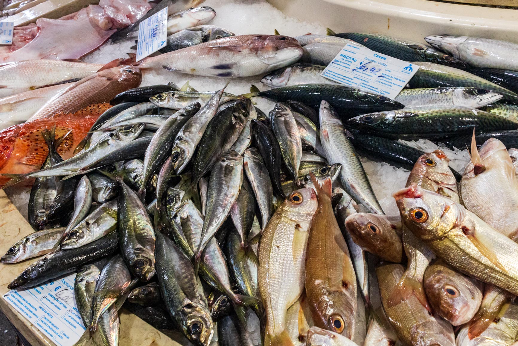
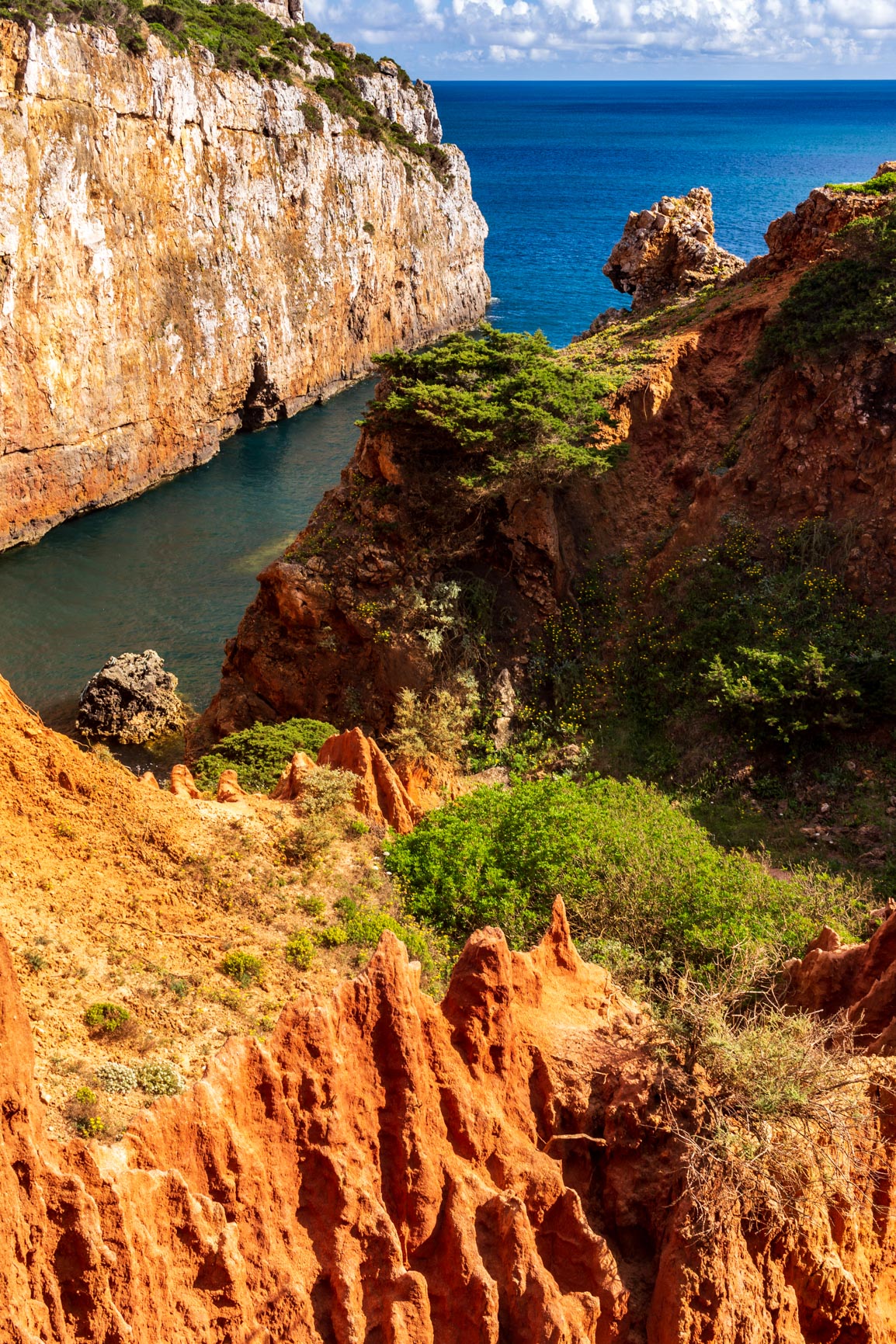
After a delicious breakfast and a visit to the fish market (highly recommended!), we left the city center quite late. The path first led past stunning clay cliffs (unfortunately also very touristy). The colors, the shapes created by erosion, and the sea combine to form a unique landscape that is one of the most beautiful on the trail. We never tired of observing these cliffs with their astonishing forms.
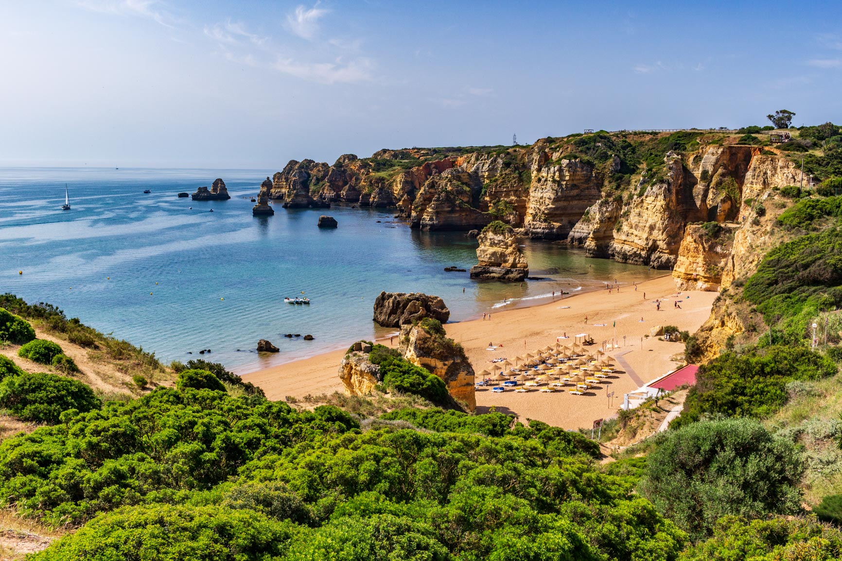
Next, we passed Punta da Piedade, and the flow of tourists stopped. The path continued along the cliffs, though they were less impressive. When I passed by, the water had a strange color. The cliffs must be eroding very quickly, tinting the water.
From Luz to Salema on the Fishermen's Trail
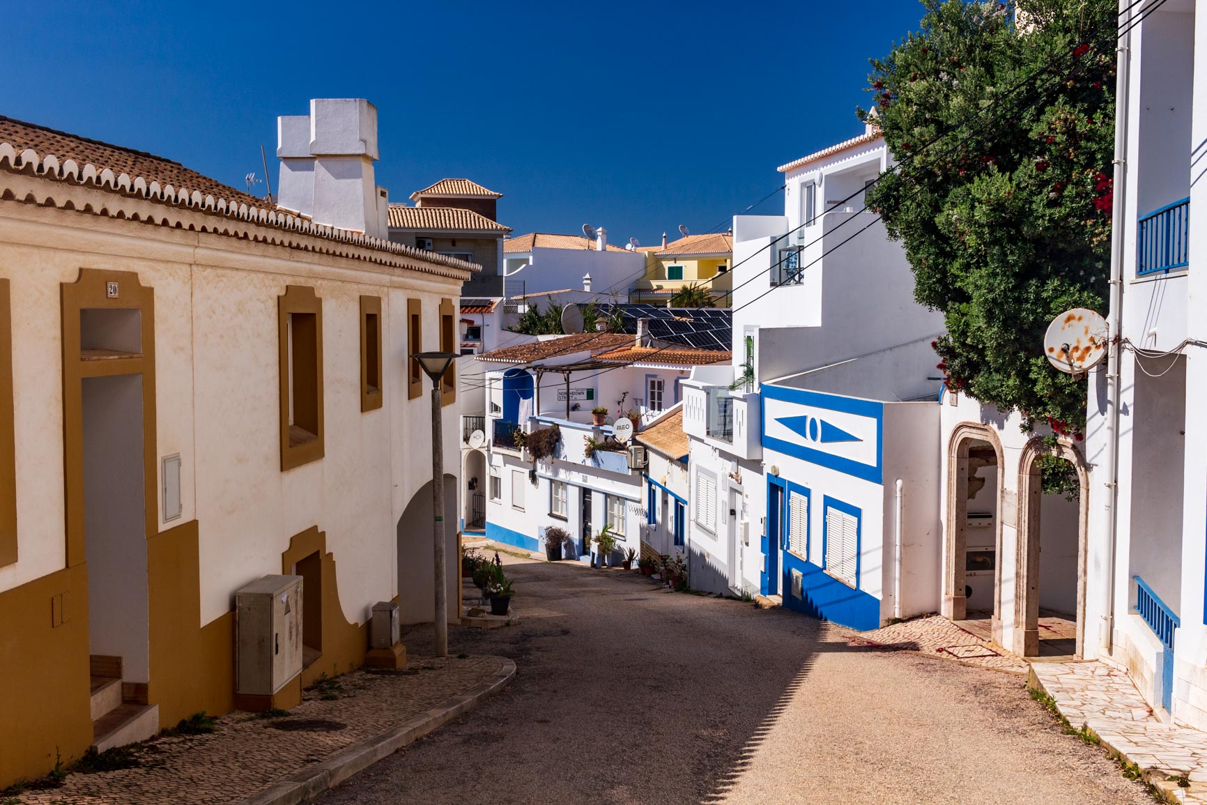
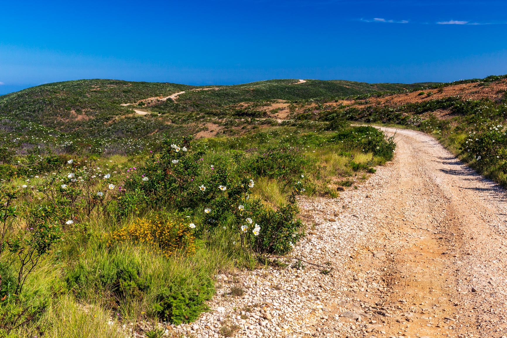
We then descend quite steeply to the village of Luz. It's a lovely spot to stop for a swim and a picnic. Afterwards, we continue along the coastal path, which is a bit wilder. We pass through the typical Algarve maquis vegetation: mastic trees and rockroses. We then arrive at the village of Burgau, where it's pleasant to stroll through the streets before stopping for a break on the beach.
Leaving Burgau, you pass a housing development of identical houses, each with a swimming pool, that you'd love to see demolished. The path then climbs slightly, offering superb views of the rocky coastline. The vegetation becomes denser; there's even a pine forest. You can feel yourself getting further from urban centers; the area is becoming wilder.
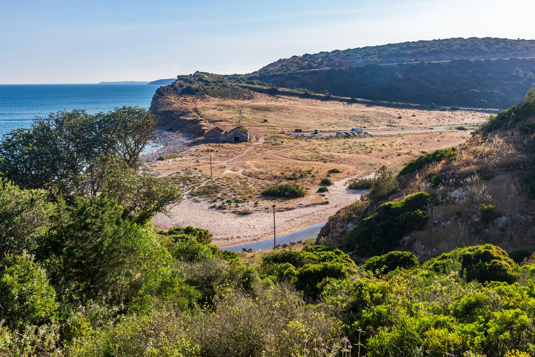
At Boca do Rio beach, there's a small river to ford. Helpful stones are placed a little upstream. The path goes up and down quite a bit: in the end, there's also some elevation change on the fishermen's trail! A final descent leads us to the pretty village of Salema. Arriving among the fishermen's houses invites contemplation.
From Salema to Praia Santa
Because of our slightly late departure from Lagos, it was getting late to complete our planned leg of the journey. Tired after a long day, we decided to stop for a beer. We fled an overpriced bar run by a Scottish woman and ended up at the local sushi place. They were so welcoming that we couldn't resist their all-you-can-eat menu. We feasted, devouring an obscene amount of sushi!
Night has now fallen, but we want to sleep on the next beach, Praia Santa. So we continue 800 meters with our headlamps; I really enjoy walking at night. We arrive at the beach where the sound of the waves is deafening. We discover a small area sheltered by rocks at the back of the beach: it's perfect for tonight.
Day 2: From Salema to Sagres
From Praia Santa to Praia do Zavial
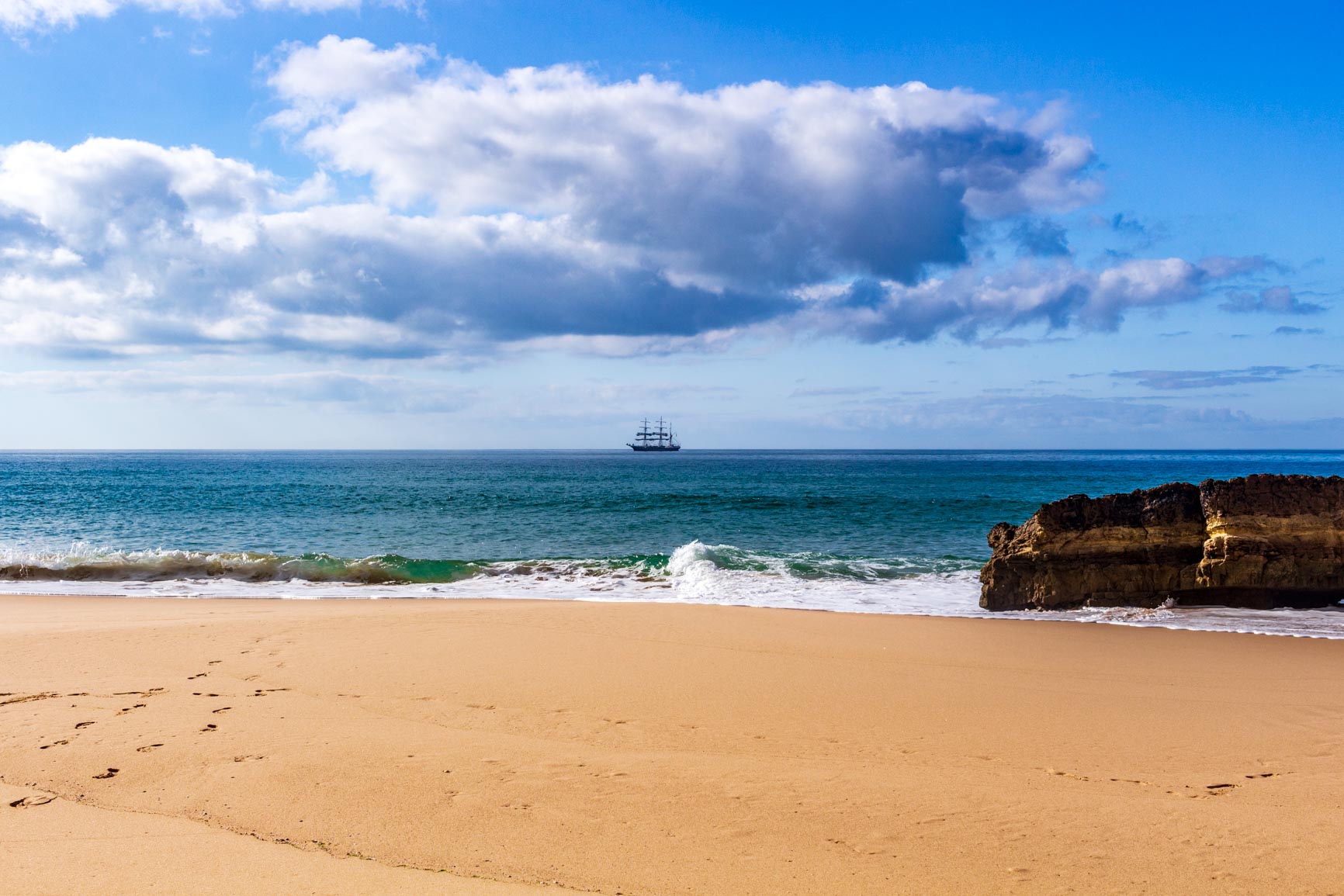
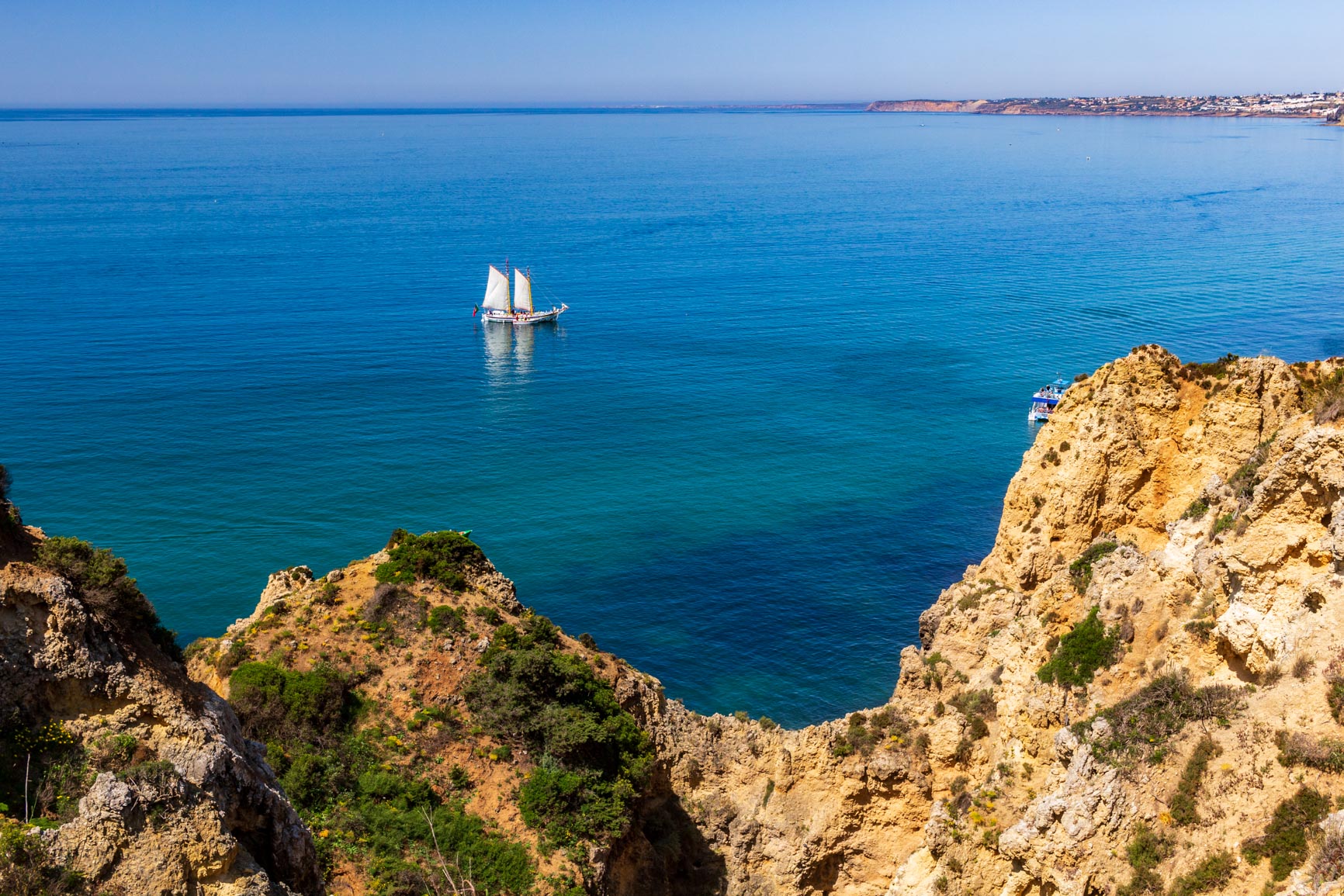
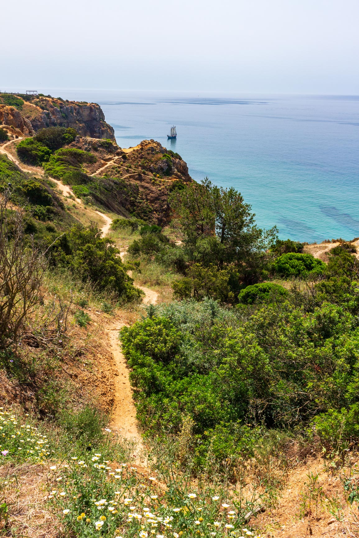
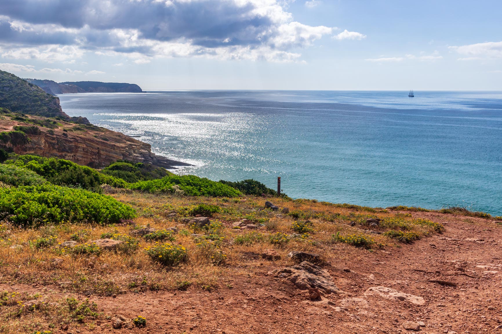
We reluctantly left this idyllic little beach. At night, we hadn't been able to fully appreciate its beauty. In the distance, on the ocean, we spotted a magnificent tall ship: the Belem, a French vessel with a Portuguese name. It would bring us luck for this leg of the journey, which, for me, was the most beautiful. Indeed, the stretch ahead was consistently beautiful throughout, unlike the other days where stunning scenery alternated with less interesting stretches.
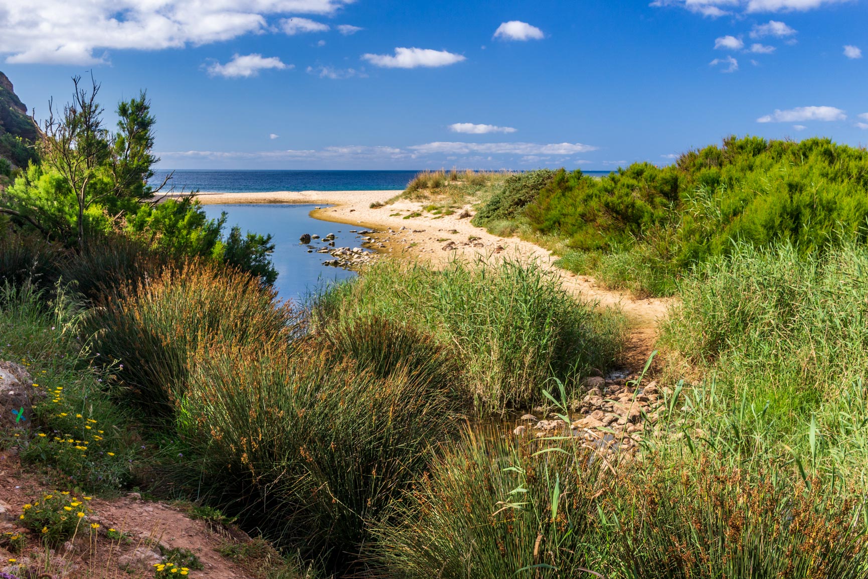
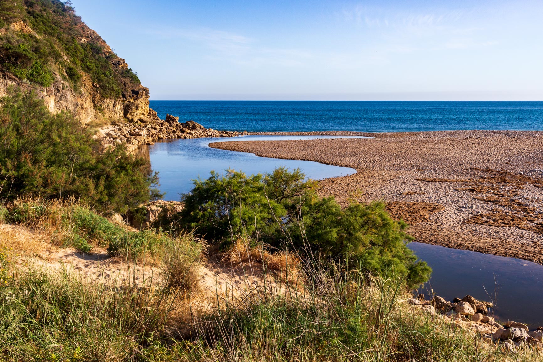
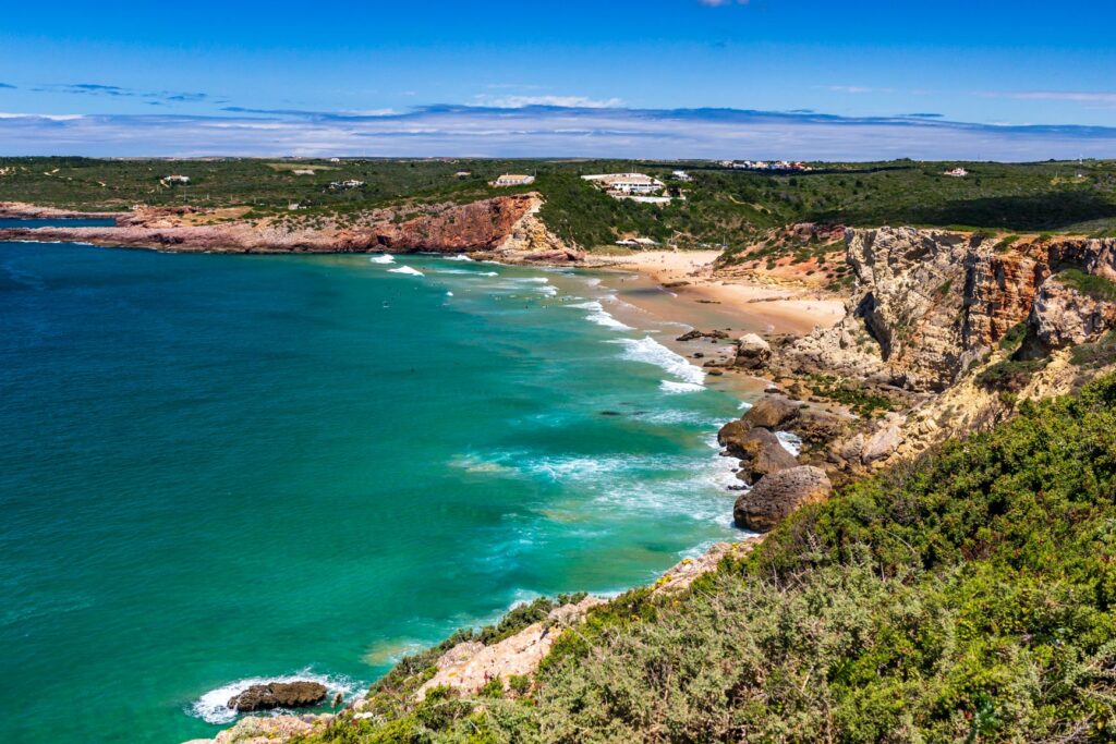
We first stopped at the stunning Figueira beach, one of my favorites on this route. It marks the end of a lush little river. Then we climbed steeply, following cliffs again with views of a string of small beaches. The area is very wild; there's hardly anyone there. We did, however, spot a few vans in a parking lot, a recurring, almost stereotypical image of this trip: hippie surfers in Volkswagen vans. The Algarve is full of them!
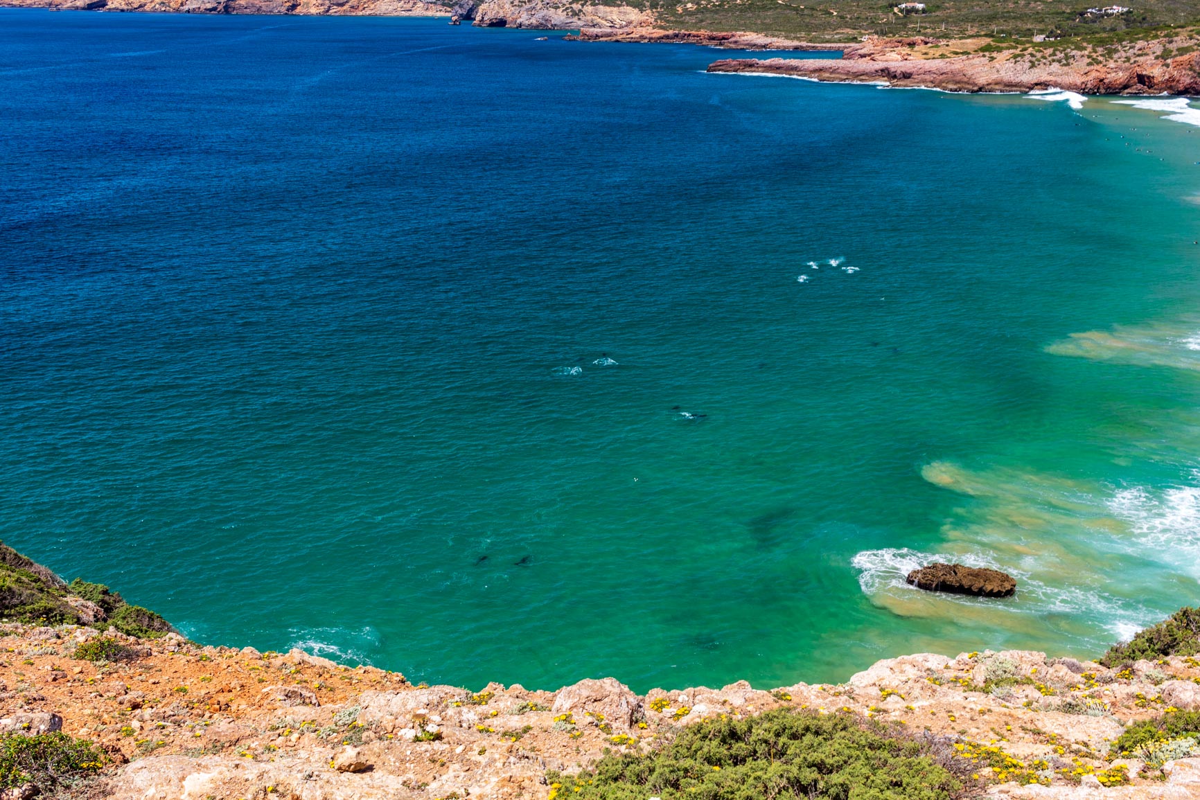
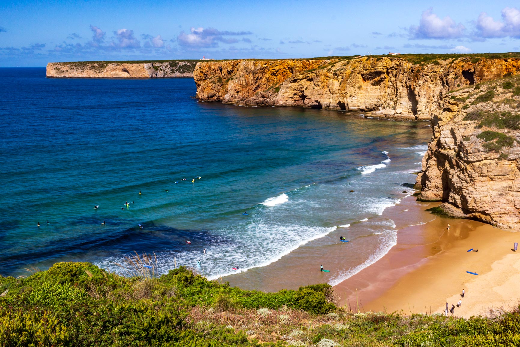
We arrive at Punta de la Torre. For the second time, we spot dolphins! They're right below the cliff we're overlooking. We can see them perfectly in the clear water. The other local animal is the surfer: the beach is full of them, peacefully waiting for the perfect wave while watching the dolphins in the distance. We head back down to Zavial beach where we stop at a café; the sun is starting to get intense.
From Praia do Zavial to Sagres
We continued on to the next beach (Ingrina) before stopping for a well-deserved long break in the shade. Then it was back to a very wild section of trekking through the maquis. We never tire of this coastal path, which constantly zigzags. Barranco beach is worth a look; once again, it's occupied by a few surfers with their vans parked in the lot.
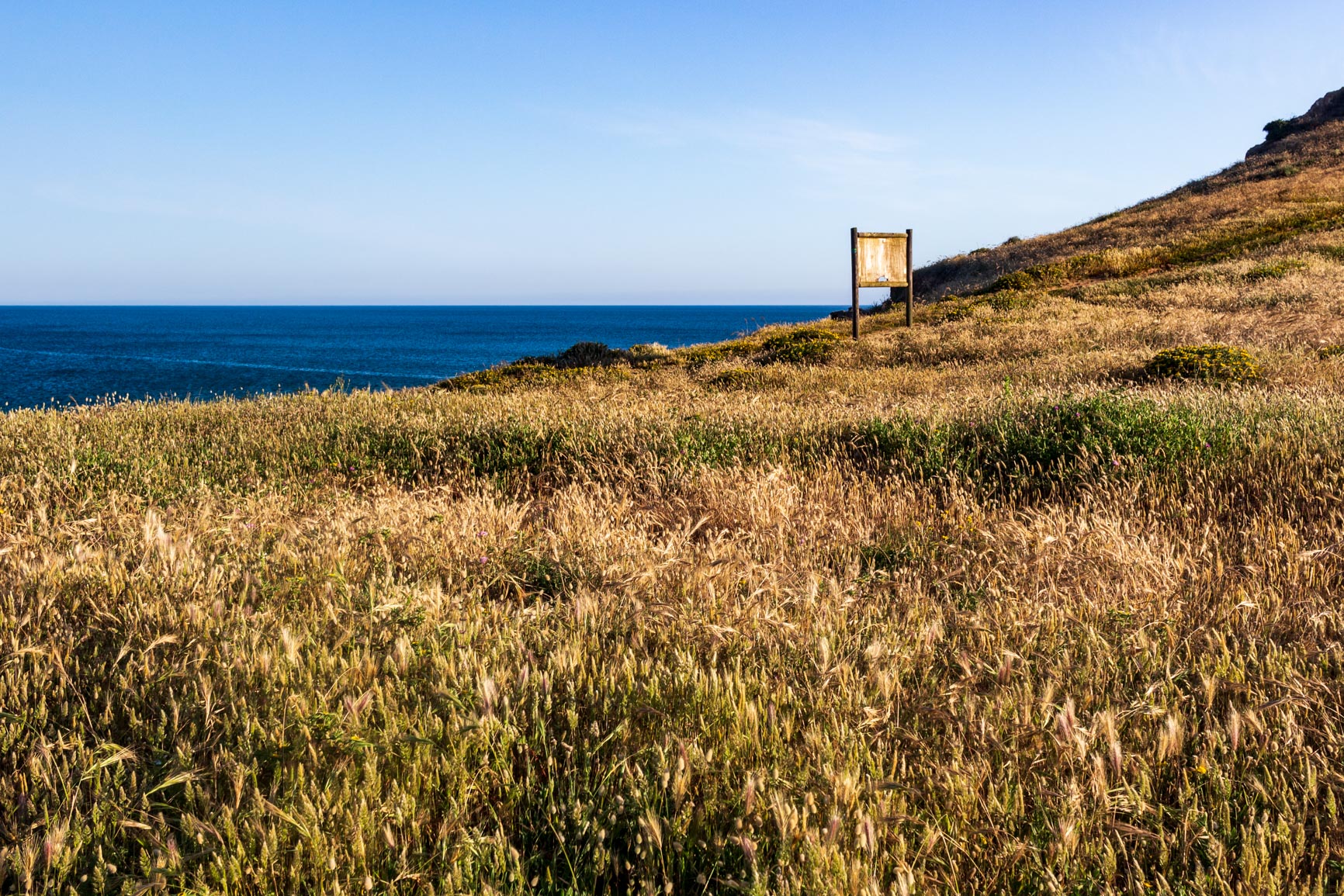
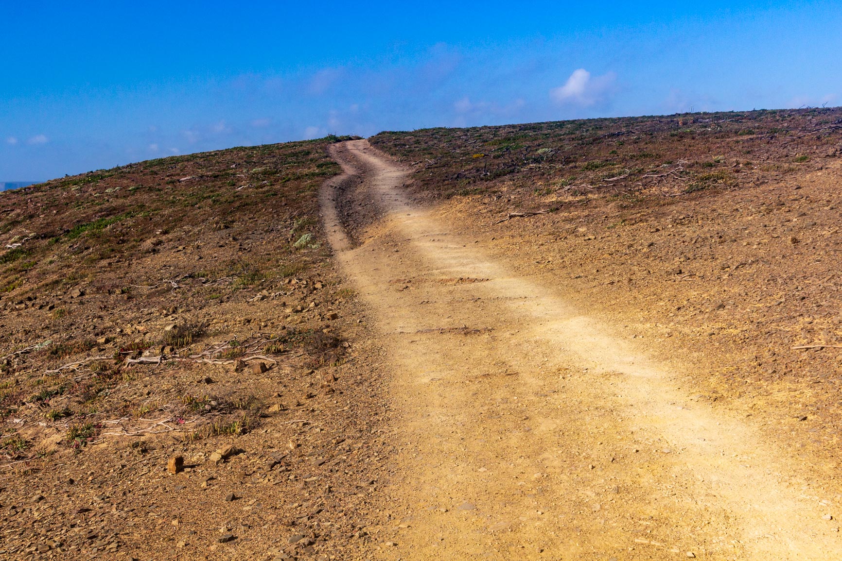
We climb again to reach a plateau. Yes, there's a significant elevation gain on this southern section of the Fisherman's Trail! But once on the plateau, the contrast is striking: the path is (for the first time) completely flat for kilometers through the fields. This allows us to hike almost on autopilot.
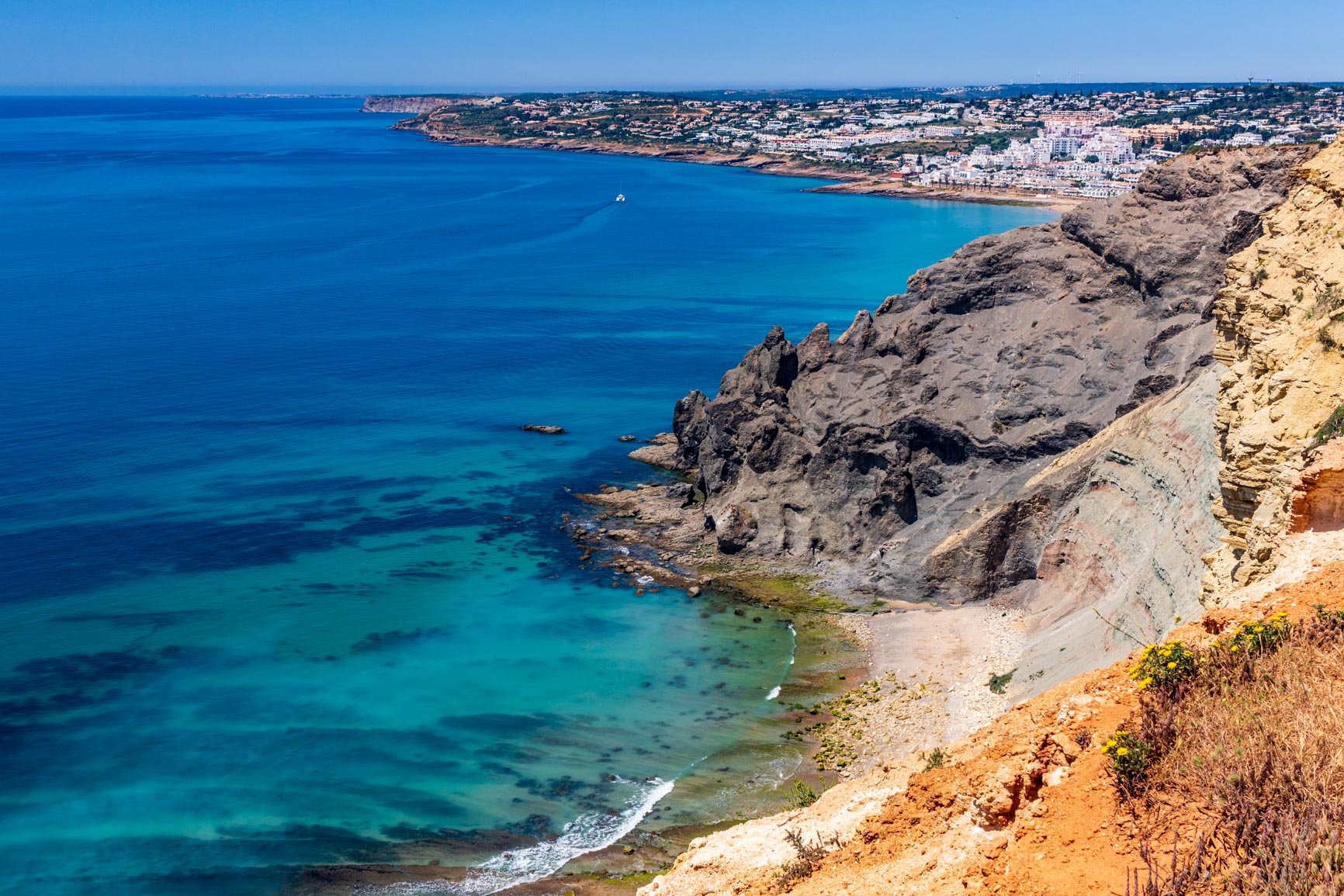
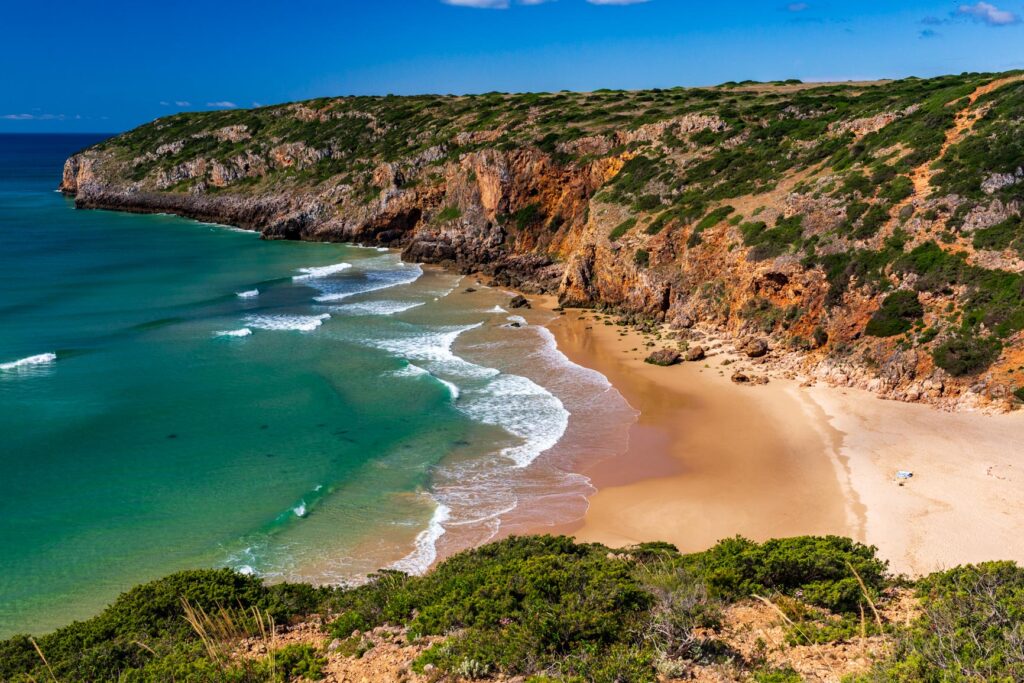
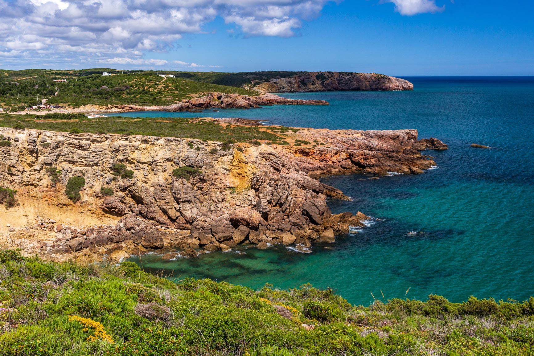
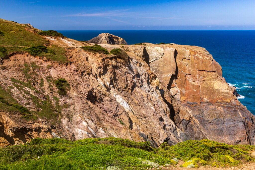
We come to a truly beautiful spot, undoubtedly one of the most beautiful on this route. A large limestone cliff borders a section of clay soil that erodes into very strange and intricate shapes. The contrast of the forms and colors with the ocean is remarkable.

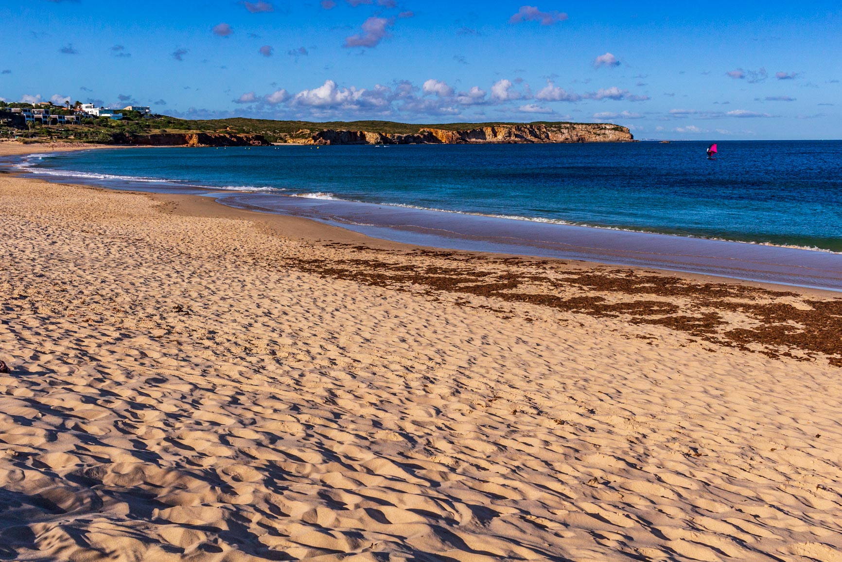
We arrive at Martinhal beach behind Sagres. It lies in the middle of a calm bay, protected from the open sea swell by the Sagres headland. We watch thoughtfully as a windsurfer makes repeated trips back and forth.
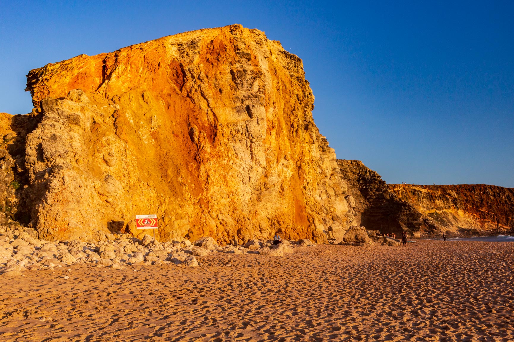
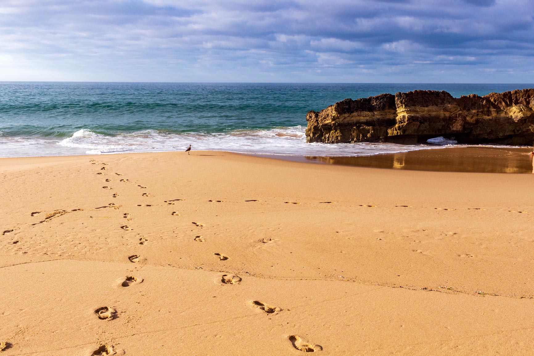
We finally head up to Sagres to end the day. The town isn't amazing; we only stop to do some shopping. Then we walk down to the beach facing the open sea. What a contrast! Enormous waves crash onto the sand with a constant roar. The cliffs turn ochre in the setting sun. We enjoy a magnificent evening before slipping into our sleeping bags, lulled by the white noise of the ocean.
Day 3: From Sagres to Vila do Bispo
From Sagres to Praia do Telheiro
In the morning, it's hard to find an open café in Sagres: the tourists are much more active in the evening! We eventually stumbled upon a surfers' hangout, perfectly in keeping with the hippie vibe. The path then follows the road straight to Cape St. Vincent: the coastline is pretty with its cliffs, but not particularly glamorous. We reached the lighthouse, perched high on the cliffs overlooking a deep blue sea.
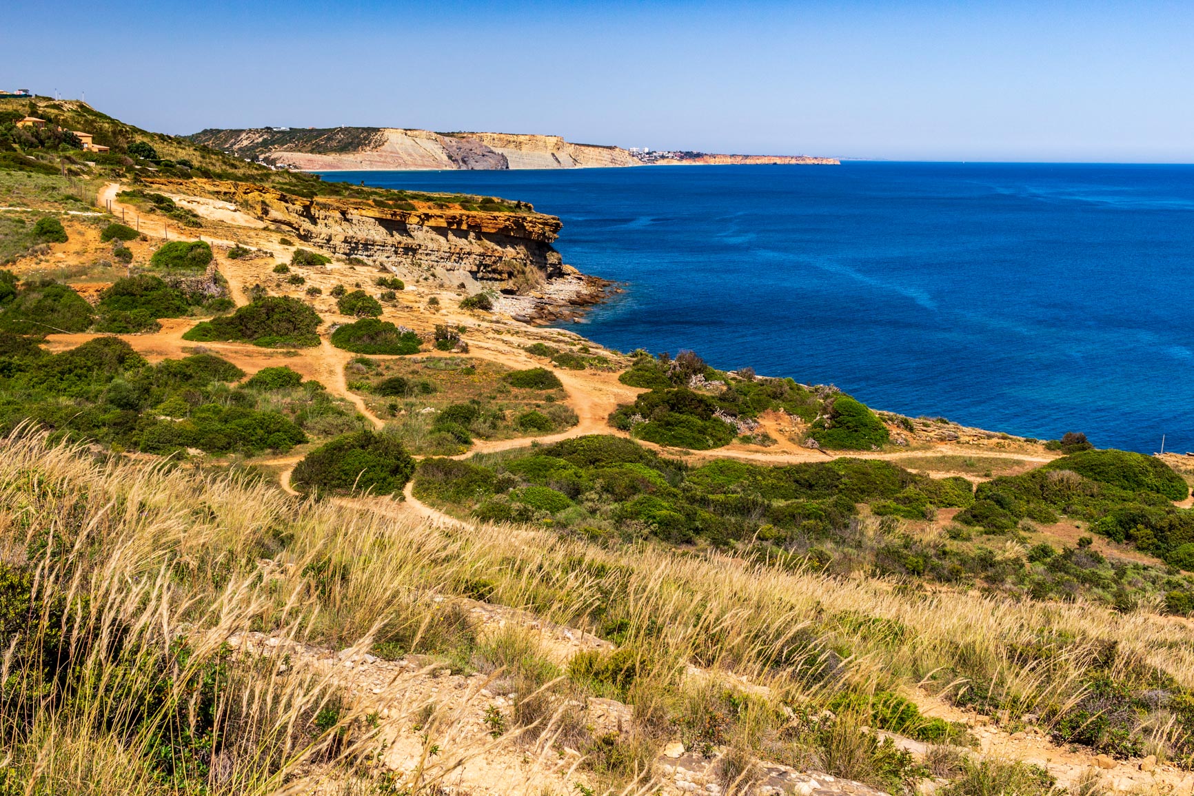
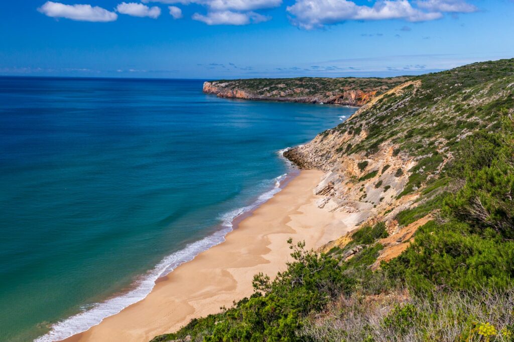
We continued along the coast, but this time without the road. The path wound through a relatively flat limestone landscape. The vegetation was sparse, as the wind and sun left little room for plant growth. We had a picnic in the sun (there was absolutely no shade in this area) overlooking a stunning, secluded beach, Praia do Telheiro.
From Praia do Telheiro to Praia da Barriga: an alternative to the fishermen's trail
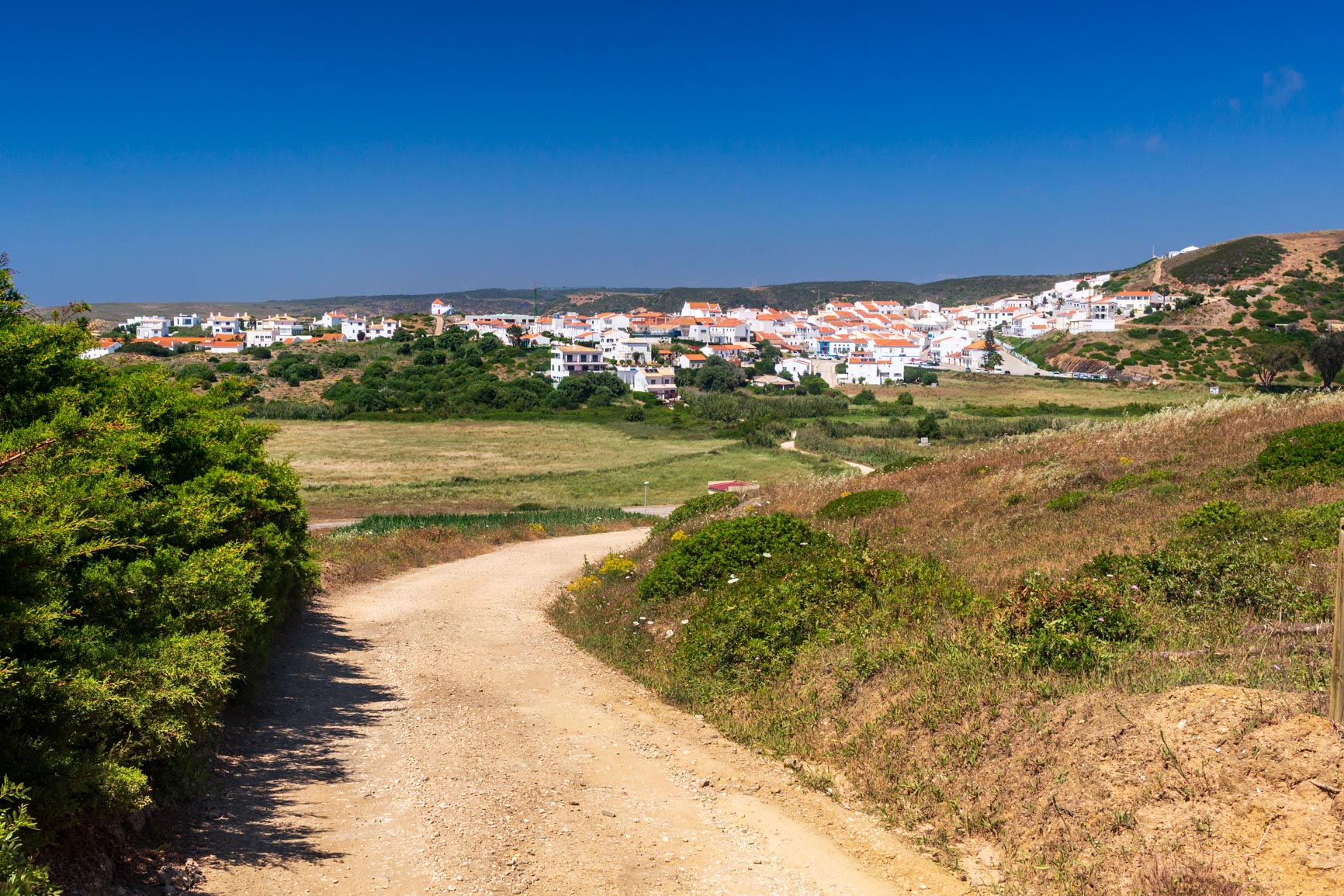
We continued along the edge of the towering cliffs overlooking the churning ocean, then the trail headed inland towards Vila do Bispo. It was completely flat (a stark contrast to the elevation gain of the past few days!) and honestly not very interesting. The best moment was when the village finally came into view: a cluster of small white houses in the middle of nowhere.
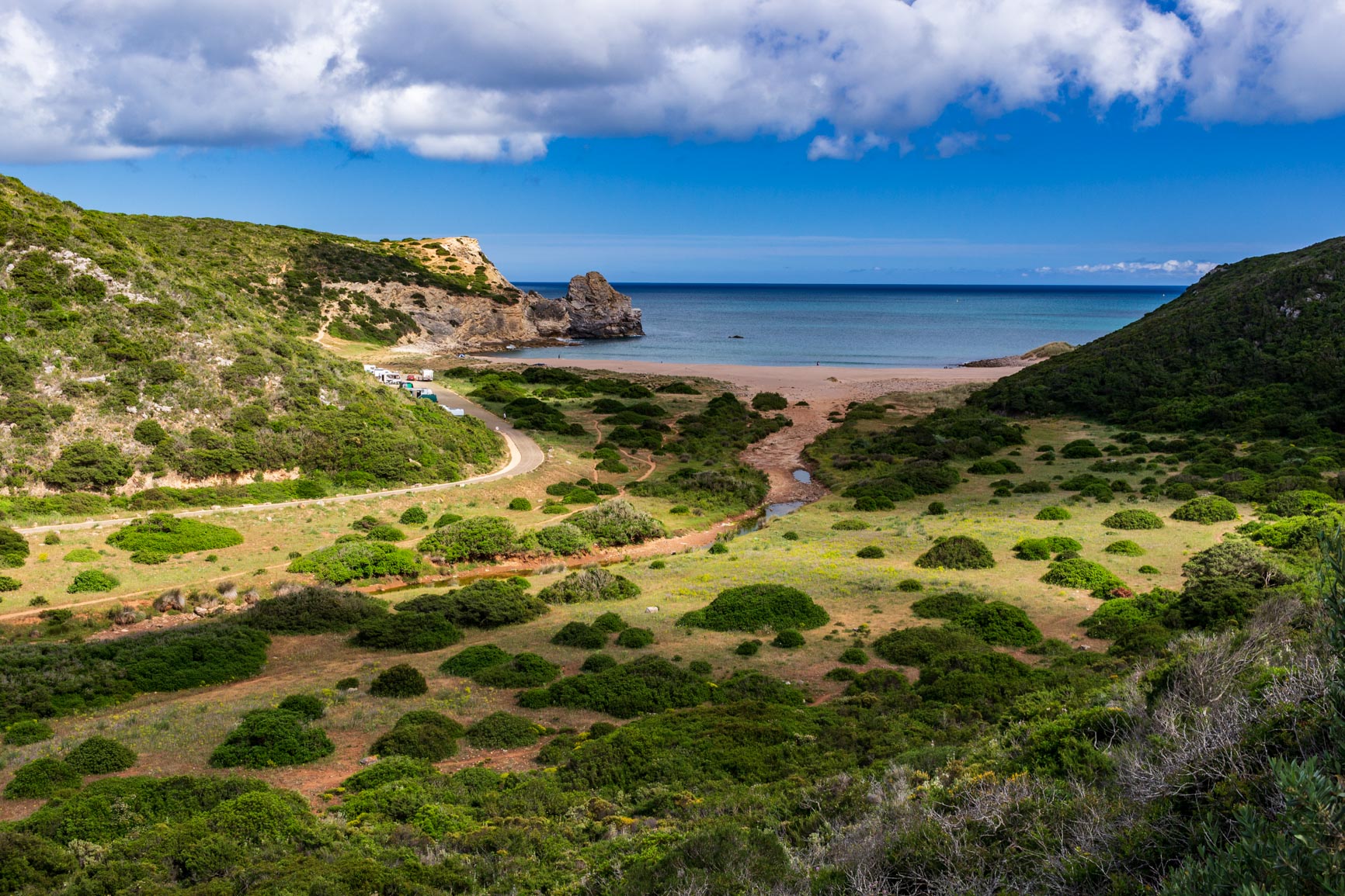
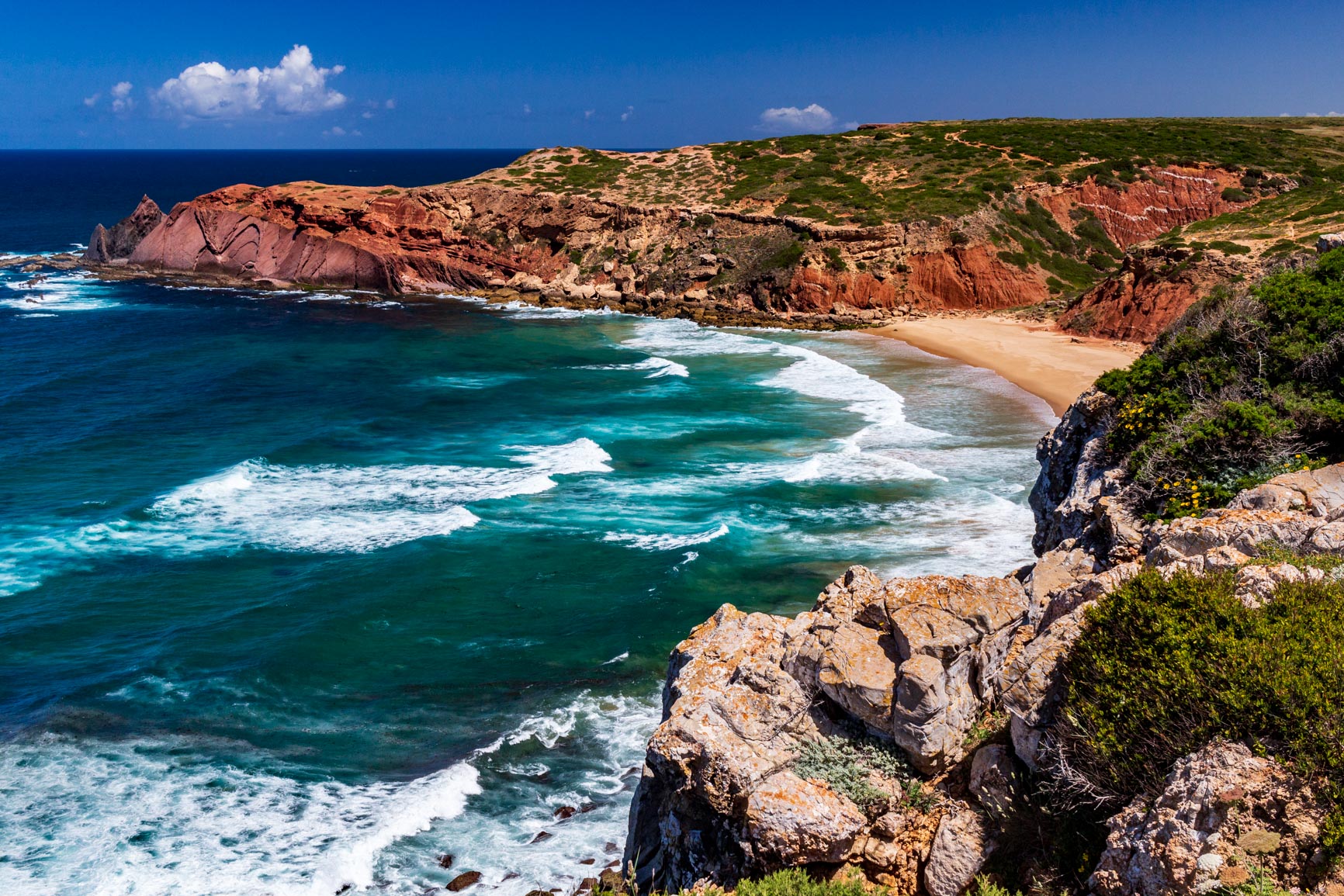
After a quick stop at Lidl (including beers for the evening!) and a stroll through the narrow streets, we set off again. We decided to leave the official fishermen's path to get closer to the coast and sleep on Barriga beach. The path descends into a large green valley that cuts a deep hole in the otherwise flat landscape. At the bottom of the valley lies the beach: it's simply stunning, framed between cliffs and surrounded by lush greenery in the background. And there's absolutely no one there. We enjoy a lovely aperitif overlooking the waves before sleeping sheltered from the wind behind the cliff.
Day 4: from Vila do Bispo to Carrapateira
From Praia da Barriga to Praia do Amado
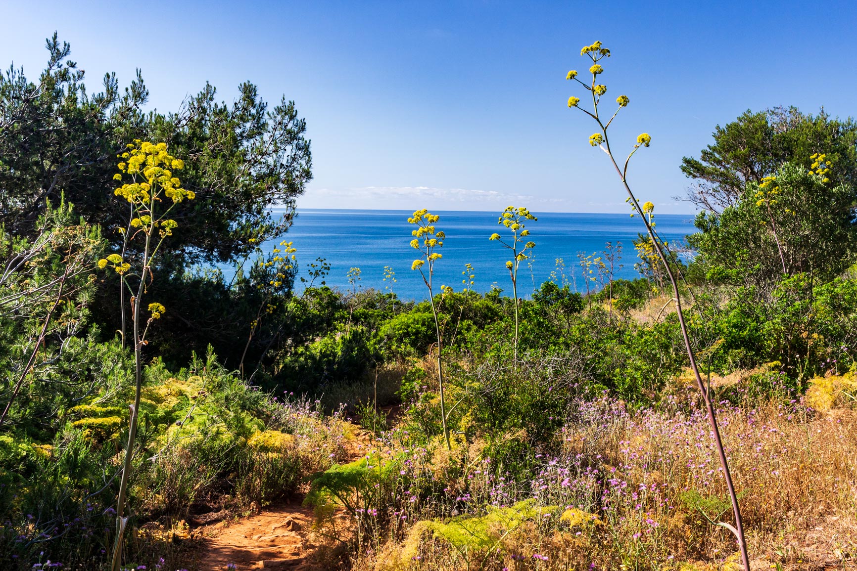
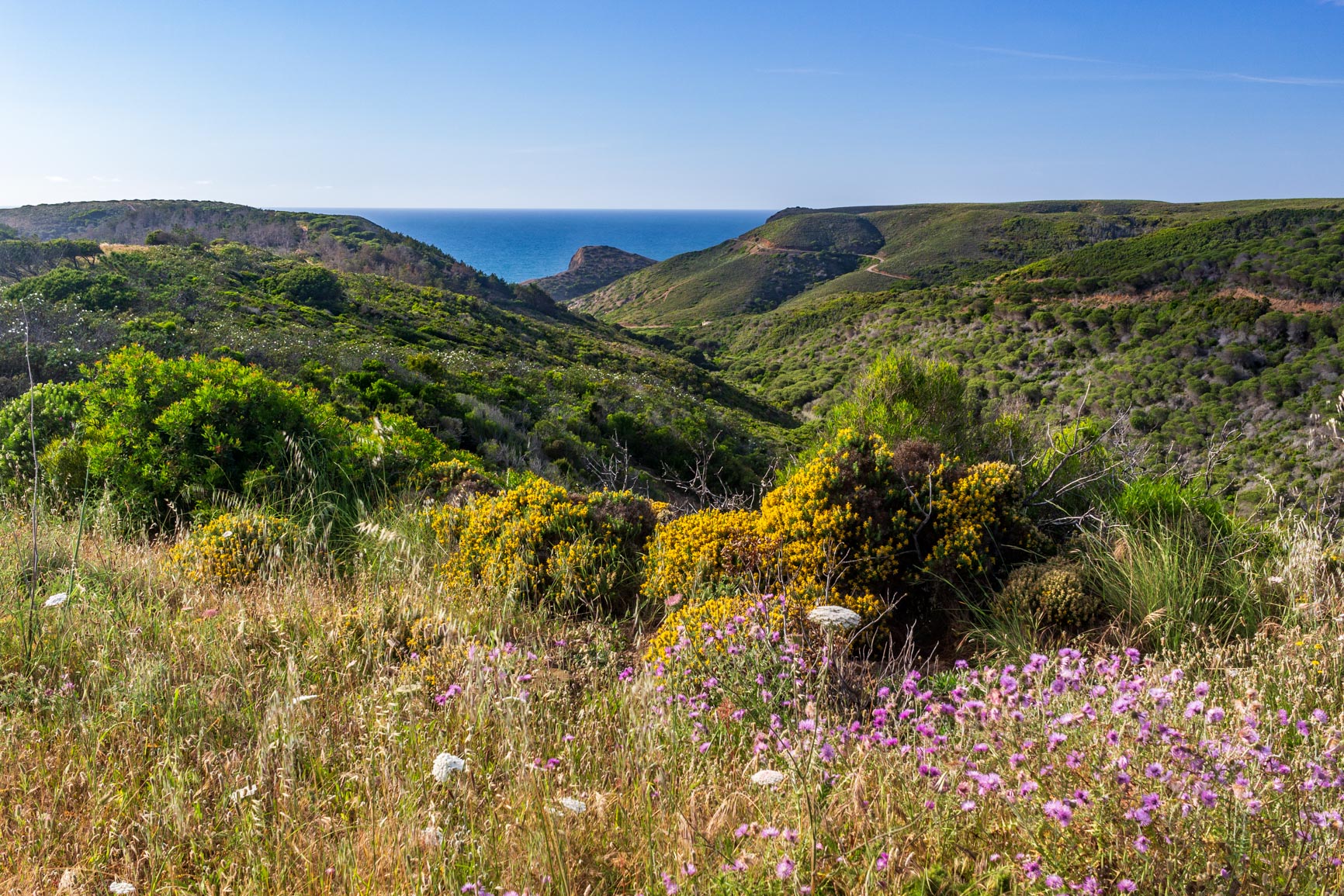
We reluctantly left this idyllic, deserted beach, following the track that climbs up the other side of the valley. We rejoined the fishermen's path, only to find ourselves back in the monotony of walking on flat terrain along a track: this detour from the route was much more interesting! However, we soon reached a lovely scrubland where flowering rockroses stretched as far as the eye could see, with the sea in the background.
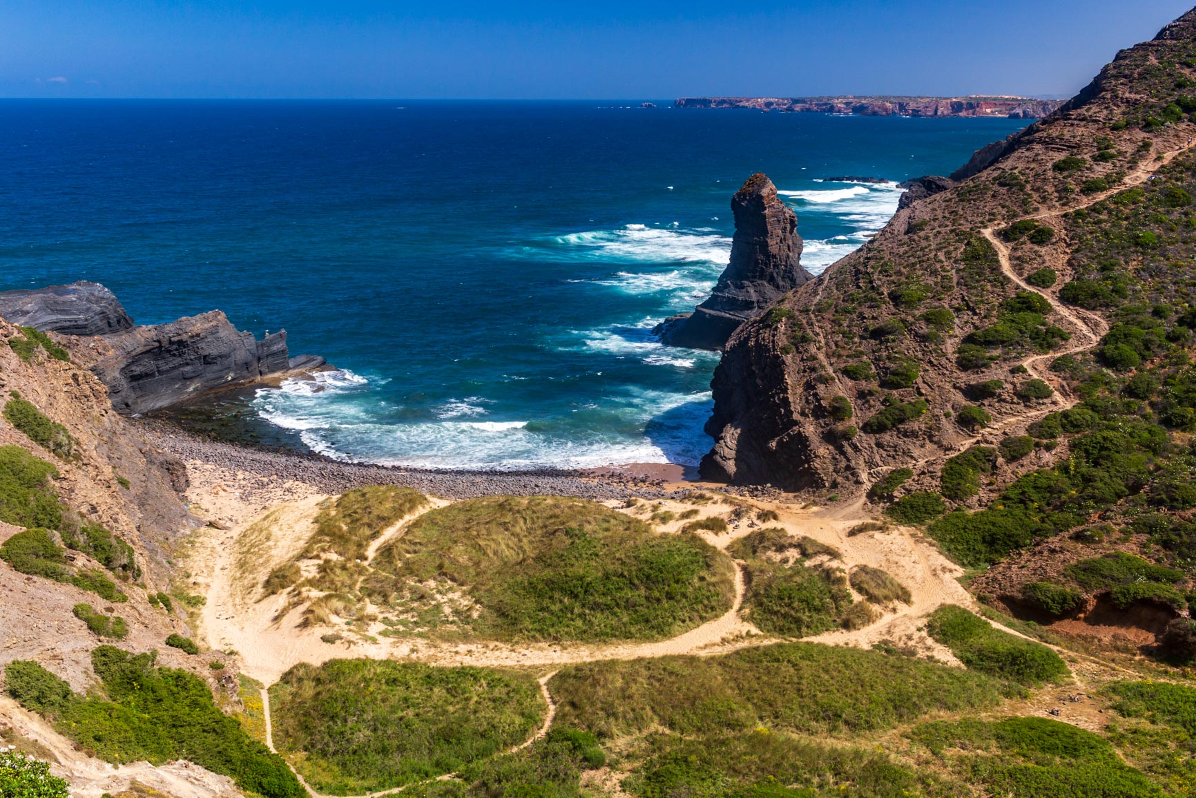
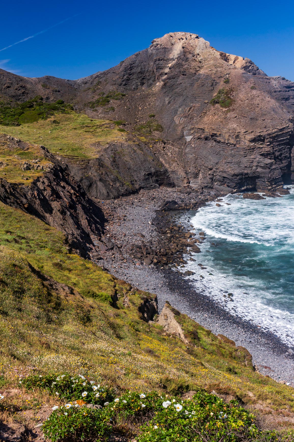
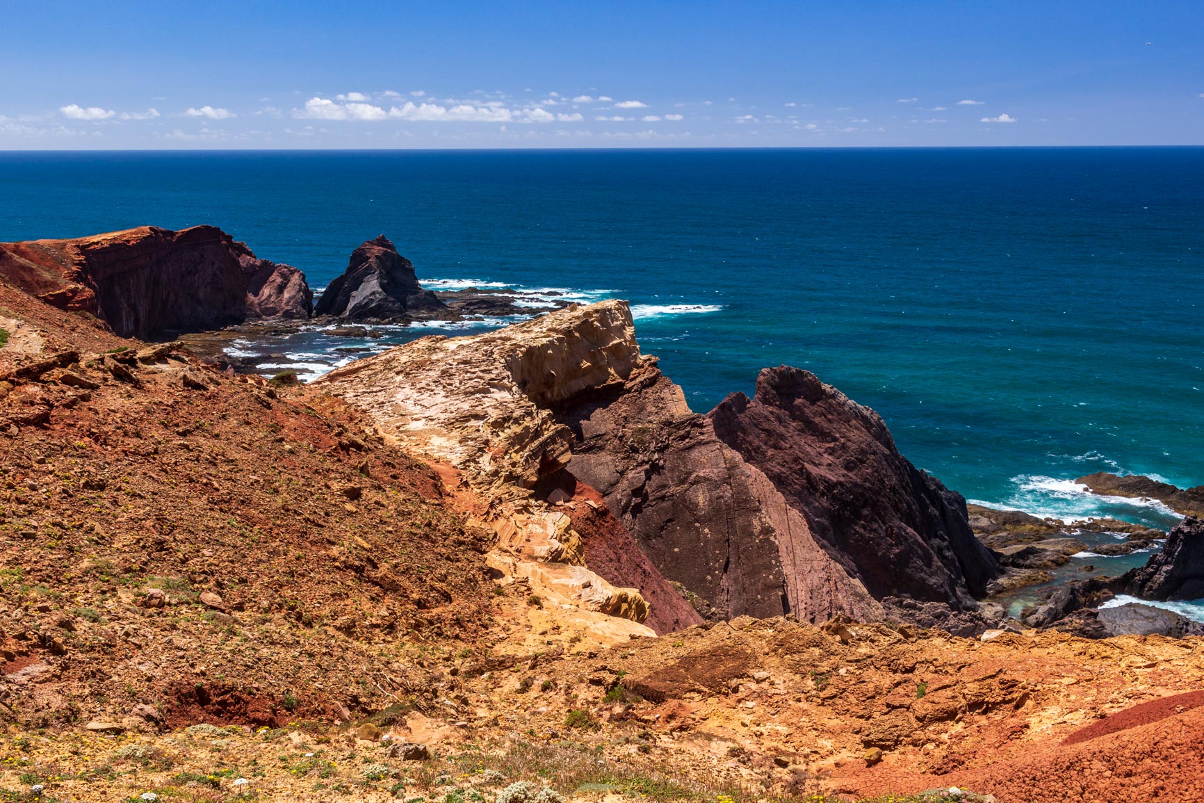
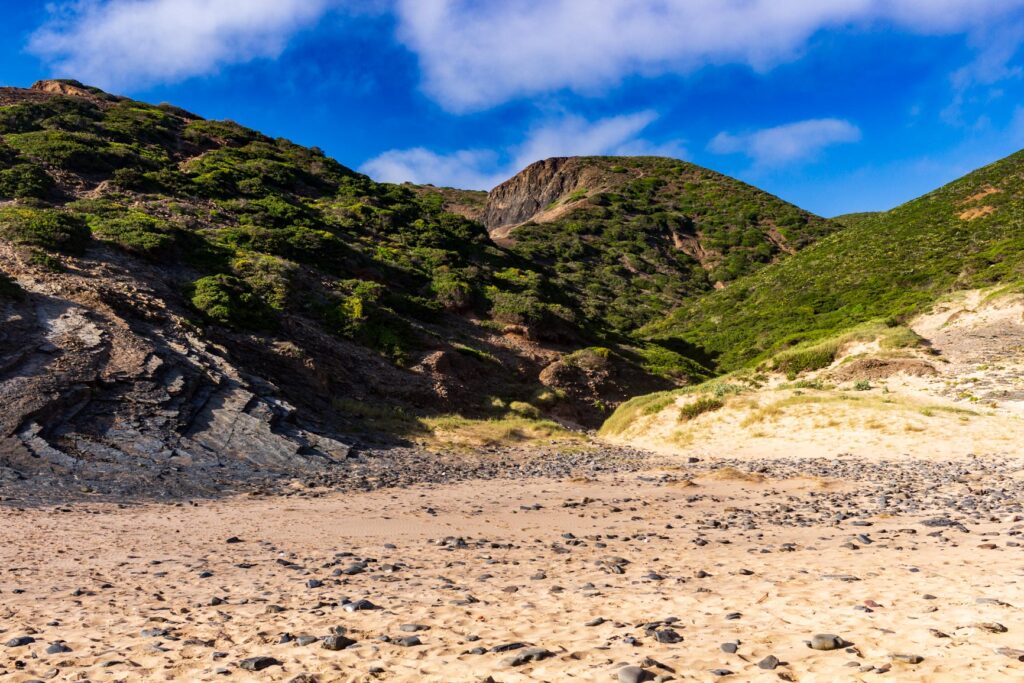
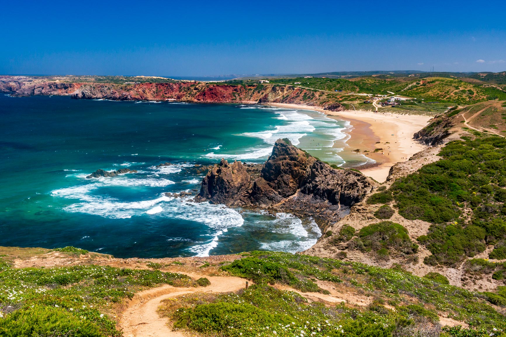
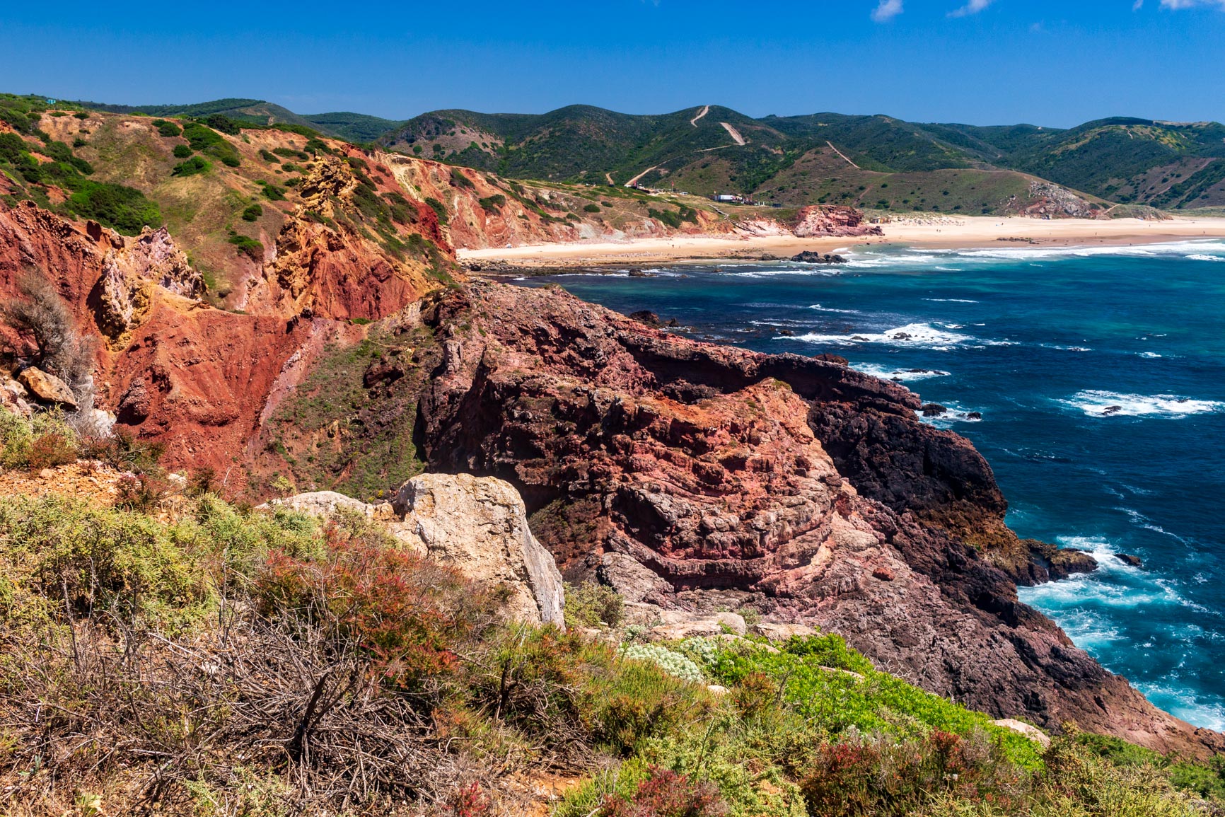
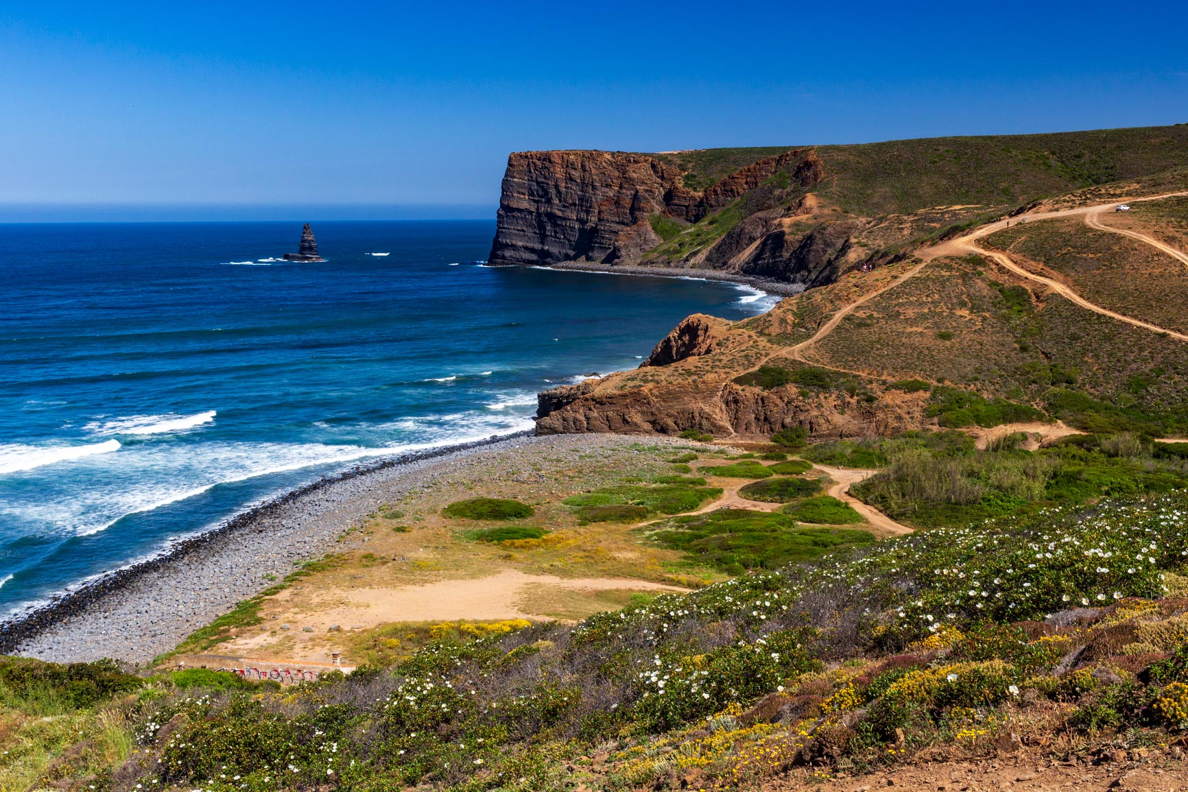
But then comes one of the most beautiful sections of the Fisherman's Trail: Mirouço Beach. The path winds down to a double beach. To the left, black rocks and tender green grass cling to the cliff faces. To the right, a sandy expanse with grassy dunes. Improbable fragments of vertical cliffs detached from the coast in the middle of the ocean. All this accompanied by the immense sound of the endless surf. We stand for long minutes, speechless, before this landscape.
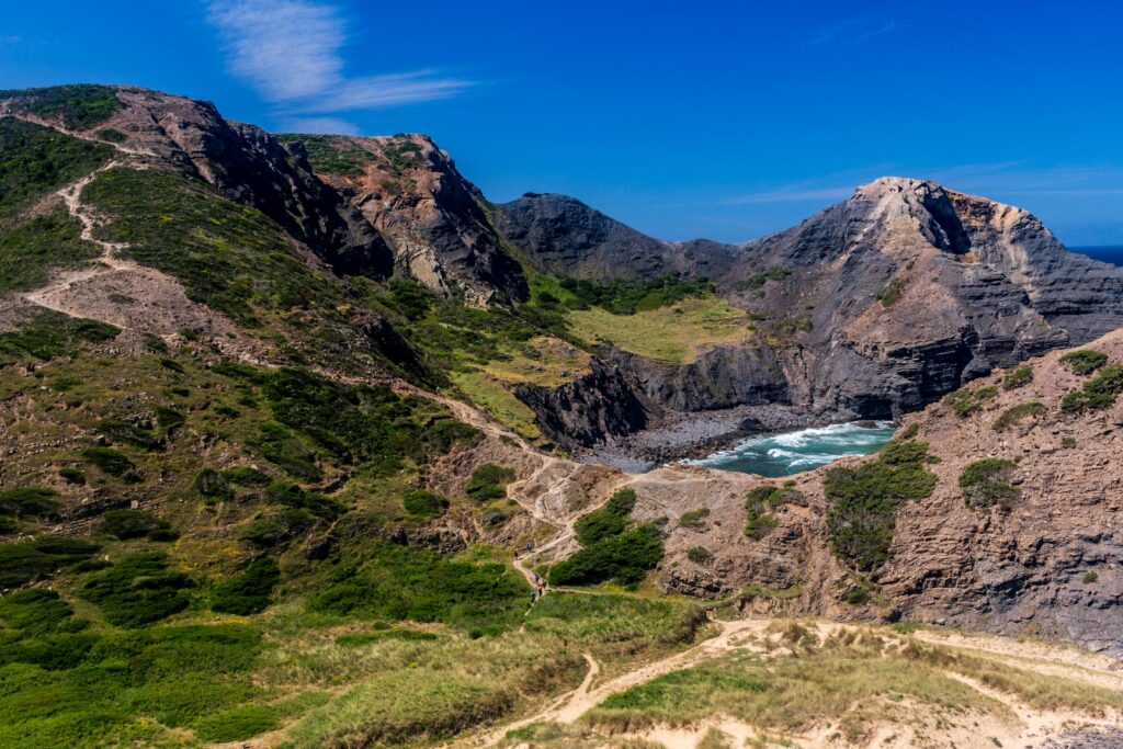
The sandy beach is perfect for a mid-morning snack break. The trail then climbs steeply on the other side. We follow a track that gently slopes down to another sandy beach, forming the bottom of a secluded valley and its river. Finally, we arrive at the large Amado beach, which seems to be a popular spot for surfing lessons.
From Praia do Amado to Praia da Bordeira
We then walked along a small road. Don't miss the view from Ponta do Castelo; the basalt rocks have unusual shapes. After that, we headed back inland to reach Carrapateira. We stumbled upon a bar that offered almost everything: smoothies, milkshakes, cakes, homemade lemonade, and even lhassi. The town was teeming with hikers looking for accommodation.
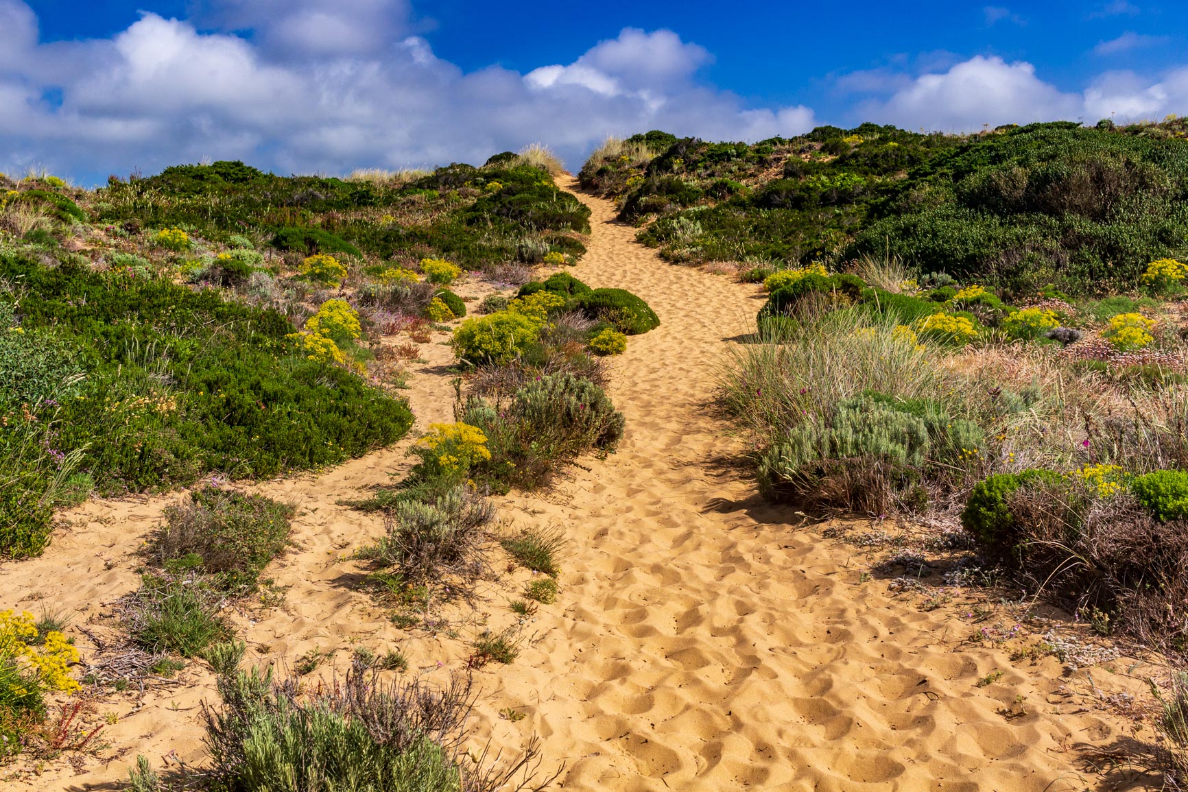
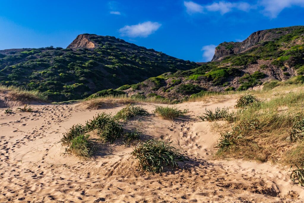
So we slipped away to continue towards the next beach. That's when we entered a magnificent area we hadn't expected: the entire landscape was one immense dune! We first walked through unique and unspoiled vegetation. I imagine such an environment is fragile (how do the plants manage to survive in the sand with so little water?), which is why it's essential to stay on the paths. An unexpected difficulty arose: the sand made progress much slower and more tiring!
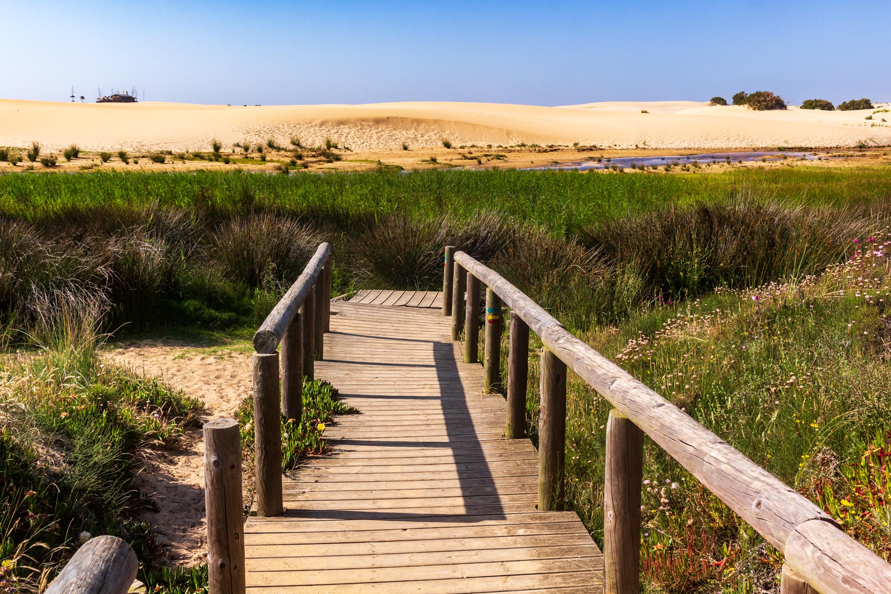
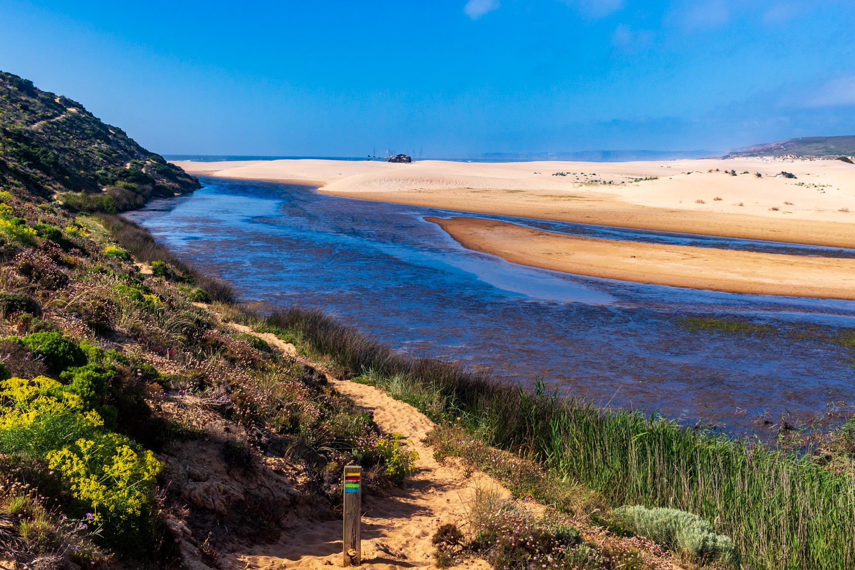
Next, we reach the small river responsible for all this sand. On the other side, there's an enormous, vegetation-free dune stretching all the way to the sea. The contrast between the green water and the sand is truly stunning. We walk along the riverbank on rocks that explain the river's meandering shape.
We finally crossed the river when it narrowed to a stream and continued along the vast beach. As evening approached, we took refuge behind a dune to get out our sleeping bags. The feeling of isolation amidst this endless expanse of sand was absolute.
Last day of the Fisherman's Trail: from Carrapateira to Aljezur
From Praia do Bordeira to Praia do Canal
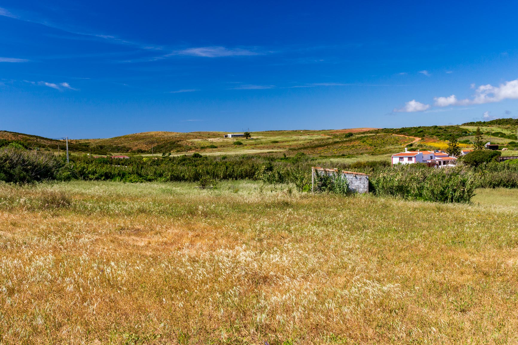
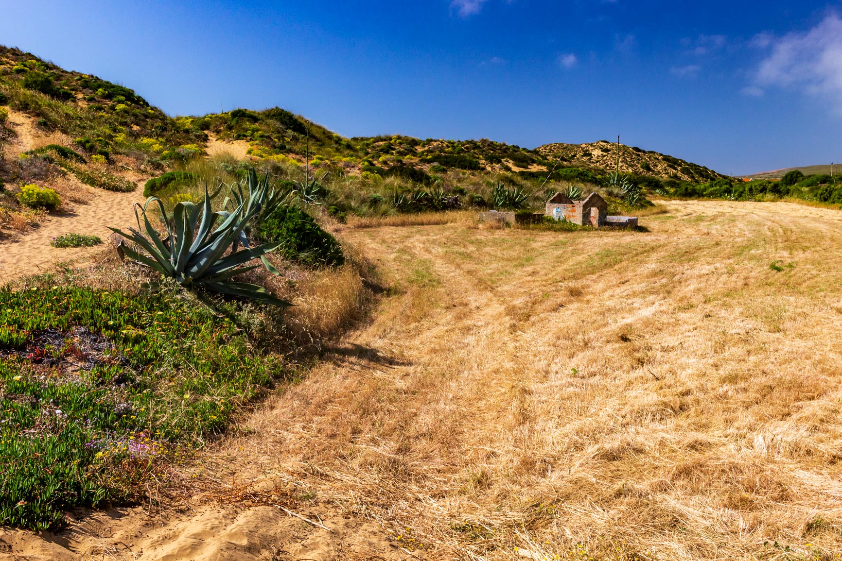
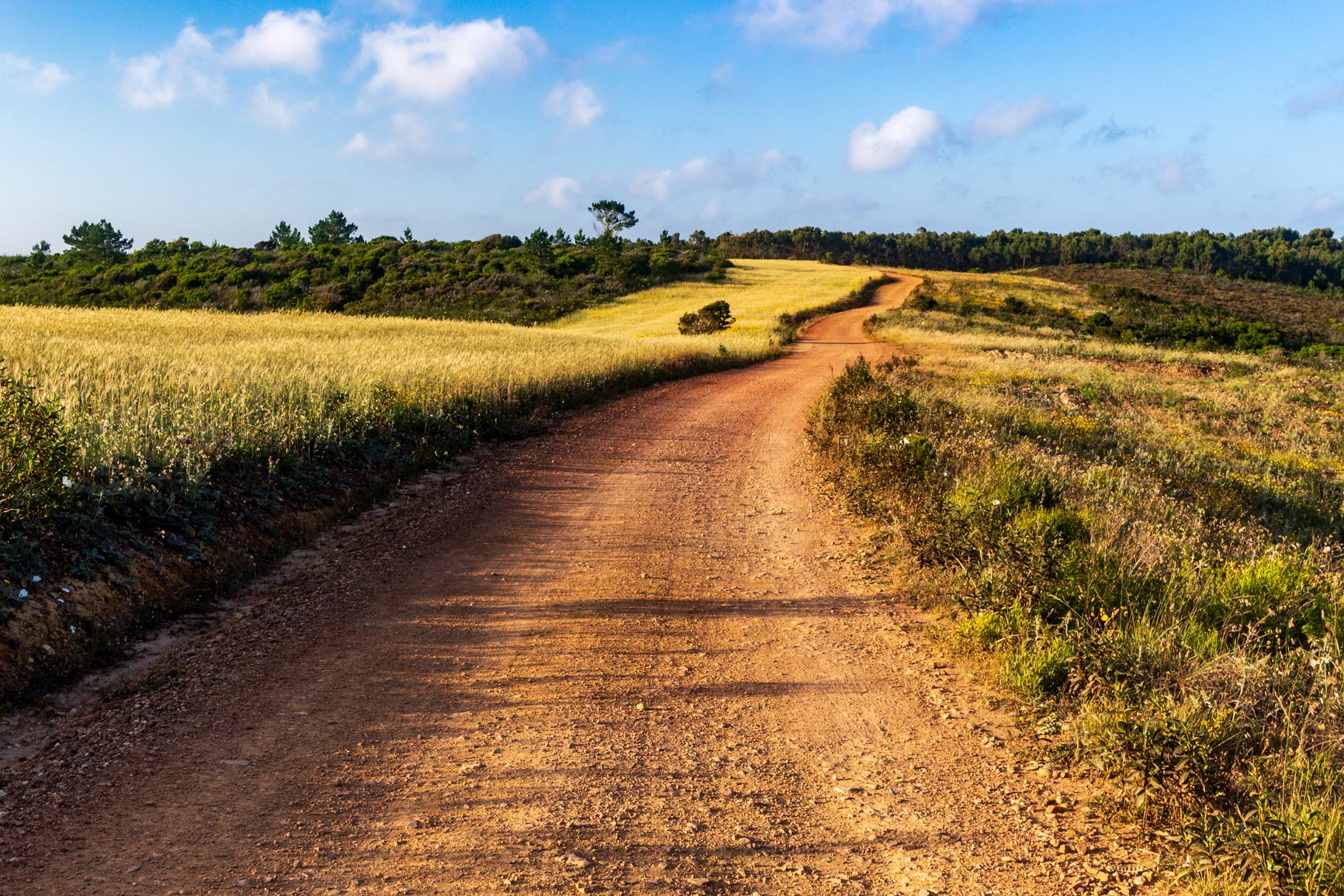
It's already our last day… The early morning trek is still just as difficult, as the path remains very sandy for a long stretch. The dune vegetation is still quite unique. We finally reach a track, and the geology changes abruptly; there's no more sand in sight. We find ourselves again across long stretches of open fields that are rather uninteresting from a hiking perspective.
We reach an isolated hamlet on the plateau. It's clear this place has recently gone from being a remote backwater to a thoroughfare for a constant stream of tourists. The trail passes by an old waterwheel (likely powered by the donkeys we see here and there). Shortly after, a brand-new building welcomes hikers for the night.
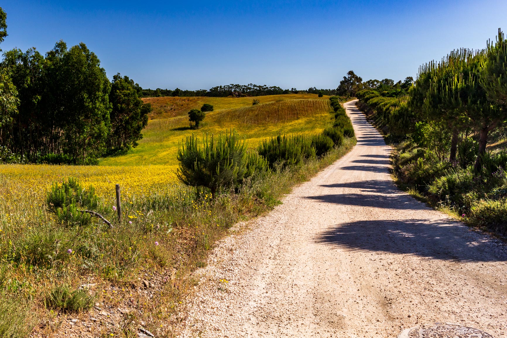
We pass the houses and continue along a track through a eucalyptus forest. Again, it's a bit long and uninteresting. We finally approach the sea again and pass the last beach on our route, Praia do Canal. We stay there for quite a while, watching the surfers' acrobatics.
From Praia do Canal to Aljezur, the end of the fishermen's path
We head back up a track. The official trail takes a long detour along the coast, which must be quite beautiful, before reaching Aljezur. But we don't have time to follow it because a bus is waiting for us in Aljezur that evening. So we follow the road to the village, which is definitely not very interesting because the road is busy. I would recommend hitchhiking along this section instead.
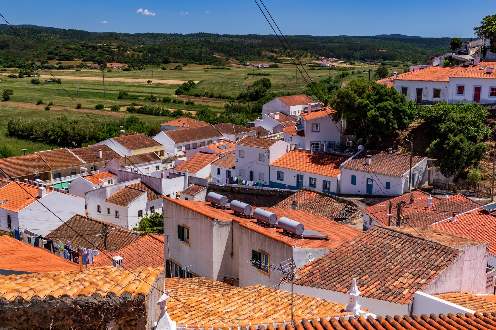
We will, however, remember our arrival in Aljezur: it was once a major port in Portugal. The river has since dried up. The whitewashed houses cling to the hillside, in a beautiful natural semi-circle. It's pleasant to stop under the trees along the lush green river while waiting for the bus (Rede Expressos) that takes us directly back to Lisbon. The sound of the waves will stay with me for a long time after these five days of camping…
0 Comments